Manzanita's Neahkahnie Overlooks an Oregon Coast Masterpiece
Published 07/21/2011

(Manzanita, Oregon) – For perhaps millions of years, Neahkahnie Mountain has loomed over these beaches like some gigantic watchful guardian. For the last few millennia that local tribes roamed the area, it was known as a spiritual spot – and even these days some locals swear it has that quality.
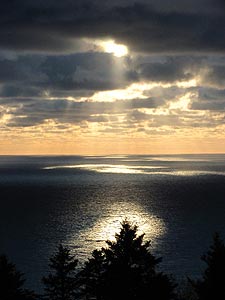 Its history is also filled with talk of a treasure buried somewhere, left by the crew of a Spanish Galleon that apparently wrecked here in the 1700s, with all sorts of dark incarnations of that tale. Then there are the rocks with mysterious markings left on them, mostly likely tied to navigational etchings from Sir Francis Drake, leaving considerable evidence he, or someone from that time period, explored this area.
Now, however, Neahkahnie Mountain is a place full of awe and ahhhh’s, an overlook of consistent wowing qualities and mind-blowing natural beauty.
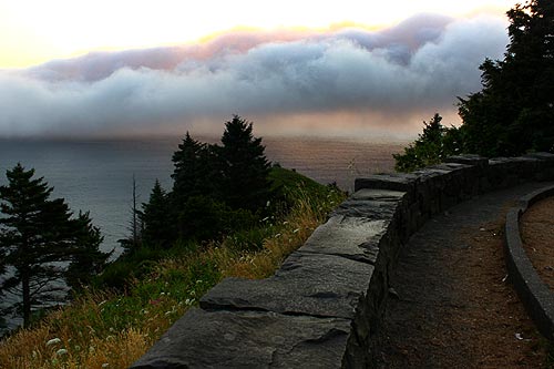
It seems nearly halfway up this 1600-foot mountain, but it’s probably only a mere 500 feet above the ocean. Yes, the overlooks above Manzanita are likely among the highest viewpoints on the Oregon coast, and certainly among the most inviting and generous with its parking spots.
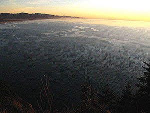
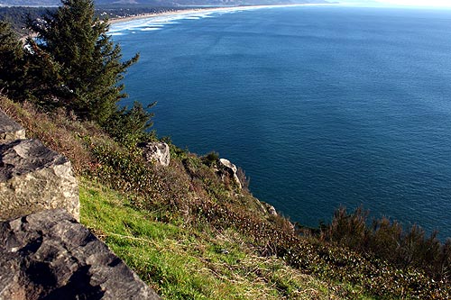
An enormous, nearly 180-degree view can be had here, with quite the line of sight to the south. On clearer days, you can see Oceanside’s Three Arch Rocks from these spots – about 40 miles to the south.
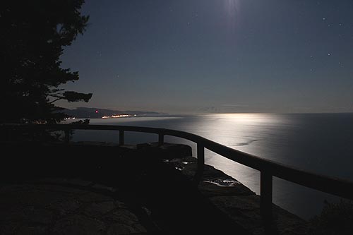
To the north, it’s mostly ocean and then a rustic headland covered with trees, blocking your view to places like Arch Cape. Still, it’s an awe-inspiring favorite for sunset watchers and those who simply like that feeling of their jaw dropping to stunning views of Manzanita or the Nehalem Bay.
A highlight on Neahkahnie is the fact there are several viewing spots, not just the main one with all the parking space. Three smaller ones line this winding stretch of road, all surrounded by those charming, atmospheric rock walls that are just a tad reminiscent of an European castle.
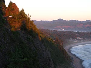 Look down from the main access onto the boulder-covered stretch hugging the mountain’s base and you’ll notice a pointed rock poking up from the trees and brush: this apparently looks like a young woman when viewed from below.
Another spectacular highlight is the gravel parking lot around the bend from the main access, a tad to the north. Here is a one mile-long trail heading down to Short Sands Beach, as well as trails to a couple of secret viewpoints, such as spots that let you see odd rock structures like Pulpit Rock or that strange hidden cove that is seen through a funnel-like configuration as you’re looking down into the cove. It's called Treasure Cove.
There's also the intriguing Cube Rock, which looks like something from a lost civilization. It's largely hidden from view, although just slightly visible from the highway and trail.
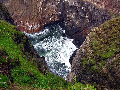
Above: Treasure Cove
Neahkanie Mountain History Also Tied to Highway 101
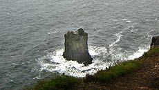 |
| Cube Rock |
More of the area’s history is somewhat evident in mysterious slabs of concrete on the other side of the walls in some spots around the overlook. There’s even a remnant of an old stairway at one point, which indicates these tourist hotspots had a different configuration in the past.
This chunk of 101 is historically significant because the portion going around Neahkahnie was the final piece of Highway 101 to be constructed. Exactly when all this completely opened up is a bit unclear. This part of 101 hugging Neahkahnie was the last finished around 1940. Although some documents indicate the Arch Cape Tunnel – just north of Oswald State Park – opened up in 1942, which then fully connected the entire coastal highway from Astoria down to Brookings.
In either case, the tunnel actually allowed easier access between Tillamook County and places like Cannon Beach and Seaside. Before, Highway 53 was the main means to get from Highway 26 to the Nehalem Bay, or even from Cannon Beach to the bay area.
 Up here, the road somewhat follows an ancient Indian path around the mountain. Major chunks of the mountain had to be dynamited away, although by and large engineers actually worked with the landscape and put the lookouts in places the topography seemed to graciously allow.
The rocky walls were the creation of crews from the Works Progress Administration, a Depression-era federal employment program which created many similar examples of this kind of rockwork around the state.
At night, this mystical mountain has its own amazing aspects that aren’t very well known. If conditions are clear, it’s absolutely perfect for star gazing. In fact, linger here at any time of year on a clear night – not just during meteor shower events – and it’s likely you’ll see some awe-inspiring shooting stars.
Because of the distinct lack of light up here the stars are a little more visible, and watching satellites and other aircraft wander through the upper atmosphere is a consistent kick in the pants.
At night, you can easily make out other fascinating landmarks, such as radio towers that appear to guide ships away from the shallow mouth of the Nehalem Bay, the lights of Wheeler, to even the lights of Rockaway Beach.
More About Manzanita, Rockaway, Wheeler Lodging.....
More About Manzanita, Rockaway, Wheeler Dining.....
LATEST Related Oregon Coast Articles
From the Puget Sound to Long Beach, alongside Oregon's cleanup. Washington coast events, Seaside events
Astoria's Riverwalk Gets New Lighting, More N. Oregon Coast Roadwork
Delays coming this summer, but the riverwalk has a new look. Seaside, Cannn Beach
April Gets Even Cheaper Midweek at Depoe Bay, Lincoln City: Oregon Coast Deals
Off-season rates plus more at Keystone Vacation Rentals. Depoe Bay lodging specials, Lincoln City hotel reviews, Newport hotel reviews
Washington Coast Begins Week of Clam Digs, April 12 Through 18
Long Beach, Twin Harbors, Mocrocks and Copalis at different times. Washington coast events
Astoria's Crab, Seafood, Wine Fest Floods N. Oregon Coast with Yumminess in A...
April 25 to 27 at the Clatsop County Fairgrounds. Astoria events, Cannon Beach events
Oregon Coast Outdoors: Clamming, Crabbing, Surfing, Fishing, Boarding Deep Guide
The wilds of the coast and hang gliding, boating, mussels, hiking, fishing, crabbing, sandboarding, more. Sciences
Earth Week at N. Oregon Coast's Netarts Bay Gets Down, Dirty and Engaging
April 18 - 19 in Netarts: asking for volunteers. Oceanside events, Tillamook events
Plane Skids Off Runway on S. Oregon Coast, Into Coos Bay Waters
All five were rescued and are okay
Back to Oregon Coast
Contact Advertise on BeachConnection.net
All Content, unless otherwise attributed, copyright BeachConnection.net Unauthorized use or publication is not permitted


