25 Years Ago Today, Wild Tale of New Carissa Wreck Began on Oregon Coast (Photos)
Published 2/04/24 at 7:15 p.m.
By Oregon Coast Beach Connection staff
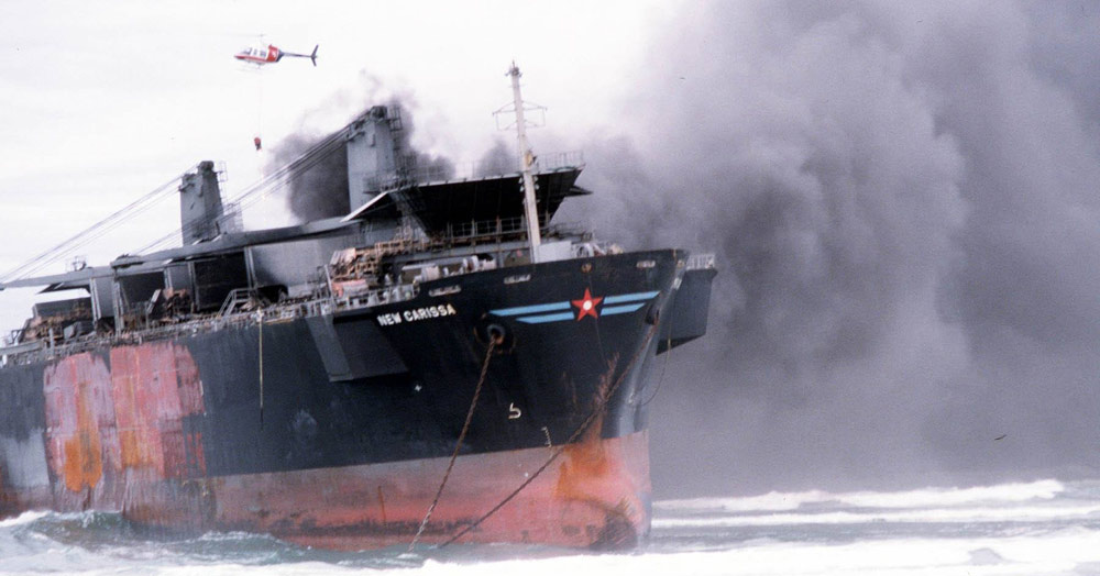
(Coos Bay, Oregon) – 25 years ago today, the freighter New Carissa lodged itself onto the North Spit of Coos Bay, setting off a historic chain of sometimes wacky events that put the international spotlight on the Oregon coast. (Photo BLM)
Includes exclusive listings; some specials in winter
In Cannon Beach:
Includes rentals not listed anywhere else
In Manzanita, Wheeler, Rockaway Beach:
Some specials for winter
In Pacific City, Oceanside:
Some specials for winter
In Lincoln City:
Some specials for winter
In Depoe Bay, Gleneden Beach:
Some specials for winter
In Newport:
Look for some specials
In Waldport
Some specials for winter
In Yachats, Florence
Some specials for winter
Southern Oregon Coast Hotels / Lodgings
Reedsport to Brookings, places to stay; winter deals
February 4, 1999, was that wild day that made the news, and a collection of stunning photographs of that time surfaced on social media through the Coos Bay office of the Bureau of Land Management (BLM) today. Like the story itself, they're an engaging set of images.
It's a very unique shipwreck in all of maritime history, as it ended up occurring in two places. Back then, Oregon Coast Beach Connection was almost ten years away, but future founder / editor Andre' Hagestedt was there to capture some of it as the saga continued in Waldport, over 100 miles away.
As BLM pointed out Sunday on social: “no one could figure out how to get it unstuck.”
“Strategies to sink the New Carissa and lessen the amount of oil it was spilling onto the Oregon coast included towing the ship, burning its diesel tanks, and firing a torpedo at its hull,” the BLM said.
Bizarre Oregon Coast History: Crazed Chaos of the Shipwreck New Carissa
This spot is a rather sensitive one for the endangered snow plover, and a top priority then was protecting the nearby population.
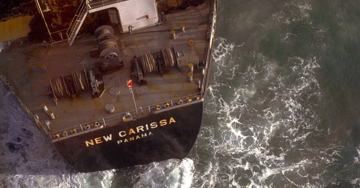
Photo BLM
The 639-foot vessel went through a bizarre set of mishaps as crews attempted to free it.
First, however, they wanted to set it on fire to burn that oil. The initial explosion by the Navy fails, but the second one – seen live on TV – only succeeds in splitting the ship in half. Later ignition attempts do not burn the remainder of the fuel.
That all occurred on February 10 and 11. It's not until early March that they get the bow half of the ship towed out to sea, and instead of sinking it as they hoped, it breaks free and crashes itself on a beach at Waldport on the central Oregon coast on March 3.
Photo BLM
It's here where Oregon Coast Beach Connection snaps photos of it, and it is gargantuan. Even just this half of the ship is a monster – it's impossible to convey that via images.
Oregon Coast Shipwrecks: List of Those You Can See - and Cannot - From Astoria down to Brookings, deep history and details of shipwrecks
A few days later this half of the ship is finally towed out to sea and sank.
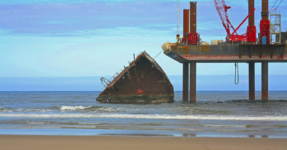
Photo BLM
Down in Coos Bay, work goes on until the last of it is removed – finally – in 2008. All the snow plovers in the area survived, by the way.
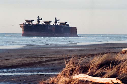
Photo Andre' Hagestedt / Oregon Coast Beach Connection (Waldport in 1999)
“In July 2007, the Confederated Tribes of Siletz Indians took title to nearly 3,900 acres of Oregon Coast Range forest as a result of the Oil Pollution Act,” the BLM said. “The New Carissa Oil Spill Natural Resource Trustees, with the BLM as the lead, jointly announced the land purchase and future management plans to benefit the marbled murrelet seabird population damaged by the oil spill.”
MORE PHOTOS BELOW
See the full New Carissa story Bizarre Oregon Coast History: Crazed Chaos of the Shipwreck New Carissa
Oregon Coast Hotels in this area - South Coast Hotels - Where to eat - Maps - Virtual Tours
Cannon Beach Lodging
Nehalem Bay Lodgings
Manzanita Hotels, Lodging
Three Capes Lodging
Pacific City Hotels, Lodging
Lincoln City Lodging
Depoe Bay Lodging
Newport Lodging
Waldport Lodging
Yachats Lodging
Oregon Coast Vacation Rentals
Oregon Coast Lodging Specials
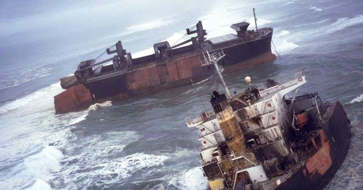
Photo BLM
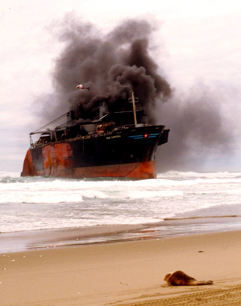
Photo BLM - a baby seal watches the wreck proceedings
More About Oregon Coast hotels, lodging.....
More About Oregon Coast Restaurants, Dining.....
 Andre' GW Hagestedt is editor, owner and primary photographer / videographer of Oregon Coast Beach Connection, an online publication that sees over 1 million pageviews per month. He is also author of several books about the coast.
LATEST Related Oregon Coast Articles
Oregon Coast Whale Watch Week Begins Amid More Worries About Gray Whale Popul...March 22 - 30, but you may see less in coming years. South coast events, Florence events, Astoria events, Seaside events, Cannon Beach events, Manzanita events, Rockaway Beach events, Tillamook events, Garibaldi events, Oceanside events, Pacific City events, Lincoln City events, Depoe Bay events, Newport events, Waldport events, Newport events, Yachats events
Cannon Beach Will Whoop It Up Over Return of Puffins to North Oregon Coast - ...
April 13 in Cannon Beach, get help spotting tufted puffins. Cannon Beach events
Oregon Coast Spring Break? Bring the Rain and Beach Hazards (But Record Temps...
S. coast sneaker waves, rain, then high temps mid-week. Weather
Road Work Coming to North Oregon Coast's Gearhart and One of World's Largest ...
Lane closures this summer on the bridge; major work in Gearhart next year. Washington coast
Lincoln City's Oceanview Walk Park May be Tiniest on Oregon Coast
Squeezed between two buildings, it's the high vantage point no one knows. Travel, Depoe Bay, Newoport, Pacific City
Exquisite Spring Break Hangouts on Oregon Coast with New Discoveries
The wows of Lincoln City and Cannon Beach, including the beginning of a ghost forest. Lincoln City hotel reviews, Cannon Beach hotel reviews, specials, Seaside hotel reviews
Back to Oregon Coast
Contact Advertise on Oregon Coast Beach Connection
All Content, unless otherwise attributed, copyright Oregon Coast Beach Connection. Unauthorized use or publication is not permitted


