Cape Kiwanda, Oregon Coast: Complete Travel Guide, Info
Published 06/16/2017 at 10:24 PM PDT - Updated Constantly
By Oregon Coast Beach Connection staff
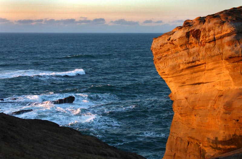
(Pacific City, Oregon) – One of two centerpieces to Pacific City (the other being Haystack Rock), Cape Kiwanda State Natural Area is the southernmost cape in the north Oregon coast's famed Three Capes Route. It's about a half hour drive from Lincoln City, and about an hour or slightly more from north coast hotspots like Cannon Beach or Seaside. It's also near the dividing line between what is considered the north Oregon coast and the central coast.
At about 240 feet high (measuring the dune), Cape Kiwanda is still not the tallest of the three capes, but it makes it the tallest dune on the entire coastline.
This guide takes you through many basics of the cape, as well as facts and travel tips not found anywhere else. However, there are numerous details here that will really assist your visit. Look for the links to even more information on the various subjects.
 Some other basics:
There is a handicap accessible viewpoint nearby, at the edge of the road going down to the beach. There's an airport here in Pacific City, not far from the beaches. See Approaching Kiwanda, Handicap Accessible Viewpoint.
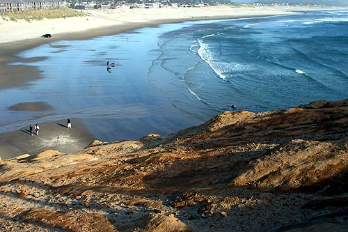
Hiking up the cape is not easy, but it's only about 30 or 40 feet to get to the top of the rocky section and its viewpoints. There are no specific hiking trails as the area is wide open.
Once at the top the views are legendary. Several sections look straight out to sea, where you can soak in the panoramas and the blindingly beautiful sunsets that can light up this area's golden cliffs into fiery, memorable reds and oranges. See Top of Cape Kiwanda.
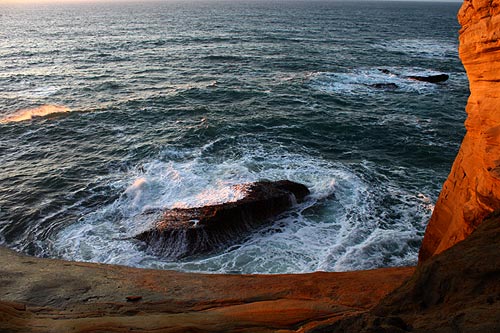
Various tide pool areas dot the base, as well as curiously pockmarked cliffs. There's even a small sea cave you can just barely see. Be extremely cautious here, however, and do not even go near this base except in the calmest of conditions. See Cape Kiwanda, Tide Pools, Rocky Crevices.
The Dory fishing fleet is famous here. A tradition that goes back decades, these small boats are most remarkable for the spectacular way they land, which is by heading straight for the beach at a high speed and literally stranding themselves there.
Safety: Stay away from ledges and do not cross the fenced areas. People continuously die here by doing so. That includes the “Punchbowl” area you look down on wild wave action from one viewpoint, and especially stay clear of the tip (where the “duck bill” rock once resided). Kiwanda's Mighty Mysteries: Astounding, Forbidden Sights.
All 185 acres of Cape Kiwanda State Natural Area were acquired from B.A. McPhillips in 1973.
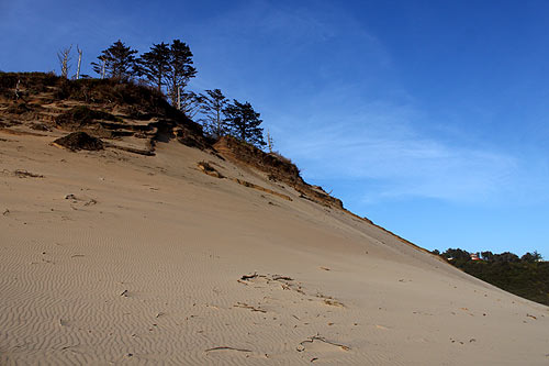
Fun Details of Kiwanda
From many angles, the top is downright surreal, like something out of a Yes album cover done by Roger Dean or a Dr. Suess book.
Lodging in Pacific City in this area - Where to eat - Maps and Virtual Tours
It also makes interesting noises, however. If the wind is whipping things up enough, parts of the cape start to sing. You'll hear a variety of whistling noises, likely coming from the pipes that hold the fences, but also quite possibly the wire fencing as well. Sights and Sounds of Cape Kiwanda
That westernmost tip area looks quite alien (the one you need to stay away from). Of historical curiosity: there was a kind of giant ape face visible from here. At least around 2000 it still existed. Later pictures from about 2016 show it having deteriorated quite a lot (according to pics taken of the now-destroyed “Duck Bill Rock” at the time). Kiwanda's Mighty Mysteries: Astounding, Forbidden Sights.
It's a testament to how the cape is slowly disintegrating.
This brings up the subject of the makeup of Cape Kiwanda. Geologically, it began some 18 million years ago, and it's comprised of a number of different kinds of rock materials. Mostly, however, it's mudstone and sandstone, which is much less resilient than the basalt stuff that makes up the other two capes or big well-known features like Tillamook Head.
Consequently, it's eroding much faster than most features of this shoreline. However, it would be eroding even faster if it weren't for the presence of Haystack Rock, which lessens the tidal poundings. See Geology of an Oregon Coast Icon: Sweeping Cape Kiwanda.
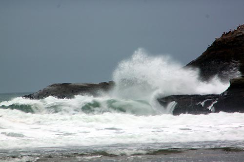
At its very northwestern edge, from McPhillips Beach (or by walking down the northern slope of the cape), you can catch site of a wild, chaotic ocean canyon. This was made visible by the eroding of Kiwanda, when an arch hanging over that section collapsed. The subsequent pile of rocks created a dam at that end which allowed people to peek around the rocks that was normally cut off by a long tide line. Photos of Manic Moods of Cape Kiwanda
More information links:
Startling Oregon Coast: Manic Moods of Cape Kiwanda. About a mile north of the parking lot for Cape Kiwanda, you’ll find an unmarked, one-lane road that mysteriously wanders down a steep hill to the west. This is still Cape Kiwanda State Natural Area, but a section otherwise known as McPhillips Beach.
Cape Kiwanda: Wild Canyon Full of Ocean. Under certain conditions, the ocean sounds a bit like the roar of a small jet engine in the distance. Perhaps it’s just the acoustics of the sound of the waves bouncing around the cliff walls, but it’s an unusual and delightful facet of this spot.
More About Pacific City, Oceanside, Netarts, Tierra Del Mar Lodging.....
More About Oregon Coast Restaurants, Dining.....
LATEST Related Oregon Coast Articles
Wonders around Astoria, Depoe Bay, Cape Kiwanda
N. Oregon Coast Parking Lot Fully Reopens: Many New Features at Cape Kiwanda
New restrooms, pay stations, overlook, more. Pacific City
Changes at Oregon's Tillamook Coast: Rockaway Improvements, Nehalem Bay SP Cl...
Park closes for winter, Kiwanda parking back, fishing tips, accessibility guide. Pacific City, Oceanside, Manzanita, Rockaway Beach
Mesmerizing Slabs Beneath Cape Kiwanda: Mysterious Caves, Holes of N. Oregon ...
Pacific City landmark has much at its base, rocky surprises, colors
10 Awe-Inspiring Must-See's of Oregon Coast in Summer and Second Summer
Secrets of Newport, Warrenton, Cannon Beach, Oceanside, Pacific City, Cape Kiwanda, South Curry Coast, Port Orford, Yachats, Florence, National Dunes
New Parking at N. Oregon Coast's Cape Kiwanda Opens After Main Lot Shut Down
86 new spots opened across the street and more nearby
UPDATE: Cape Kiwanda Parking Lot to Close for Months: Long Walk to N. Oregon ...
Closes down March 4 and reopens sometime in July
N. Oregon Coast Rental Firm Builds Charity Fund for Pacific City Causes
Pacific City's Kiwanda Coastal Properties started a charity fund back in 2020. Pacific City lodging, Tierra Del Mar, Pacific City hotel news
Back to Oregon Coast
Contact Advertise on BeachConnection.net
All Content, unless otherwise attributed, copyright BeachConnection.net Unauthorized use or publication is not permitted


