Will the Real China Creek of Oregon Coast Please Stand Up: Bandon, Near Florence
Published 02/02/22 at 4:32 AM PST
By Oregon Coast Beach Connection staff
Includes exclusive listings; some specials in winter
In Cannon Beach:
Includes rentals not listed anywhere else
In Manzanita, Wheeler, Rockaway Beach:
Some specials for winter
In Pacific City, Oceanside:
Some specials for winter
In Lincoln City:
Some specials for winter
In Depoe Bay, Gleneden Beach:
Some specials for winter
In Newport:
Look for some specials
In Waldport
Some specials for winter
In Yachats, Florence
Some specials for winter
Southern Oregon Coast Hotels / Lodgings
Reedsport to Brookings, places to stay; winter deals
(Bandon, Oregon) – Sometimes it may seem as if you're seeing double along the Oregon coast, especially if you're looking at maps. There's three Haystack Rocks, different places with Otter in the name - and there's two China Creeks (and a third rather unknown one).
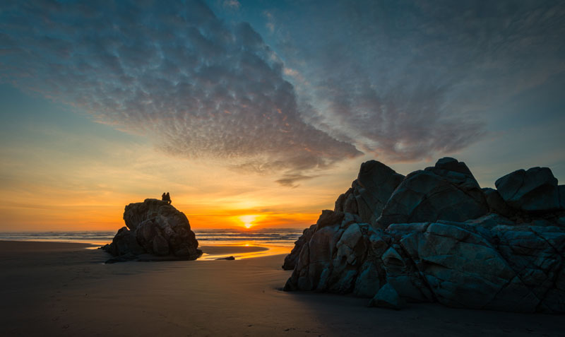
One sits at Bandon, providing the gateway to a whole host of hidden adventures. The other sits not far from Florence, making for wild hikes and trippy discoveries that evoke the world of Tolkien. (Above: China Creek at Bandon. Photo courtesy Manuela Durson - see Manuela Durson Fine Arts for more)
Well, actually there's three China Creeks. The third is also on the south coast at China Beach in the Samuel H. Boardman Corridor.
China Creek at Bandon State Natural Area. On the southern Oregon coast, drive your way from Bandon's Devil's Kitchen viewpoint southward along Beach Loop Road and you'll encounter the China Creek access, which is where the road elbows eastward back towards 101. It's a bit less than a mile from Devil's Kitchen, and that's about where Bandon State Natural Area begins.
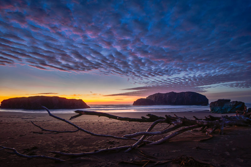
(Above: China Creek at Bandon. Photo courtesy Manuela Durson - see Manuela Durson Fine Arts for more)
China Creek sits sort of at the edges of it all, where some amount of pockmarked, alien-looking rocky structures still lie, but it begins to get all sand, surf and soaring cliff here. In fact, China Creek is the final access along Bandon State Natural Area, with Floras Lake and Langlois popping up rather soon to to the south.
The weird rock fun really kicks in just north of here, with the third Haystack Rock of the Oregon coast nearby (joining the ranks of Haystack Rocks at Pacific City and Cannon Beach). Just north of that you have the surrealistic Face Rock, Wizard's Hat Rock and whole bunches of unique finds.
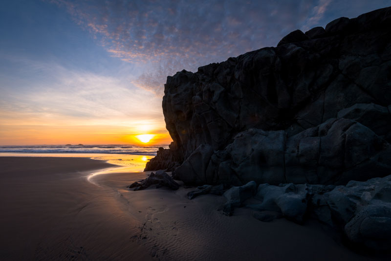
(Above: China Creek at Bandon. Photo courtesy Manuela Durson - see Manuela Durson Fine Arts for more)
Along the China Creek access of the southern Oregon coast, you'll find tons of intricate logs gathered by the creek, summertimes filled with fat and phat dunes, and winters with rollicking waves smacking Haystack and other features not far off.
The dunes here and the cliffs at Devil's Kitchen have been chopped at rather mightily by the storms of 2021 and that area has some recovering to do in that regard. But it's interesting watching the scenery change from season to season.
Some of this area gets closed off to pets and other activities during some seasons due to snow plover nesting. Be watchful of signs here.
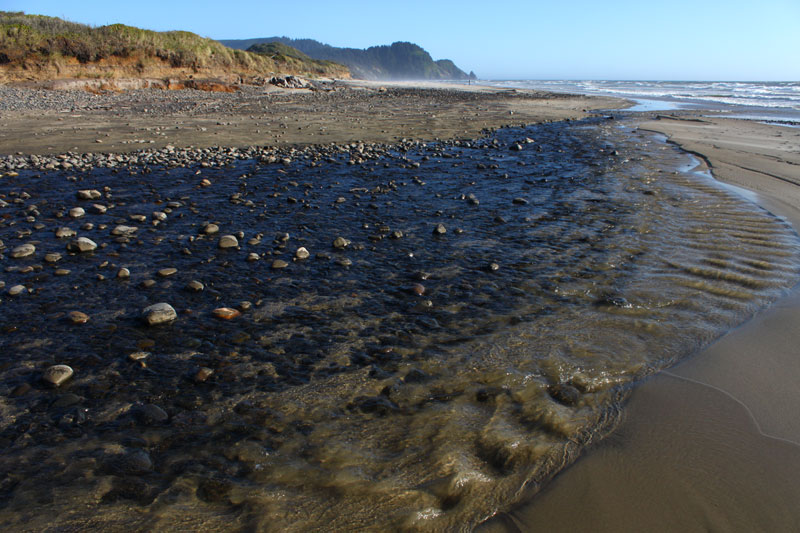
Muriel O. Ponsler Memorial State Scenic Viewpoint near Florence. Just north of Florence, and a sliver north of Carl G. Washburne State Park and the Hobbit Trail, Muriel O. Ponsler Memorial State Scenic Viewpoint sits in the midst of all manner of tufts of sand and bulbous cliff structures. Here, the other China Creek emerges, spilling out rather suddenly and without much hint it was there. See the Upper Lane County Virtual Tour
However, China Creek is part of a trail system in this section of wild central Oregon coast, and it intersects with the famed Hobbit Trail, Washburne's campgrounds, and it trails through the wilderness well east and above the Heceta Head Lighthouse.
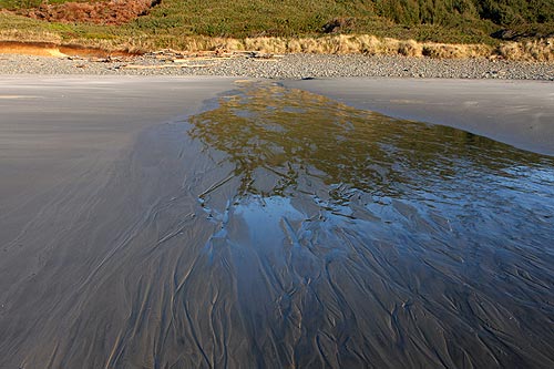
The China Creek Loop Trail is 3.3 miles of a loop found at one end of the Valley Trail or the eastward section of the Hobbit Trail, encircling the creek, a few ponds and sometimes even a beaver-damned lake. Wander up about two miles from the Hobbit Trail or from Carl G. Washburne, and you'll enter some thick, atmospheric forest.
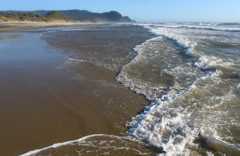
A trailhead at Hobbit Trail also winds a little over a mile through forestland and the occasional stunning viewpoint, eventually twisting and switching back periodically to wind up in back of the Heceta Head Lighthouse.
Ponsler itself is a hidden gem, with a somewhat small parking lot providing a low beach access to all that fluffy sand. The beach is long and flat, disappearing to the south into the headland next to Hobbit Trail's access and then dead-ending to the north in some hidden cliffs just south of Tokatee Klootchman. It's actually the only way to get to those distant cliffs: you have to hike northward from Ponsler.
Sands here are an interesting breed of Oregon coast landscape. They pile really high in the summer and become wispy dunes, but they sink substantially in winter and show lots of gravel beds. It's not a bad place to search for agates.
Oregon Coast Hotels in this area - South Coast Hotels - Where to eat - Maps - Virtual Tours
Cannon Beach Lodging
Nehalem Bay Lodgings
Manzanita Hotels, Lodging
Three Capes Lodging
Pacific City Hotels, Lodging
Lincoln City Lodging
Depoe Bay Lodging
Newport Lodging
Waldport Lodging
Yachats Lodging
Oregon Coast Vacation Rentals
Oregon Coast Lodging Specials
More About Oregon Coast hotels, lodging.....
More About Oregon Coast Restaurants, Dining.....
LATEST Related Oregon Coast Articles
The building had also been robbed of pipes and copper by other thieves. True Crime, Astoria, Warrenton
Oregon Coast Crabbing Petition Denied, Rulemaking Process Remains on Course
A petition on procedural matters denied; no major changes yet. Whale
S. Oregon Coast Wind Warnings, Waves Up To 23 Feet
Gusts up to 65 and high waves for the weekend from Reedsport to Brookings. Weather
Newport Latest Oregon Coast Town to Ban Personal Fireworks Year-Round
City countcil voted this week; the pro fireworks display goes on as usual
Hazardous Seas Watch on N. Oregon Coast, S. Washington Coast, Waves Up To 15 Ft
Beaches will require caution but some good wave shows possible
Annual 'Maine' Event Returns to N. Oregon Coast's Seaside Aquarium
February 22 brings the fundraiser to Seaside. Seaside events
From Taking In Cool Oregon Coast Colors on the Patio to Seaside's Action
Review of Seaside's Seashore Inn on the Beach: spectacle with breakfast and your dog. Seaside hotel reviews
Oregon US Coast Guard Team Assists in Olympic National Forest Rescue
Helicopter team from Astoria rescued hikers on Washington's Mount Ellinor
Back to Oregon Coast
Contact Advertise on BeachConnection.net
All Content, unless otherwise attributed, copyright BeachConnection.net Unauthorized use or publication is not permitted


