From the Oregon Coast's Tallest Peaks: Perpetua, Humbug, Neahkahnie, Foulweather
Published 04/15/21 at 5:55 AM PDT
By Oregon Coast Beach Connection staff

(Oregon Coast) – From the north Oregon coast down through the south coast, little can fill you with wonder like a big view from up on high. You’re not exactly touching the sky – but sometimes you’re far up enough that the clouds will touch you. On occasion you’re even above them. (Above: atop Neahkahnie Mountain, courtesy Tiffany Boothe / Seaside Aquarium)
Aside from that gripping I’m-at-the-beach feeling, when are you at your highest on the Oregon coast?
At its peaks. Literally, there are truly soaring places next to the sands that jut up higher than you can imagine.
Humbug Mountain. A multi-faceted journey, this southern Oregon coast monster of an attraction sits about six miles south of Port Orford, offering up a wide array of beaches surrounding it, the Humbug Mountain State Park and its campgrounds, and expansive trails to some jaw-dropping peaks.
At 1,765 feet, Humbug Mountain is the biggest behemoth directly over the Oregon coastline.
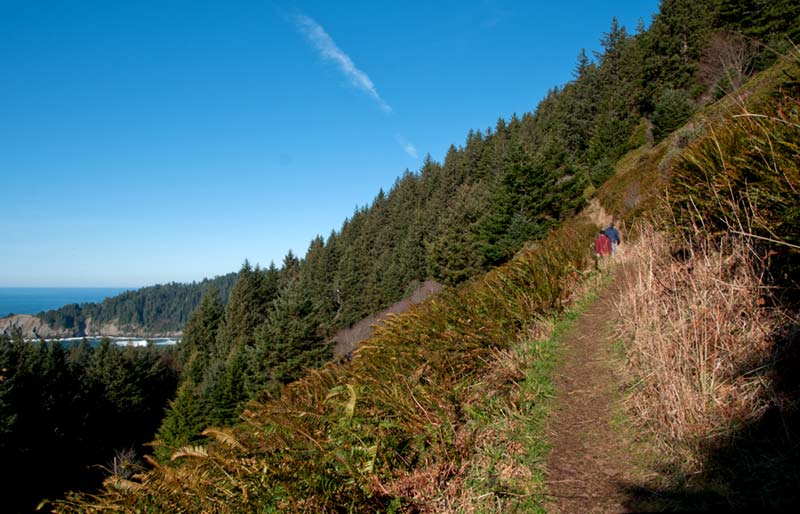
That peak is a ways away: it’s a 5.5-mile hike round-trip. However, you get to witness numerous spots along the way giving somewhat aerial views of the ocean and even Port Orford in the distance. Many gigantic, often ancient trees inhabit this wonderland, occasionally coming with unique looks, all covered in mossy material or bent in wacky ways. To the east sit the sprawling coast mountains and hills going as far as the eye can see.
Don’t be surprised to see deer wandering past you, and other extremely remote areas may cloister cougar or bear.
The beaches are often the big attraction, and they’re generally broad and long, with the occasional mind-numbingly old sea stack plopped here or there. They’re all a short walk from the state park or from roadside pullouts. South Coast Hotels - Southern Coast

Includes exclusive listings; some specials in winter
In Cannon Beach:
Includes rentals not listed anywhere else
In Manzanita, Wheeler, Rockaway Beach:
Some specials for winter
In Pacific City, Oceanside:
Some specials for winter
In Lincoln City:
Some specials for winter
In Depoe Bay, Gleneden Beach:
Some specials for winter
In Newport:
Look for some specials
In Waldport
Some specials for winter
In Yachats, Florence
Some specials for winter
Southern Oregon Coast Hotels / Lodgings
Reedsport to Brookings, places to stay; winter deals
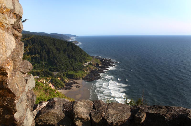
Top of Cape Perpetua. A few miles south of Yachats and eight hundred feet up, Cape Perpetua provides some of the more intense views along the entire Oregon coast. You’re atop an old volcano here as well.
You can choose to wind your way up slowly via the hiking trail and some fairly cramp-inducing stretches, or simply drive the twisting road up and take the really easy way. Through this thickly forested area you may see a black bear on the rare occasion.
From this vantage point, you get a rather dizzying sense of how high you are. The sheer dropoff in front of the main viewpoint is one, or check out the rooftop of the Cape Perpetua Interpretive Center – from a few hundred feet up. You also get a remarkable glimpse of that long walkway from the top of the parking lot down to Devil’s Churn.
The highlight, of course, is the famed stone shelter, created in the ‘30s. There, to everyone’s delight, is a uniquely atmospheric building that gazes out over surf, sky and lush forestland. Hotels in Yachats - Where to eat - Yachats Maps and Virtual Tours

Cape Foulweather, Depoe Bay area. Day or night this spot is a wow-inducer.
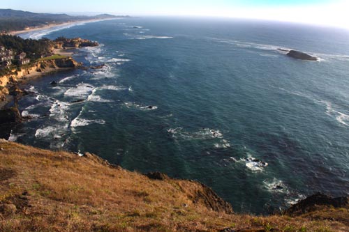
500 feet above it all, Cape Foulweather is known for its whale-spotting surprises as well as endless views north or south. Beyond just the sheer expanse of ocean, even more intriguing are the bubble-like cliffs seen from here, which you drove past along the Otter Crest Loop as you get here. They are mesmerizing and truly secretive: most you cannot get near. You’ll never get to see those massive sea caves any other way than from here. You’ll never get to explore those complex, thickly-greened undulating landscapes. Only from Cape Foulweather, next to the old lookout gift shop, can you see them.
Except for one area: one of these is accessible via a secret trail farther north.
To the south, there’s a completely aerial view of Otter Crest, the village Otter Rock and the Devil’s Punchbowl.
Then at night, if you get clear conditions, the place is a complete show-stopper. Vast displays of the night sky and the ring of the galaxy surround you. Or if there’s a moon involved and some amount of fog, you may get to see the mists lit up by our lunar orb and all of it reflected in the ocean.
Cape Foulweather is high up enough to create its own weather in a way. See video of fog flying up the side of the peak. Hotels in Depoe Bay - Where to eat - Depoe Bay Maps and Virtual Tours

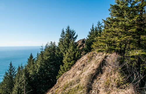
Neahkahnie Mountain. The second highest peak right above the Oregon coast, Manzanita’s Neahkahnie Mountain soars up to 1,680 feet high. The Neahkanie viewpoints are definitely a highlight, but they’re only about 600 feet up. To get to the very top, it’s a three-mile hike and a fair amount of work, but it’s not too difficult. Hiking experts say even the novices can do it. (Above: atop Neahkahnie Mountain, courtesy Tiffany Boothe / Seaside Aquarium)
About a mile up, after sometimes steep switchbacks, you arrive at a ridge. After that, stunning viewpoints appear with great regularity. Another half mile up and you’re at the top, with a meadow and sprawling vistas of Manzanita, Nehalem Bay and sometimes even glimpses of Rockaway Beach and Oceanside far to the south. Hotels in Manzanita, Wheeler - Where to eat - Manzanita, Wheeler Maps and Virtual Tours
Cannon Beach Lodging
Nehalem Bay Lodgings
Manzanita Hotels, Lodging
Three Capes Lodging
Pacific City Hotels, Lodging
Lincoln City Lodging
Depoe Bay Lodging
Newport Lodging
Waldport Lodging
Yachats Lodging
Oregon Coast Vacation Rentals
Oregon Coast Lodging Specials
More About Oregon Coast hotels, lodging.....
More About Oregon Coast Restaurants, Dining.....
LATEST Related Oregon Coast Articles
The building had also been robbed of pipes and copper by other thieves. True Crime, Astoria, Warrenton
Oregon Coast Crabbing Petition Denied, Rulemaking Process Remains on Course
A petition on procedural matters denied; no major changes yet. Whale
S. Oregon Coast Wind Warnings, Waves Up To 23 Feet
Gusts up to 65 and high waves for the weekend from Reedsport to Brookings. Weather
Newport Latest Oregon Coast Town to Ban Personal Fireworks Year-Round
City countcil voted this week; the pro fireworks display goes on as usual
Hazardous Seas Watch on N. Oregon Coast, S. Washington Coast, Waves Up To 15 Ft
Beaches will require caution but some good wave shows possible
Annual 'Maine' Event Returns to N. Oregon Coast's Seaside Aquarium
February 22 brings the fundraiser to Seaside. Seaside events
From Taking In Cool Oregon Coast Colors on the Patio to Seaside's Action
Review of Seaside's Seashore Inn on the Beach: spectacle with breakfast and your dog. Seaside hotel reviews
Oregon US Coast Guard Team Assists in Olympic National Forest Rescue
Helicopter team from Astoria rescued hikers on Washington's Mount Ellinor
Back to Oregon Coast
Contact Advertise on BeachConnection.net
All Content, unless otherwise attributed, copyright BeachConnection.net Unauthorized use or publication is not permitted


