 |
What a Difference Seasons Make on Oregon Coast
Published 03/09/2012
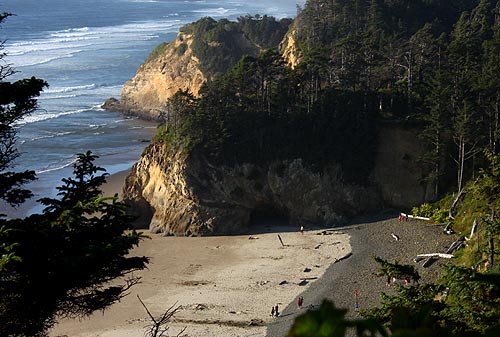
(Cannon Beach, Oregon) – Hug Point, on the north Oregon coast – just south of Cannon Beach – could well be the poster child for Oregon coast geologic oddities. It also tends to show off just how dramatically that beaches can change over the course of the year, when sand levels rise and fall.
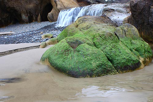
When it's summer and everything is blue and wonderful (or whatever weather pattern the Oregon coast gets during summer), sand levels get quite high. Calmer ocean conditions bring in sand, raising the levels. In the photo above, this is Hug Point during such a summer's sand level rise. Note the slope filled with the polished, rounded rocks the area is know for, and where the sand begins. Also notable is the cave, where sand has filled it to some degree.

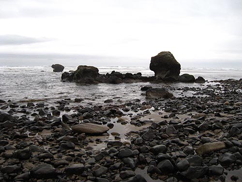
Then in this photo, check out the sand levels during winter. They've dropped so low you can see the bedrock, and those sands in the first photo have almost completely disappeared. Again, quite notable is that cave, where you can now see its rubble-filled bottom.
When you see bedrock like this or gravel beds during the winter, this is also a good sign for agate hunting.
Winter's storms are what scour out the sand levels. All that crazy, foamy action sucks sand outward. When the storms subside, you can sometimes see the sand levels go right back up, given the right conditions.
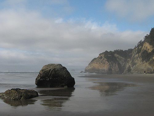
Certainly, summertime replenishes all that sand (above: Hug Point in summer).
During really active winters, Hug Point can yield some remarkable coastal oddities that were hidden beneath the sand, like ghost forest stumps a few thousand years old to “red towers” - conglomerations of iron and other elements that form surreal reddish structures beneath the sands.
Tom Horning, a geologist from Seaside who studies the north Oregon coast, including these areas near Cannon Beach, said this place can yield all sorts of clues to the prehistory of the region. Before the last Ice Age, things were markedly different here.
Above: the same structure at winter, when you can also see the bedrock.
The intricate and even weird cliffs visible now at the state park were once buried beneath all sorts of sediment, and were under layers of a terrace and shoreline that stretched miles out beyond where the sea and beach now meet.
 “Most likely, the terrace surface extended thousands of yards to many miles to the west, but the ocean has eroded it away,” Horning said. “This erosion took place after the most recent ice age peaked around 18,000 years ago. At that time, sea level was nearly 375 ft below its present level, and the shoreline was approximately 20 miles west of Hug Point.”
Beneath the sea, there is still evidence of some of this landscape, Horning said – stuff that echoes that current look of Cannon Beach in an odd way. “There are even sea stacks that look just like Haystack Rock, surrounded by rounded boulders.”
More About Oregon Coast hotels, lodging.....
More About Oregon Coast Restaurants, Dining.....
 |
 |
 |
LATEST OREGON COAST NEWS STORIES
Oregon Coast Whales - Guide to Whale Watching; Whale News, Blog |
Back to Oregon Coast
Contact Advertise on BeachConnection.net
All Content, unless otherwise attributed, copyright BeachConnection.net Unauthorized use or publication is not permitted
Secrets of the Season |
Unusual Travel Articles TravelParanormal.com allows you to submit your own creepy tale or debunk one - or see up-to-the-minute news headlines about travel and the paranormal. News Headlines from All Over Oregon Need to scan Oregon headlines? Constantly updated news from all over Oregon: a comprehensive, up-to-the-minute display of news headlines from a variety of media |


