Coos Bay, Charleston, North Bend Complete Guide: Southern Oregon Coast Travel
Updated Weekly
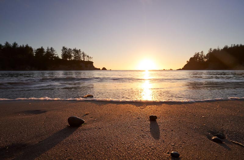
(Coos Bay, Oregon) – Need a guide that shows every beach and attraction in the Coos Bay area? Hang on for quite a ride on this part of the southern Oregon coast. There’s a lot to check out, and it all starts at Beale Lake, just north of Coos Bay and North Bend. (Above: Sunset Bay. Photo courtesy Oregon's Adventure Coast)
Along this section of Highway 101, you’re a ways inland and the beaches aren’t usually visible, mostly blocked by firm layers of towering trees and undulating dunes. Riley Ranch County Park allows you access to the dunes and the scenic pleasures of Beale Lake. Otherwise, beach accesses along here are few and far between. There’s camping at the county park as well. More Southern Coast
From here, Highway 101 takes you into the tiny community of Hauser and the absolute edges of Oregon Dunes National Recreation Area. A variety of little lakes occupy these large tracts of dunes, which include Hauser Sand Camping Access. Various dune buggy rental spots are found in these areas.
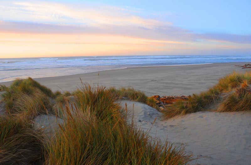
Horsfall Beach. A short jaunt down the highway, Horsefall Beach has more easily accessible roads as well as lakes, hiking, campgrounds and the centerpiece park that’s run by the feds. There’s an easily accessible viewing platform and a sizable campground as well. It’s about three or four miles southward to reach the north spit of Coos Bay. (Photo courtesy Oregon's Adventure Coast)
Coos Bay’s North Spit – Glasgow. The spit has seen its share of shipwreck action in the past (see the Coos Bay Mystery Shipwreck of 2008 and the Wreck of the Czarina). Glasgow was founded by a group of real estate speculators in the 1890s, and didn’t become much until Highway 101 was constructed in the 1920s. More Southern Coast
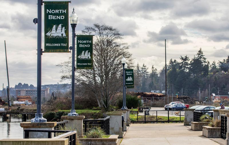
As the highway bridge brings you onto the mainland again you think you’re entering Coos Bay - it’s actually North Bend. That city was incorporated in 1903. (Photo courtesy Oregon's Adventure Coast)
A short jaunt through and you’ve entered Coos Bay, which doesn’t technically have any ocean beaches within city limits. Those are up on the north spit, which again gets tricky in spots.
Coos Bay Attractions
North Spit, Coos Bay. There’s at least three miles worth of beachy goodness along what is considered the spit, with a terrain largely similar to the dunes areas just north, though it flattens out considerably. It’s truly remote and rugged here, traversed via what is called Foredune Road running alongside the foredunes of the beaches.
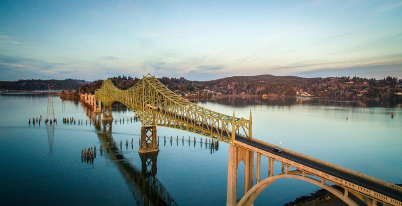
Conde McCullough Bridge to Empire. The first part of Coos Bay to come into being was a little place called Empire, which was later absorbed by the larger city. Now, you’ll see some references to a district called Empire. There, facing the north spit, you’ll find the Hollering Place, which is a park with various bay views and that inimitable pier for checking things out. (Photo courtesy Oregon's Adventure Coast)
There’s the Coos Bay History Museum where you can enlighten yourself on the many distinctive aspects of the area’s past (1210 N Front St, Coos Bay, 541-756-6320), Mingus Park is an eye-popping cavalcade of flowery color with a myriad of little walking trails. The other main attraction is the Conde McCullough Memorial Bridge, a definite stunner designed by the famed OSU grad in the mid century. There’s also the Coos Art Museum and the Oregon Coast Historical Railway and museum.
Cape Arago Highway to the Beaches (North to South). Shortly after the Hollering Place begins the scenic highway. More Southern Coast
Barview. A tiny unincorporated community on the outskirts of Coos Bay with – you guessed it – lots of views of the bar and jetties. It includes a placid little wayside from which to watch it all. This is the second of two Barviews on the Oregon coast: the other, larger one is on Tillamook Bay.
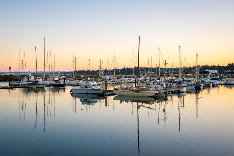
Charleston. The teeny, tiny place is home to a large fishing fleet and comes with exquisite dockside and marina scenery. It contains the brain-tickling Charleston Marine Life Center. Watch the ships come in or admire the freaky, hole-covered yellow cliffs below. Continue down the highway or onto the roads toward Bastendorff Beach, or keep heading south down Seven Devils Road until it meets up with Highway 101 near Bandon. (Photo courtesy Oregon's Adventure Coast)
Bastendorff Beach. A wide stretch of beach along with other attractions such as Tunnel Point and access to the south jetty. Campgrounds are found nearby.
Yoakam Point. Though it lacks signage it’s actually part of the state parks system. With sweeping cliffs and views towards the lighthouse and to the north, there is one informal, unmarked parking lot in the trees and a trail or two letting you in on the secret views. More Southern Coast
Lighthouse Beach. Most visitors access the beach by parking along the Cape Arago Highway near the intersection of Lighthouse Way, then walking down a footpath to the beach. Secluded and elusive, it has funky, almost serrated rock structures jutting up from the sands.
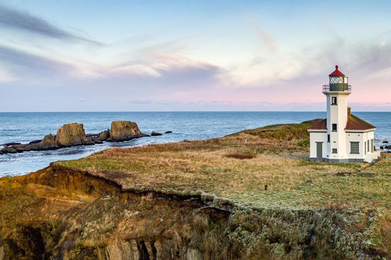
Cape Arago Lighthouse. The headland with the lighthouse is in reality called Chief’s Island: ironically the actual Cape Arago is a bit south of here. Gawk at the remnants of the old walkway to the island; you can no longer get to the lighthouse. (Photo courtesy Oregon's Adventure Coast)
Sunset Bay State Park. This stunner always seems to live up to its name, with plenty of sands to play on and intricate cliffs that are wowing. The trailhead for the Sunset Bay to Cape Arago Trail (8.5 miles) lies here. There’s a campground with RV spots as well. Also see New Ghost Forest on S. Oregon Coast Remains of 1700 Megathrust Quake, Tsunami. More Southern Coast
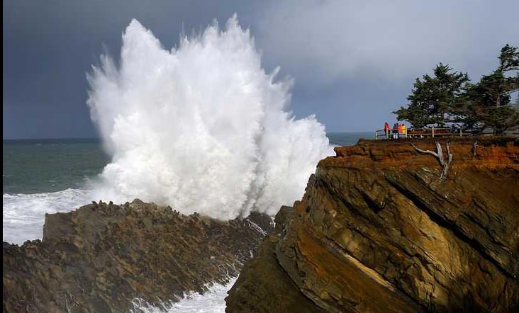
Shore Acres State Park. An incredible garden of colorful flowers, gargantuan waves, a wildlife overlook and astounding rock formations: this one has it all. It’s one jaw-dropping moment after another, whatever time of year. (Photo courtesy Oregon's Adventure Coast)
Simpson Reef Overlook. About a half mile south of Shore Acres, what looks like a modest, unassuming pullout provides grand views of wacky wildlife below. You’ll hear the barks and moans of all kinds of seals and sea lions and watch them carouse. Puffins and other types of birds are seen here.
Cape Arago State Park. A sprawling headland with remarkable views, it’s like the climax to the Arago highway. A stone lookout lends the place even more atmosphere. Take the South Cove trail to amble around a rather dramatic beach, or head to Drake Point (named for Sir Francis Drake who documented his passing by in the 1500s). More Southern Coast
Latest Coos Bay, Charleston, North Bend
The building had also been robbed of pipes and copper by other thieves. True Crime, Astoria, Warrenton
Oregon Coast Crabbing Petition Denied, Rulemaking Process Remains on Course
A petition on procedural matters denied; no major changes yet. Whale
S. Oregon Coast Wind Warnings, Waves Up To 23 Feet
Gusts up to 65 and high waves for the weekend from Reedsport to Brookings. Weather
Newport Latest Oregon Coast Town to Ban Personal Fireworks Year-Round
City countcil voted this week; the pro fireworks display goes on as usual
Hazardous Seas Watch on N. Oregon Coast, S. Washington Coast, Waves Up To 15 Ft
Beaches will require caution but some good wave shows possible
Annual 'Maine' Event Returns to N. Oregon Coast's Seaside Aquarium
February 22 brings the fundraiser to Seaside. Seaside events
From Taking In Cool Oregon Coast Colors on the Patio to Seaside's Action
Review of Seaside's Seashore Inn on the Beach: spectacle with breakfast and your dog. Seaside hotel reviews
Oregon US Coast Guard Team Assists in Olympic National Forest Rescue
Helicopter team from Astoria rescued hikers on Washington's Mount Ellinor
Search over 7,5000 Pages for Oregon coast subjects, articles or lodging...
Back to Oregon Coast
Contact Advertise on BeachConnection.net
All Content, unless otherwise attributed, copyright BeachConnection.net Unauthorized use or publication is not permitted


