 |
New Tech Deployed Off Oregon Coast to Study Climate, Dead Zones
Published 06/08/2015 at 5:41 AM PDT
By Oregon Coast Beach Connection staff
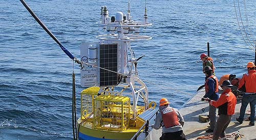
(Newport, Oregon) – A cutting-edge piece of technology is being deployed off the Oregon coast this week to more closely study climate change, dead zones, earthquakes and many more aspects of the ocean.
It's the last piece of what's called the Endurance Array – a buoy fitted with a large number of complex instruments that detect details of what's going on inside the ocean. Part of a major science infrastructure called the Ocean Observatories Initiative that was created in 2009, at $386 million it is the largest single investment in ocean monitoring in U.S. history.
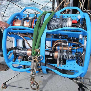
The array is fitted from top to bottom with instruments that can study ocean acidifacation, subduction zone earthquakes, tsunamis, harmful algal blooms, wave energy and even the hypoxia that sometimes takes place in this region, resulting in “dead zones.” It's the first time that scientists have a device that can see all the components of the ocean simultaneously, from the physics to the biology to the chemistry.
The sensors begin on the seafloor, attached to where the buoy array is anchored at the bottom. More sensors are placed on the attaching cable, running all the way up the water column to instruments on the surface. Various sensors will measure water velocity, temperature, salinity, pH, light intensity, carbon dioxide, dissolved oxygen, nitrate, chlorophyll, backscatter (or the measure of particles in the water), light absorption – and even populations of zooplankton and fish.
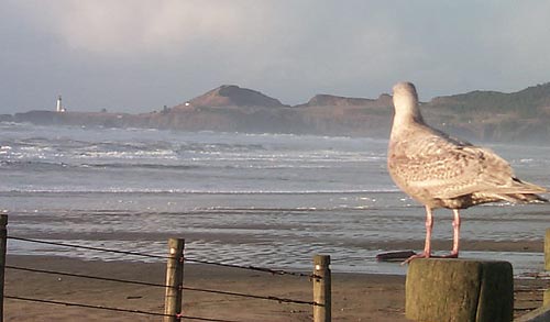
 This week, scientists from Oregon State University and the Hatfield Marine Science Center will place the complex buoy about a mile offshore from Newport's Nye Beach area, at about 25 meters deep. It's the third and final platform in the array's “Newport Hydrographic Line,” which already includes a shelf surface buoy in 80 meters of water, about 10 miles off the coast; and an off-shore surface buoy in 500 meters of water, about 35 miles out.
The in-shore surface buoy is designed to be battered by severe Pacific Ocean waves that hit the coast in winter, yet stay in place and continue making important measurements.
Jack Barth, an OSU oceanographer, has been a lead scientist on the Ocean Observatories Initiative since its initial plannings a decade ago.
“For the first time, the science community will be able to monitor and assess all components of the ocean simultaneously, from the physics to the biology to the chemistry,” Barth said. “The OOI is not just about measuring the ocean in different ways – it is a way to understand how ocean processes affect things like plankton production and how that in turns fertilizes the marine food web, affects acidification, leads to harmful algal blooms, and affects oxygen in the water that may lead to dead zones.”
Barth said this array system is a game-changer, enabling scientists to better monitor toxic plankton blooms and other threats. Even fishermen can utilize some of the data to assist them as well.
The other two buoys in the Newport Hydrographic Line don't as yet have all the instrumentation as the latest array. Once they do, they will be plugged into an underwater cable that will provide additional power and two-way communications.
Scientists from OSU deployed three others off the Washington coast, and together the two systems will provide data on what happens just and south of the highly influential Columbia River. Undersea gliders are also being used as part of OOI, with six moving around the Northwest coastline.
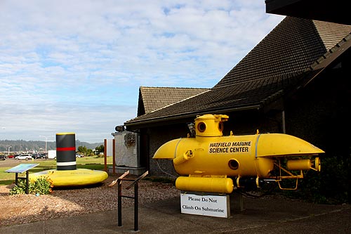
More on Newport and the Hatfield Marine Science Center below, and at the Newport Virtual Tour, Map.
More About Oregon Coast hotels, lodging.....
More About Oregon Coast Restaurants, Dining.....
LATEST Related Oregon Coast Articles
Stabbed Seal Ends Up Having Comic Adventures on Oregon / Washington Coast |
Back to Oregon Coast
Contact Advertise on BeachConnection.net
All Content, unless otherwise attributed, copyright BeachConnection.net Unauthorized use or publication is not permitted
Secrets of the Season |
Unusual Travel Articles TravelParanormal.com allows you to submit your own creepy tale or debunk one - or see up-to-the-minute news headlines about travel and the paranormal. News Headlines from All Over Oregon Need to scan Oregon headlines? Constantly updated news from all over Oregon: a comprehensive, up-to-the-minute display of news headlines from a variety of media Oregon Coast Oceanfront Lodging, Hotels, Rentals |


