Video: Stunning Sights Around Oregon Coast's Depoe Bay Take Way More Than a Day
Published 07/17/2017 at 8:23 PM PDT - Updated 07/17/2017 at 8:33 PM PDT
By Oregon Coast Beach Connection staff
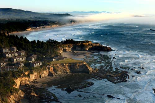
(Depoe Bay, Oregon) – There's so much in and around Depoe Bay, on the central Oregon coast, that it's dizzying. The tiny town itself is crammed with loads of sights and secret spots, but that's another story (see Five Gloriously Hidden, Secret Spots of Depoe Bay, Oregon Coast). If you expand your explorations to just four miles on either side of the little burgh by the bay, than you've literally got more to do than you could handle in one day. Two days might not even be enough.
This recent video by Oregon Coast Beach Connection gives you a scenic overview – albeit an extremely brief one. To get a much better picture of the area, from generalities to deep details, see the Depoe Bay Virtual Tour.
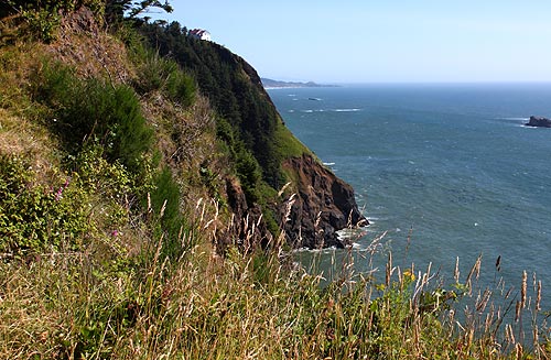
A quick explanation of the video's scenes:
With the initial views of the Depoe Bay Bridge, you glimpse the heart of the town's history. This bridge was designed by famed architect Conde B. McCullough and built in 1927, just as this part of Highway 101 was being built. It clocks in at 312 feet in length and the main span is a 150-foot rib deck arch. Later additions to the structure happened in 1940, allowing more traffic.
Depoe Bay has long laid claim to “smallest navigable harbor in the world,” and you see that in action with a whale watch tour boat coming in through the bay mouth. Interesting fact: there is no official status or criteria for what is the smallest navigable harbor in the world. That category doesn't really exist. It's still a nice little slogan for this part of the Oregon coast.
In the next scene, you're standing at the southern face of Otter Rock (your back would be to the Devil's Punchbowl). It's a bit of a secret viewpoint – quite overlooked for the more obvious spots facing the rampaging Punchbowl. Below you is the famed surfing hotspot neighboring Moolack Beach and a fascinating attraction that's about 4,000 years old.
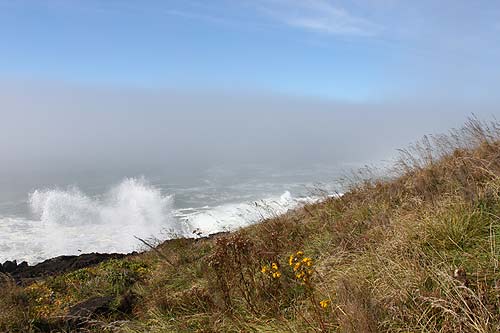
After that, you're staring out over Rocky Creek State Scenic Viewpoint, which sits just a couple miles north of Depoe Bay city limits. This is a small headland of raucous and raging waves, constantly battering the basalt cliffs below the grassy stretches. Taking a picture here is often a bit of a challenge: the sea more often than not keeps spraying you and it takes just a couple of clicks before you have to wipe your lens.
Includes exclusive listings; some specials in winter
In Cannon Beach:
Includes rentals not listed anywhere else
In Manzanita, Wheeler, Rockaway Beach:
Some specials for winter
In Pacific City, Oceanside:
Some specials for winter
In Lincoln City:
Some specials for winter
In Depoe Bay, Gleneden Beach:
Some specials for winter
In Newport:
Look for some specials
In Waldport
Some specials for winter
In Yachats, Florence
Some specials for winter
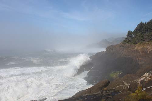
Next up is a clip from Otter Loop Road, the tiny road that runs just below Highway 101 as you get closer to Cape Foulweather and Otter Rock. For a couple miles or more it's a one-way stretch. The views here a complete knockout, with dramatic cliffs that plunge abruptly into the ocean and an expansive horizon.
The following clip comes from Boiler Bay – the headland portion of it. Officially known as Boiler Bay State Scenic Viewpoint, the main section has restrooms, a large grassy area, and a stunning, enormous view of the bay (which was named after the wreck of the J. Marhoffer in 1910). Another, smaller section is almost a mile north along the highway, where a small patch of gravel allows you to park and see the boiler from the shipwreck.
At the one-minute mark, the video shows off the northern view from the Otter Rock, from the viewpoint just above the Devil's Punchbowl. From here, you can see the marine gardens that you can access from a path about half mile from this spot. You're also looking at the top of Cape Foulweather.
The final scene shows just that lookout point. Cape Foulweather sits about 500 feet above it all, and from here you could swear you're in heaven. It's that gorgeous and that lofty. Depoe Bay Lodgings / Hotels in this area - Where to eat - Maps and Virtual Tours
More About Depoe Bay Lodging.....
More About Oregon Coast Restaurants, Dining.....
Cannon Beach Lodging
Nehalem Bay Lodgings
Manzanita Hotels, Lodging
Three Capes Lodging
Pacific City Hotels, Lodging
Lincoln City Lodging
Depoe Bay Lodging
Newport Lodging
Waldport Lodging
Yachats Lodging
Oregon Coast Vacation Rentals
Oregon Coast Lodging Specials
LATEST Related Oregon Coast Articles
The process is painful but it needs to be left alone. Marine sciences
Lincoln City Police Car Hit By Falling Tree in Central Oregon Coast Storm: Video
You can see the tree leaning then tipping over. 1 other car involved. Weather
Two N. Oregon Coast Rescues Near Cannon Beach Involve Various Agencies - Video
Rescues at Ecola State Park and Saddle Mountain
Images, Video and Tales from Oregon Coast / Washington King Tides
Some as-yet-unreleased images, wild incidents. Weather
Comet ATLAS Captured Above Oregon, Even Coast - Photos, Video
Surprise astronomy moments all over Oregon on Sunday. Weather
Green Fireball Lights Up Portland, Washington, Eugene, Oregon Coast - Video
In slow motion; seen up and down the west coast. Find out what it's made of. Sciences, astronomy
Video, Photos Dig Into Story Behind N. Oregon Coast's Reopened, Captivating T...
After about ten years of being closed off due to a major landslide. Oceanside, Pacific City
Did You Know There's a Scenic Highway Beneath a Part of Oregon Coast's 101? V...
Near Depoe Bay, as the road rises you may spot a nondescript route
Back to Oregon Coast
Contact Advertise on BeachConnection.net
All Content, unless otherwise attributed, copyright BeachConnection.net Unauthorized use or publication is not permitted


