 |
Oregon Scientists: Japan, Sumatra Earthquakes Rewrite Standards
Published 01/28/2013
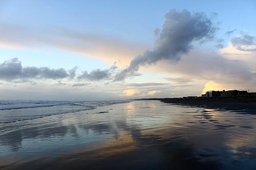
(Corvallis, Oregon) – The two most prominent earthquakes of the last decade in Japan and Sumatra caused a lot of stunned geologists, as they had no idea that either region was capable of producing a megathrust earthquake with a magnitude exceeding ̴ 8.4. Earthquake scientists started to rewrite their predictive models. (Above: Seaside, on the Oregon coast, is among the beach towns overdue for a major earthquake event).
Now, a group of Oregon geologists have published a paper in the journal Seismological Research Letters that describes how these earthquake prediction standards need to be amended, and how scientists need to look back farther in time. The team from Oregon State University, led by researcher Chris Goldfinger, describes how past global estimates of earthquake potential were constrained by short historical records and even shorter instrumental records. To gain a better appreciation for earthquake potential, he says, scientists need to investigate longer paleoseismic records.
“Once you start examining the paleoseismic and geodetic records, it becomes apparent that there had been the kind of long-term plate deformation required by a giant earthquake such as the one that struck Japan in 2011,” Goldfinger said. “Paleoseismic work has confirmed several likely predecessors to Tohoku, at about 1,000-year intervals.”
Researchers also looked at long-term “supercycles” of energy within plate boundary faults, which appear to store this energy like a battery for many thousands of years before causing a massive earthquake that releases all that stored up pressure. The OSU group also noted smaller earthquakes do not dissipate that energy to any sizable degree.
The analysis admits scientists have likely been underestimating the number of regions around the world that are capable of producing earthquakes on the same scale as that in Tohoku, Japan in 2011. Goldfinger said many of the plate boundaries thought to have the potential for a 9.0 or greater have been part of modeling systems since the 70's.
It's possible many models have been wrong, Goldfinger said.
“We have to assume, however, that the potential for 9.0 subduction zone earthquakes is much more widespread than originally thought,” Goldfinger said.
Paleoseismic evidence of subduction zone earthquakes is not yet plentiful in most cases, so little is known about the long-term earthquake potential of most major faults. Scientists can determine whether a fault has ruptured in the past – when and to what extent – but they cannot easily estimate how big a specific earthquake might have been. Most, Goldfinger says, fall into ranges – say, 8.4 to 8.7.
Nevertheless, that type of evidence can be more telling than historical records because it may take many thousands of years to capture the full range of earthquake behavior.
Goldfinger's group of OSU researchers are now pointing to several areas previously thought to be not as powerful in potential but which should be reconsidered. These include central Chile, Peru, New Zealand, the Kuriles fault between Japan and Russia, the western Aleutian Islands, the Philippines, Java, the Antilles Islands and Makran, Pakistan/Iran.
Onshore faults such as the Himalayan Front may also be hiding outsized earthquakes, the researchers add. Their work was supported by the National Science Foundation.
Goldfinger, who directs the Active Tectonics and Seafloor Mapping Laboratory at Oregon State, is a leading expert on the Cascadia Subduction Zone off the Pacific Northwest coast of North America. His comparative studies have taken him to the Indian Ocean, Japan and Chile, and in 2007, he led the first American research ship into Sumatra waters in nearly 30 years to study similarities between the Indian Ocean subduction zone and Cascadia.
There is an abundance of paleoseismic evidence in this area off the Oregon coast and the western U.S., Goldfinger said. When a major offshore earthquake occurs, the disturbance causes mud and sand to begin streaming down the continental margins and into the undersea canyons. Coarse sediments called turbidites run out onto the abyssal plain; these sediments stand out distinctly from the fine particulate matter that accumulates on a regular basis between major tectonic events.
By dating the fine particles through carbon-14 analysis and other methods, Goldfinger and colleagues can estimate with a great deal of accuracy when major earthquakes have occurred. Over the past 10,000 years, there have been 19 earthquakes that extended along most of the Cascadia Subduction Zone margin, stretching from southern Vancouver Island to the Oregon-California border.
Other researchers on the analysis include Yasutaka Ikeda of University of Tokyo, Robert S. Yeats of Oregon State University, and Junjie Ren, of the Chinese Seismological Bureau.
More about Oregon coast geology
More Oregon coast images below:
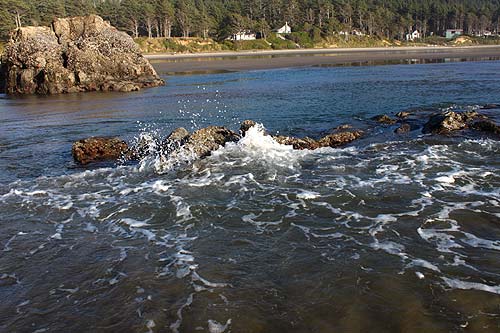
Cannon Beach (more on Cannon Beach)
More About Oregon Coast hotels, lodging.....
More About Oregon Coast Restaurants, Dining.....
 |
 |
 |
LATEST OREGON COAST WHALE STORIES
Oregon Coast Whales - Guide to Whale Watching; Whale News, Blog
Oregon Coast Vacation Rentals - A Massive List
N Oregon Coast's Manzanita, Wheeler, Nehalem and Rockaway Beach Offer Lodging...
Latest Lodging Specials, Deals from Cannon Beach, N. Oregon Coast
Staying in Pacific City, Tierra Del Mar or Oceanside? Lodging Deals Emerge
Lincoln City Lodgings, Central Oregon Coast: Latest Deals, Specials
Lincoln City Oregon Coast Lodging Updates
Complete List of Lodgings, Motels, Hotels and Vacation Rentals in Manzanita, ...
Oregon Coast Lodging Renovation News and Eclipse Openings, Alerts
Cape Kiwanda, Oregon Coast: Complete Travel, Guide, Info
Oregon Coast Summer, Events, Attractions, Science and Tourism Latest Summer News
Yachats State Recreation Area - Yachats, Oregon Coast Virtual Tour
Where Are You Going to Next on the Oregon Coast?
Best Lodgings for Storm Watching on Oregon Coast
|
Back to Oregon Coast
Contact Advertise on BeachConnection.net
All Content, unless otherwise attributed, copyright BeachConnection.net Unauthorized use or publication is not permitted
Secrets of the Season |
Unusual Travel Articles TravelParanormal.com allows you to submit your own creepy tale or debunk one - or see up-to-the-minute news headlines about travel and the paranormal. News Headlines from All Over Oregon Need to scan Oregon headlines? Constantly updated news from all over Oregon: a comprehensive, up-to-the-minute display of news headlines from a variety of media |


