Five Startling, Sometimes Scary, Geologic Changes of the N. Oregon Coast
Published 12/29/2016 at 6:53 PM PDT - Updated 12/29/2016 at 7:24 PM PDT
By Oregon Coast Beach Connection staff
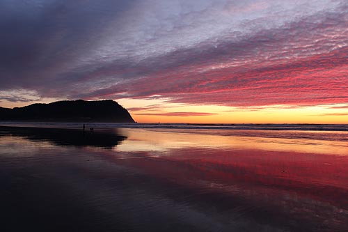
(Manzanita, Oregon) – What has happened on the north Oregon coast and what continues to change, in geologic terms, is downright awe-inspiring – even frightening. Imagine lava flows sometimes 20 feet high searing their way across Oregon and 75 miles past the beaches. Imagine that your favorite flat beach in places like Seaside, Oceanside, Manzanita or Cannon Beach may eventually become a new clifftop lookout thousands of years from now. Imagine watching one of your beloved rock structures disappear into nothing. (Above: Seaside's Tillamook Head has a particularly frightening origin story)
How the Oregon coast was born and what continues to move it around is absolutely startling. Here are five such facts about the geology of the beaches of the upper third of the coastline.
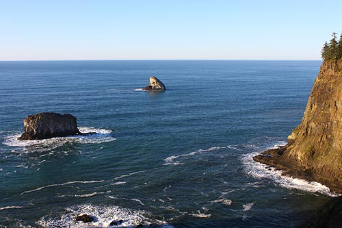
Cape Meares
Scary Lava Flows Gave Birth to Oregon Coast. Starting around 15 million years ago, a colossal fissure in the Earth around where Lewiston, Idaho is now began pouring insanely huge lava flows into this area. It’s the same hot spot that now powers Yellowstone National Park, and has before created the mega-disastrous super volcanoes that have erupted a few times over the ages.
These flows shot out over a few hundred miles, over to what is now the Oregon coast and beyond where it was then. The shoreline was 15 miles or so farther back, and the current coastline still just wide open ocean. Numerous such eruptions happened over millions of years, and scientists don't really know how many. These are called the Columbia River Basalts, as they also formed the Columbia Gorge along the way.
Cape Foulweather, Cape Lookout, Yaquina Head and Cape Meares were the result of these flows filling up huge canyons that existed at the time. Eventually, these spots rose and fell over the next 15 million years, several times over, and the canyon material around the cooled basalt eroded away, leaving just the black rock – a bit like a molding cast. Eventually, erosion took its toll on these areas as well, especially by the sea, whittling them into the shapes we know and love as the towering cliffs and headlands that attract tourists and whale watchers. Pacific City's Haystack is believed to be the remnant of this action as well, whereas the Haystack Rock at Cannon Beach is something slightly different (see below).
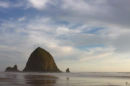
Lava Flows Burrow Then Come Back Up. Many of your favorite coastal landmarks were the result of a truly surprising action. Haystack Rock at Cannon Beach, and Rockaway Beach's Twin Rocks were something a little different.
Those massive eruptions from the east were so powerful they would burrow down into softer sediment and then come back – re-erupting elsewhere. They are called intrusive basalts, because they intruded down into the Earth's sediments and softer material and re-erupted.
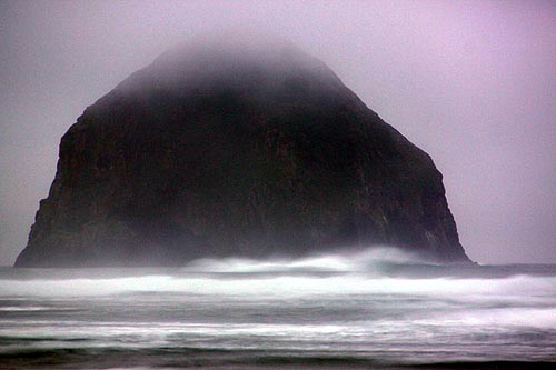
A Tale of Two Haystacks. Yes Virginia, there are two Haystack Rocks on the Oregon coast (actually there are three: one is on the south coast). The two most well-known are those at Pacific City (above) and Cannon Beach.
Have you ever wondered how tall they are?
We asked geologist Jonathan Allan, with Oregon Department of Geology and Mineral Industries, about the height of the Haystack at Pacific City.
“The rock has an estimated height of 340.6 feet (103.8 m) as determined from Lidar data collected by our agency,” he said.
Tom Horning, a geologist from Seaside, echoed what we already knew about Haytack Rock in Cannon Beach. It’s about 235 feet high.
Which one is bigger in terms of mass?
“I have calculated the Cannon Beach Haystack at 1 million tons of rock,” Horning said. “My best guess for Pacific City’s rock is about 3 million tons.”
How The N Coast is Moving. The north Oregon coast – meaning from about Pacific City northward – seems to be moving differently than the rest of the coast: the central and south coast. While all of the shoreline is changing slowly through erosion (and that seems to be happening at a higher rate due to climate change), Horning thinks the north coast is actually slowly lifting upwards, in between those big mega-quakes that are supposed to bring the Big One to the Oregon coast sometime in the next 50 years.
“If all this is accurate, the north coast is rising independently of sea level by about one foot every thousand years,” Horning said. “It appears that the coast drops from one to six feet with each earthquake, but the land still rises slowly in the meantime.”
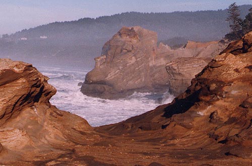
The face-like rock in 2000
Hug Point, Cape Kiwanda Disappearing? Horning notes how the beach at Hug Point – near Cannon Beach – has been steadily eroding for 4,000 years. But this is incredibly slow: the cliffs here are disappearing at a rate of 40 or 50 feet in that time. Compare that with the enormous sand dunes at Newport that were so big 4,000 years ago they covered Yaquina Head. Those took much less time to disappear.
Cape Kiwanda, however, seems to be getting sucked out to sea at a greater rate. That promontory is only made of sandstone, which isn't very resilient. There's no firm stats on how fast it's going away, but an example of this is a large arch on the northern face that crumbled back in 2007, leaving a huge pile of rubble that lets you get close to that canyon-like area at the cape's northern tip.
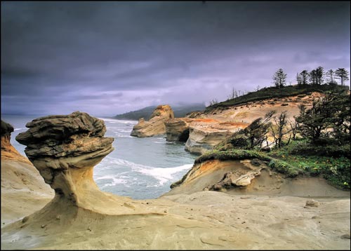
What's left of the face 15 years later
Most poignantly, if you look at pics of certain structures 15 years ago and compare them with now, you can see a huge difference. Oregon Coast Hotels in these areas - Where to eat - Maps - Virtual Tours
More About Oregon Coast hotels, lodging.....
More About Oregon Coast Restaurants, Dining.....
Cannon Beach Lodging
Nehalem Bay Lodgings
Manzanita Hotels, Lodging
Three Capes Lodging
Pacific City Hotels, Lodging
Lincoln City Lodging
Depoe Bay Lodging
Newport Lodging
Waldport Lodging
Yachats Lodging
Oregon Coast Vacation Rentals
Oregon Coast Lodging Specials
LATEST Related Oregon Coast Articles
A special history project wants your story
Updates on Snow / Freezing Rain Next Week in Oregon, Washington - South Coast...
Forecasters say be prepared in case; freeze warning south next two nights
Cape Arago Highway Reopens, S. Oregon Coast Landmarks Like Shore Acres Access...
Shut down for a month, surprise announcement on the Coos Bay-area road
Netarts Online Nature Program Takes You Inside N. Oregon Coast Beaches
February 19 from 6:30 p.m. to 8 p.m., called Beaches, Birds, and Beyond. Oceanside events, Tillamook events, Pacific City events
Small Travel Impact from Snow in Oregon Coast Range Over Weekend - Portland G...
Brief, minor snow issues in Coast Range as Portland dries up
N. Oregon Coast's Chowder Crawl Declares Washington's Castaways Seafood Grill...
Oregon Culinary tradition names a Washington coast eatery the winner. Seaside, Astoria, Long Beach, Cannon Beach, restaurant
When Sand Dollars Move on Oregon / Washington Coast the Unexpected Can Happen
They can inadvertently create art; how sand dollars move. Marine sciences
Snow Alerts Vary Around Oregon, Washington, Coastlines - Icy Roads Possible
Winter weather advisories or warnings for most of Oregon
Back to Oregon Coast
Contact Advertise on BeachConnection.net
All Content, unless otherwise attributed, copyright BeachConnection.net Unauthorized use or publication is not permitted


