'Wave Height' Explained Along Oregon, Washington Coast: What It Means
Published 11/24/20 at 4:55 AM PDT
By Oregon Coast Beach Connection staff
Includes exclusive listings; some specials in winter
In Cannon Beach:
Includes rentals not listed anywhere else
In Manzanita, Wheeler, Rockaway Beach:
Some specials for winter
In Pacific City, Oceanside:
Some specials for winter
In Lincoln City:
Some specials for winter
In Depoe Bay, Gleneden Beach:
Some specials for winter
In Newport:
Look for some specials
In Waldport
Some specials for winter
In Yachats, Florence
Some specials for winter
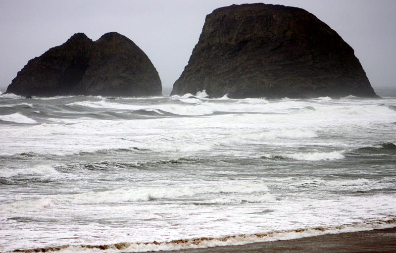
(Portland, Oregon) – What does it mean when the National Weather Service (NWS) talks about “30-foot waves” coming onshore along the Oregon coast or Washington coast? (Above, Rockaway Beach)
No, that does not mean a wall of water 30 feet high lumbering its way onto the beach. It’s more subtle and complex than that, but still dangerous if the predictions are that high.
The height of a wave is measured from trough to ridge, according to NWS meteorologist Briana Phillips. That means the top of the wave is known as the ridge – the highest point – while the trough is the bottom, or where the lowest point is.
In order to actually visualize that you’d have to be out at sea, she said. Then you could see the difference between the trough and the ridge, as you’d essentially be riding somewhere in the middle of that height difference.
Basically, that is the height of a wave measured offshore and it can, under some circumstances, crash onto the sands with that kind of strength – but not necessarily that tall.
“If there’s a big height difference between the ocean bottom and the surface, and if it’s 30-foot waves offshore and you’re watching them hit an abrupt edge like a cliff, then yes, you’ll see 30-foot waves crashing,” Phillips said. “But if it’s a beach where the slope is a gentle rise, you’ll see a gradual wave coming onto the beach. It’ll break onto the surf zone and lose its height.”
An Important Note:
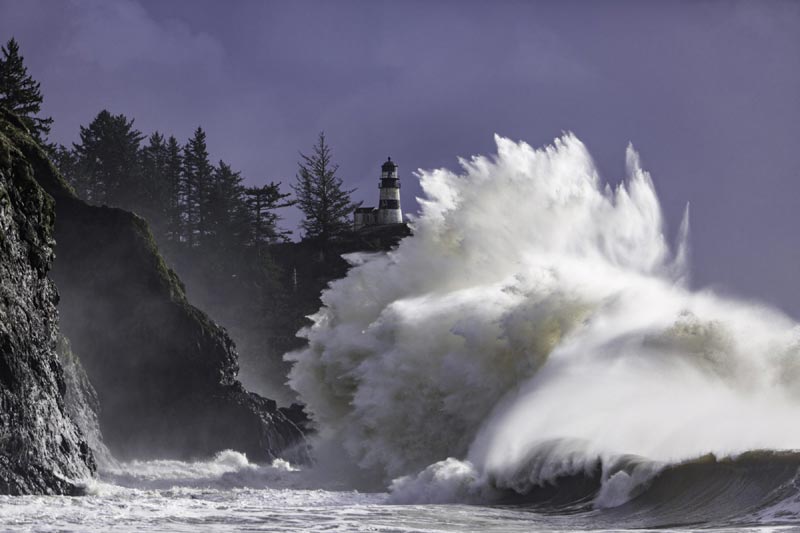
Cape Disappointment, courtesy Long Beach Peninsula Visitors.
When the NWS talks about wave height of 20 feet or 30 feet offshore, that doesn’t always translate into that kind of height or energy coming onto the beaches. The other big deciding factor is the period swells: the timing between the swells. The higher the timing in seconds, the worse a wave will be when it slams into your favorite spot along the Oregon coast or Washington coast.
Timing - or period swells – is what causes a wave to hit the shoreline with a lot of energy and come up either as a sneaker wave or a set of giant waves that inundate the sands and maybe even smack something. When the timing gets beyond 12 seconds or so, that starts to bring in more wave energy.
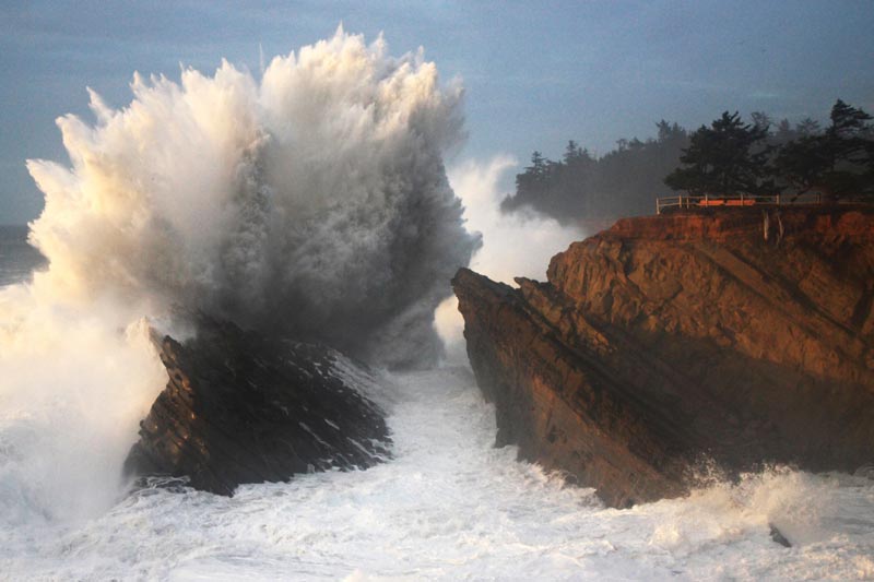
You can have 15 to 20-foot waves offshore and a low period swell, like below ten seconds, and it may not make much of a difference on the beach (rocky areas like Yachats or Shore Acres could be raucous, however.) Yet when there’s something like 15-foot wave height offshore and the period swells get really long, then you have a greater chance of sneaker waves and debris like logs being tossed onto the beaches.
Those two elements combined – wave height and period swells – are what make for dangerous conditions onshore. This is when surf advisories and surf warnings get issued.
The Portland office of the NWS deals with the area from Florence through much of the southern Washington coast (and the Seattle office also deals with the bottom part of Washington). The Medford office handles predictions for just south of Florence down to just below the California border, basically the entire southern Oregon coast and then some. Phillips said the south coast and north coast predictions and warnings or advisories can be different between the offices because they have different criteria for issuing beach messages.
As in the case of November 24, 2020, when the north coast had a surf advisory but the south coast a surf warning.
Where do such strong, dangerous waves come from? Far out at sea, according to the NWS. Essentially, a storm out there is causing waves to build up high by winds blowing across them. After awhile, the waves can literally outrun the storm that created them, which is why you’ll get some nice days with wild breaker action on the coasts of the northwest.
Wind-driven waves are a strange vicious circle. The higher the speed and duration of the winds, the larger the waves get, and then the easier it is for winds to grip them and make them even higher. Adding to that can be more local winds, especially if they’re blowing in from the west.
Another interesting even trippy fact about waves: they can “sense” the ocean floor beneath them. The contour of the land below the ocean surface will nudge waves in certain ways, sometimes taking them different directions than simply onto land, or they’ll make land-bound waves even bigger. More storm photos below
See Oregon Coast Weather - Washington Coast Weather
Oregon Coast Hotels in this area - Where to eat - Maps - Virtual Tours
Cannon Beach Lodging
Nehalem Bay Lodgings
Manzanita Hotels, Lodging
Three Capes Lodging
Pacific City Hotels, Lodging
Lincoln City Lodging
Depoe Bay Lodging
Newport Lodging
Waldport Lodging
Yachats Lodging
Oregon Coast Vacation Rentals
Oregon Coast Lodging Specials
Coos Bay's Shore Acres State Park, courtesy Oregon's Adventure Coast
More About Oregon Coast hotels, lodging.....
More About Oregon Coast Restaurants, Dining.....
LATEST Related Oregon Coast Articles
The building had also been robbed of pipes and copper by other thieves. True Crime, Astoria, Warrenton
Oregon Coast Crabbing Petition Denied, Rulemaking Process Remains on Course
A petition on procedural matters denied; no major changes yet. Whale
S. Oregon Coast Wind Warnings, Waves Up To 23 Feet
Gusts up to 65 and high waves for the weekend from Reedsport to Brookings. Weather
Newport Latest Oregon Coast Town to Ban Personal Fireworks Year-Round
City countcil voted this week; the pro fireworks display goes on as usual
Hazardous Seas Watch on N. Oregon Coast, S. Washington Coast, Waves Up To 15 Ft
Beaches will require caution but some good wave shows possible
Annual 'Maine' Event Returns to N. Oregon Coast's Seaside Aquarium
February 22 brings the fundraiser to Seaside. Seaside events
From Taking In Cool Oregon Coast Colors on the Patio to Seaside's Action
Review of Seaside's Seashore Inn on the Beach: spectacle with breakfast and your dog. Seaside hotel reviews
Oregon US Coast Guard Team Assists in Olympic National Forest Rescue
Helicopter team from Astoria rescued hikers on Washington's Mount Ellinor
Back to Oregon Coast
Contact Advertise on BeachConnection.net
All Content, unless otherwise attributed, copyright BeachConnection.net Unauthorized use or publication is not permitted


