Hiking Neahkahnie Mountain Complete Guide: Manzanita's Marvel, Oregon Coast's Landmark - Views, Insider Tips
Updated Periodically
By Oregon Coast Beach Connection Staff
Includes exclusive listings; some specials in winter
In Cannon Beach:
Includes rentals not listed anywhere else
In Manzanita, Wheeler, Rockaway Beach:
Some specials for winter
In Pacific City, Oceanside:
Some specials for winter
In Lincoln City:
Some specials for winter
In Depoe Bay, Gleneden Beach:
Some specials for winter
In Newport:
Look for some specials
In Waldport
Some specials for winter
In Yachats, Florence
Some specials for winter
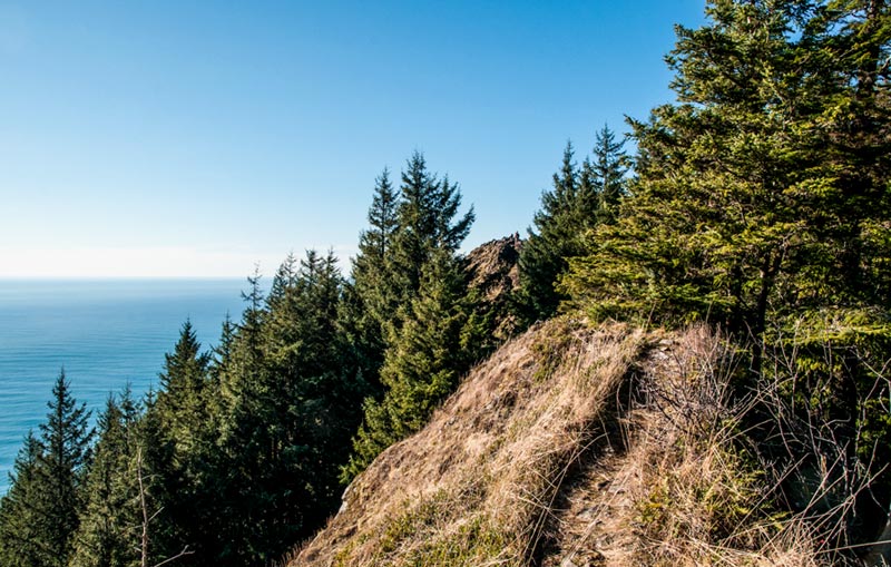
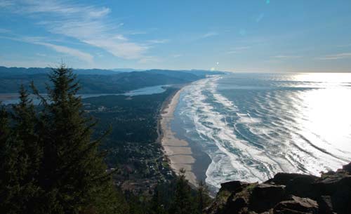
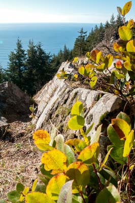
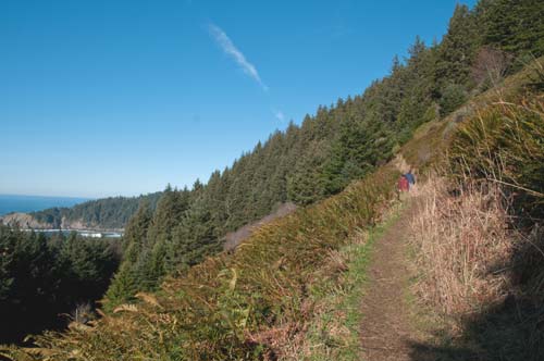
(Manzanita, Oregon) -Certainly the viewpoints at Manzanita's Neahkahnie Mountain are among the most impressive of the Oregon coast: on a clear day you can see forever. They may actually pale in comparison, however, to the high vistas of this looming presence over the laidback town. It's the trail to the top that wins those accolades, bringing you to the highest point possible above the state's beaches. (Photos courtesy Tiffany Boothe, Seaside Aquarium).
Douglas Lorain is a well known author on the subject of hiking and backpacking around the western states and the Oregon coast. He’s hiked an estimated 30,000 miles in his career. Formerly of Oregon, he has penned quite a number of books on hiking, including the popular “One Night Wilderness Portland.”
His take: What’s not to like about hiking up Neahkahnie Mountain?
“I’d venture that pretty much anyone, even if they never hike (as long as they are in reasonable shape) would love or at least really enjoy this trip,” Lorain said.
FUN FACT: How High is Neahkahnie Mountain? According to surveying done since the early part of the century: 1,680 feet high.
It’s three miles roundtrip to the top, about 1,680 feet, which all starts at a trailhead between milepost 41 and 42, not far the southern overlook with the pyramid-looking rock. There’s a trailhead sign by the highway that takes you up a gravel road to the trailhead.
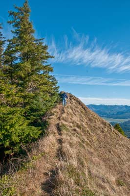
Almost a mile up, through sometimes steep switchbacks and misty forest, you come to a ridge. Along the way things get incredible fairly quickly. Several stunning viewpoints pop out and at least one has a bench. From the ridge, it’s another .6 miles to the very top where you come out onto a meadow and more breathtaking views of the water world below.
To add more excitement to the sojourn, you can head down the other side of the mountain that meets up with a trailhead about a mile south from the main trailhead. But wait, there’s more.
 Lorain has an insider’s tip to hiking this trail. He suggests parking at that gravel lookout between Oswald West State Park and the main trailhead, which is where the backside trail comes out. Here, it’s insanely beautiful even if you don’t hike anywhere: you can see parts of Cape Falcon and the top of Cube Rock from here.
“Take 10 extra minutes and head down through the manzanita brush, on the sometimes poorly marked Coast Trail for about 0.2 mile then out on a short bushwhack route to some incredibly dramatic viewpoints directly atop towering cliffs hundreds of feet above the crashing waves,” Lorain said. “It’s not a place for those with a fear of heights, but it’s really memorable.”
Then there are the grand summit views in this spot.
“Especially from the western high point (although both summits are worth exploring),” Lorain said. “Lunch spots are rarely better than this. In season, it’s also a great place to spend an hour or two with strong binoculars watching the migrating gray whales.”
Down there, you’ll encounter the freaky Devil’s Cauldron, a kind of gigantic hole in the cliff where you can look down. Walk to the right from the gravel parking lot and you join the trail to Short Sand Beach. Walk straight west and you’ll find Devil’s Cauldron, as well as the full sight of Cube Rock and another oddity called Pulpit Rock. Walk to the left and it takes you down some brush-covered slopes to ragged basalt structures that look like cathedrals that had been through some sort of apocalypse. A small sci-fi movie was filmed there a few years back.
“Then there’s the nice and shady forest walk up the peak, where it stays pleasantly cool even on warm spring and summer days, and on at least two occasions I have seen and heard large and impressive pileated woodpeckers (relatively uncommon birds in the Oregon Coast Range),” Lorain said. “In addition there are the abundant May and June rock-garden wildflowers that carpet the peak’s upper meadows and ridges putting on a superb color show and providing food for a healthy population of hummingbirds zipping about and even going after things like red backpacks.”
Lorain mused this caused an interesting and slightly humorous moment while hiking once.
“Oh, there’s a big flower, strange that it’s moving, but let’s go get it anyway,” he said.
That Coast Trail not only brings you down to Short Sand Beach after almost a mile and a half, but then you can come out in the middle of Oswald West. The trail then morphs into the wild Cape Falcon trail, and that in turn can lead you to Arch Cape after another few miles.
Many hikers will take either a southside jaunt back down the mountain through a forest service road or that that northern backside route to the gravel lookouts, or some of the longer routes. Lorain has some cautions about this, however.
“Although it is tempting to take this route for a change of pace, unless you have a car shuttle, I would not recommend it,” Lorain said. “Walking back along US 101 to your car is scary and maybe even dangerous. The highway has no sidewalk or even much of a shoulder. There is lots of traffic and the road has many sharp curves and drop offs allowing few opportunities for pedestrians to get out of the way of cars.” Hotles in Manzanita, Wheeler - Where to eat - Maps and Virtual Tours
Find more Doug Lorain books at Doug Lorain at Wild Press. Photo tour of the area below:
Cannon Beach Lodging
Nehalem Bay Lodgings
Manzanita Hotels, Lodging
Three Capes Lodging
Pacific City Hotels, Lodging
Lincoln City Lodging
Depoe Bay Lodging
Newport Lodging
Waldport Lodging
Yachats Lodging
Oregon Coast Vacation Rentals
Oregon Coast Lodging Specials
More About Oregon Coast hotels, lodging.....
More About Oregon Coast Restaurants, Dining.....
LATEST Related Oregon Coast Articles
A quiet but quirky sense of the laidback. Neahkahnie Mt., Nehalem, Wheeler
Hiker Falls 60 Feet from North Oregon Coast's Neahkahnie Mountain, Rescued on...
Hiker required medical attention. Manzanita, Cannon Beach, safety
Widely Varied Spring Break on N. Oregon Coast at Manzanita, Rockaway Beach, P...
Pleasantly action-packed meets convenience at the Tillamook Coast. Oceanside, Neahkahnie Mountain, Nehalem, Wheeler, Tillamook events, Pacific City events
Surreal Constructs of N. Oregon Coast's Neahkahnie Mountain
Near Manzanita, a wriggling mountain outline and shoreline with surprises
Three Incredible Viewpoints Along Oregon Coast with Some Twists | Video
Cape Lookout, Neahkahnie Mountain and the secrets of Otter Crest Loop: Manzanita, Depoe Bay, Oceanside
From the Oregon Coast's Tallest Peaks: Perpetua, Humbug, Neahkahnie, Foulweather
There are truly soaring places next to the sands that jut up higher than you can imagine. Sciences
Neahkahnie Viewpoint Provides Fun History, Unsolved Mystery on N. Oregon Coast
Neahkahnie Viewpoint above Manzanita has been around almost 100 years, and there's a mystery
Back to Oregon Coast
Contact Advertise on BeachConnection.net
All Content, unless otherwise attributed, copyright BeachConnection.net Unauthorized use or publication is not permitted


