Three Startling Bits of Oregon Coast History Hiding Just Out of View
Published 02/13/2016 at 4:01 PM PDT
By Oregon Coast Beach Connection staff
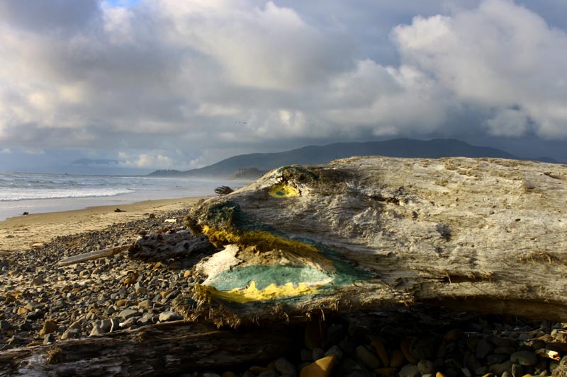
(Oregon Coast) – There are lots of tiny remnants of Oregon coast history lurking beneath the sands or just out of sight that will surprise. In some ways, they're hiding in plain sight. You just have to know where to look. (Above: Bayocean as it looks like now. There is some surprising history here).
Here are three such stellar, even startling examples, each with an amazing history bigger than you'd expect. One is a shipwreck you didn't know was sitting at a major tourist hotspot, another a ghost town reclaimed by nature, and a third a rock structure with an almost paranormal coincidence attached to it.
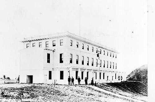
The Bayocean Spit, on the north Oregon coast, currently creates the sandy barrier between the Tillamook Bay and the Pacific, and provides plenty of scenic hiking possibilities. But this barren place was once a bustling resort town in the first decade of the 20th century.
There were around 100 plots set for homes, many of which were actually built. A natatorium, tennis court and even a theater or two entertained people for a few years. It started somewhere around 1910, with grandiose plans to become the "Atlantic City of the West," which never quite materialized. It all ended somewhere before the close of the 20's, after a few periodic pushes to restart it. The depression and wartime finally permanently killed the whole thing off.
 Eventually, storms ravaged the ghost town remnants of Bayocean more and more, and many buildings fell into the sea. From the 40's through the '60s, a few stragglers remained, and there were even some attempts to start businesses. The rest of it was bulldozed over in the '70s. It's one of Oregon's real ghost towns - but without the hint of any town.
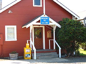
The village of Cape Meares hosts the only remnant of the place: a little meeting hall that was moved from its location farther down the spit (see above). You can get a rather striking feel for the destruction of this once sparkling spot by looking at Third Street in the village and the diagonal shoreline, by where the street is layed out. There was once a First and Second Street here, now beyond that shoreline.
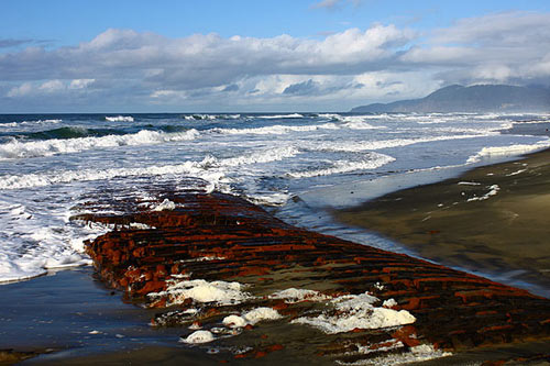
Rockaway Beach hides a shipwreck beneath its sands – one that has only appeared a handful of times since the 50's. The wreck of the Emily G. Reed was unearthed by winter storms in 2010, but sand levels haven't gotten low enough for it to show since.
Back then, around 100 feet of the ribcage-like structure was visible, but only for about two weeks.
The Reed hit the mouth of the Nehalem River in 1908, back when there was no jetty. It grounded and snapped in half, with one section floating to its resting place near the main wayside at Rockaway Beach. This portion was the largest chunk, and it was thoroughly raided pretty quickly in those days.
Other small bits and pieces still sit in some stream areas of the town. The Emily Reed has been a secretive, shy shipwreck, hiding beneath the sand the majority of its time on these shores. It was visible most of the time until the 40’s and 50’s, when its visibility became less and less. In 2007, it made an extremely brief appearance, and then made the regional news in 2010.
Down on the central Oregon coast, at the tiny community of Otter Rock, just north of Newport, there was once a rock structure named Elephant Rock here (see above). It looked significantly similar to an elephant with its trunk dipped into the water. Elephant Rock was quite a draw to tourists, who snapped many a picture of the charming formation. But it was also important to regional local tribes, whose lore said this was some kind of creature that had beaten back devastating fires by dipping its trunk into the sea and putting them out.
The legend also held that if that “elephant”- as it was called - ever lost its head (historians think white settlers applied that animal name to it), that disaster would befall the tribes.
In the 30's, just that happened. A storm destroyed the trunk-like feature (the arch), and not only did a series of huge fires hit Depoe Bay, Bandon, Yachats and Waldport that same year, but the local tribes were dissolved by the government.
That rock is still there, a mere blob in an inaccessible part of the beach next to Devil's Punchbowl. See below. Oregon Coast Hotels in these areas - Where to eat - Maps and Virtual Tours

More About Oregon Coast hotels, lodging.....
More About Oregon Coast Restaurants, Dining.....
Cannon Beach Lodging
Nehalem Bay Lodgings
Manzanita Hotels, Lodging
Three Capes Lodging
Pacific City Hotels, Lodging
Lincoln City Lodging
Depoe Bay Lodging
Newport Lodging
Waldport Lodging
Yachats Lodging
Oregon Coast Vacation Rentals
Oregon Coast Lodging Specials
LATEST Related Oregon Coast Articles
Likely just before dawn best hour but peak happens during daylight. Weather
Dark Sky Week is Prime Along Oregon Coast: Where and Where Not to Go
General guide to dark sky viewing from south to north coast. Astronomy
Sizable Price Drop, Deals in Lincoln City During Quiet of April on Central Or...
20 perc off at A1 Vacation Rentals across its roster, including Gleneden Beach. Lincoln City specials
Upcoming S. Oregon Coast Events Include Gem Show, History: Coos Bay, Bandon
May 6 talk at Coos History Museum, Mayfly Fest May 17, Bandon Rock / Gem Show June 7,8
Washington Coast Cleanup on April 19 - Coinciding with Oregon Coast's SOLVE E...
From the Puget Sound to Long Beach, alongside Oregon's cleanup. Washington coast events, Seaside events
Astoria's Riverwalk Gets New Lighting, More N. Oregon Coast Roadwork
Delays coming this summer, but the riverwalk has a new look. Seaside, Cannn Beach
April Gets Even Cheaper Midweek at Depoe Bay, Lincoln City: Oregon Coast Deals
Off-season rates plus more at Keystone Vacation Rentals. Depoe Bay lodging specials, Lincoln City hotel reviews, Newport hotel reviews
Washington Coast Begins Week of Clam Digs, April 12 Through 18
Long Beach, Twin Harbors, Mocrocks and Copalis at different times. Washington coast events
Back to Oregon Coast
Contact Advertise on BeachConnection.net
All Content, unless otherwise attributed, copyright BeachConnection.net Unauthorized use or publication is not permitted


