A Multitude of Finds, Unusual Features at N. Oregon Coast's Hug Point
Published 01/06/2017 at 1:23 AM PDT
By Oregon Coast Beach Connection staff
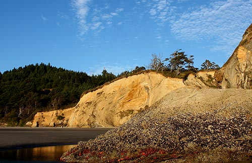
(Cannon Beach, Oregon) – You could easily spend a few hours exploring Hug Point State Recreational Site on the north Oregon coast, but you would literally have to spend a year or more to see it all. That's because this enormously engaging spot near Cannon Beach doesn't let on all its secrets at all points during the year. It changes drastically during some seasons and switches its hidden treasures from one thing to another.
There's not only more than meets the eye here, there's quite literally more beneath the surface than you'd imagine.
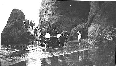
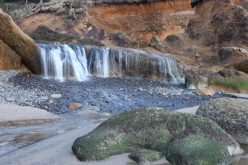
The most obvious features are, of course, the engaging waterfall and that old road going around the point. But this site can change appearance depending on tide and season.
A little over 100 years ago, back when the beaches were the only official highways along the Oregon coast, this section presented particular problems. It was passable only at really low tides, making mail delivery and daily travel stuck in its tracks for a few days or more. So a road was carved out along this point by blasting the rock in 1910, finally allowing Model T's and horse-drawn carriages around the corner a little more often.
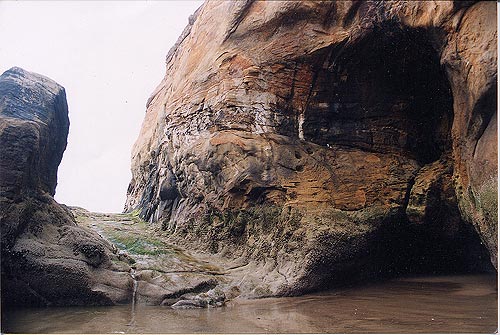
You can still see the ruts dug into the old rock by those ancient vehicles.
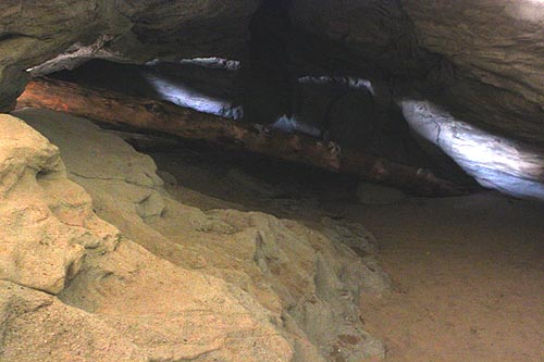
It is an awesome feature, unlike anything on the entire Oregon coast. But right next to it is the enormous, shudder-inducing sea cave that is also unforgettable. Inside, the colors get wild and strange, and you see giant chunks of driftwood crammed into spaces in odd ways, displaying the power of the ocean that put them there.
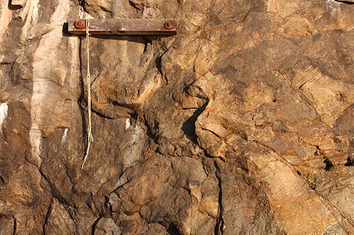
Two curiosities lurk on that road: one is the occasional chunk of wood bolted into the face, closer to the northern side; and the other is a tiny brass knob embedded in the edge of the road. The board of wood appears then disappears every few years. While no one is sure exactly why it's there, it's believed either park rangers or locals put it there and attach a rope to it, in case anyone gets into distress because of the tides.
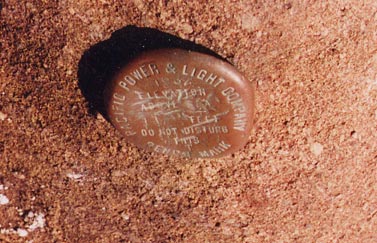 Exactly what the knob is or why it's there is also a bit of a puzzle. It has an elevation marking, but also the inscription of Pacific Power and Light. The company could not find any documentation on it, but they theorized it was originally used by the power company in the '20s as a survey marker.
When sand levels get super high, as in most summers, Hug Point becomes much larger. The tide is kept at bay, and you can even walk beneath that road in complete safety. But in winters, if the tide gets low enough, you can see wildly colored rock slabs just beneath the waves next to the road, often covered in tide pool life.
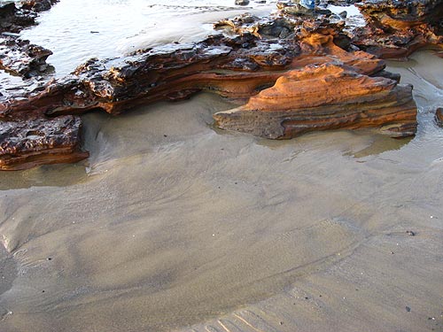
Winters are when Hug Point can really come alive. In the 2000's, the Oregon coast had a run of winters where ten feet or more of sand was taken off many beaches. At these extraordinary times, incredible objects came to light. Beneath these sands lie the remnants of a forest more than 4,000 years old – commonly called ghost forests. These, plus other stunning geologic wonders called “red towers” (surreal chunks of reddish clay-like material) showed up as well.
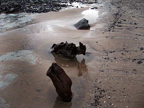
Not to mention, agates are prime at this spot when sand levels drop. This whole section of Oregon coast is a gold mine of dreamlike exploration.
Some details at Hug Point are staring you in the face but you don't notice them. And they're almost shocking.
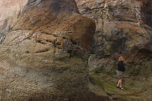
One is the ancient carvings in the face of the rock surrounding the road. If you look closely at the slab that covers part of the old roadway, you'll notice a series of indentations. Some of this is just tidal melee, but some are the remnants of ancient handholds carved into it by native tribes. Pictures from the 1930's shows these as still more pronounced, but now they're whittled down a ways. Before this rock was blasted out, a whole series of these went up the rockface to the top, basically a crude ladder. They could be hundreds of years old or older.
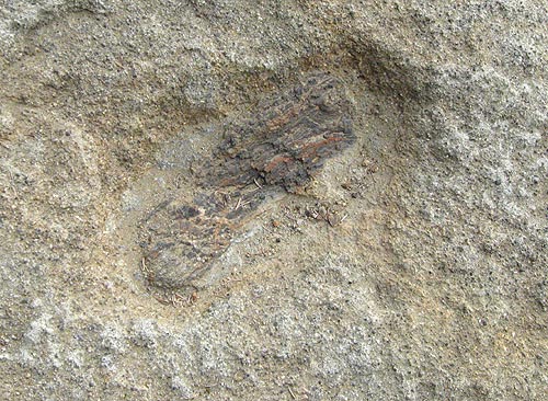
The real shocker is the ancient petrified forests embedded in parts of Hug Point, millions of years old. Local geologist Tom Horning explains the sandstone here was formed about that time when this area was an estuary of the Columbia River. The petrified wood was – long story short – made by creatures making tiny holes, and then those holes were slowly filled up with sand, becoming sandstone. Oregon Coast Lodgings for this - Where to eat - Maps - Virtual Tours
LATEST Related Oregon Coast Articles
Likely just before dawn best hour but peak happens during daylight. Weather
Dark Sky Week is Prime Along Oregon Coast: Where and Where Not to Go
General guide to dark sky viewing from south to north coast. Astronomy
Sizable Price Drop, Deals in Lincoln City During Quiet of April on Central Or...
20 perc off at A1 Vacation Rentals across its roster, including Gleneden Beach. Lincoln City specials
Upcoming S. Oregon Coast Events Include Gem Show, History: Coos Bay, Bandon
May 6 talk at Coos History Museum, Mayfly Fest May 17, Bandon Rock / Gem Show June 7,8
Washington Coast Cleanup on April 19 - Coinciding with Oregon Coast's SOLVE E...
From the Puget Sound to Long Beach, alongside Oregon's cleanup. Washington coast events, Seaside events
Astoria's Riverwalk Gets New Lighting, More N. Oregon Coast Roadwork
Delays coming this summer, but the riverwalk has a new look. Seaside, Cannn Beach
April Gets Even Cheaper Midweek at Depoe Bay, Lincoln City: Oregon Coast Deals
Off-season rates plus more at Keystone Vacation Rentals. Depoe Bay lodging specials, Lincoln City hotel reviews, Newport hotel reviews
Washington Coast Begins Week of Clam Digs, April 12 Through 18
Long Beach, Twin Harbors, Mocrocks and Copalis at different times. Washington coast events
Back to Oregon Coast
Contact Advertise on BeachConnection.net
All Content, unless otherwise attributed, copyright BeachConnection.net Unauthorized use or publication is not permitted


