New Oregon Coast Mysteries, Discoveries at Hug Point Go Back Millions of Years
Published 12/20/2015 at 5:13 AM PDT
By Oregon Coast Beach Connection staff
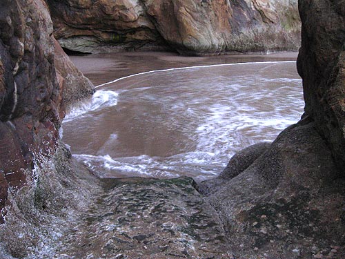
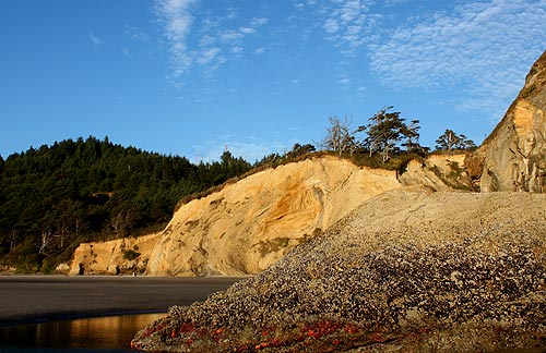
(Cannon Beach, Oregon) – There is already a lot jam-packed into the relatively small space of Hug Point State Recreation Site, on the north Oregon coast. This hotspot just south of Cannon Beach boasts bundles of surprises and numerous layers, from the waterfall, sea cave and ancient road carved out of rock to the geologic wonders and hints of chaos in those cliffs and under the sands.
Some new mysteries and discoveries have recently come to light about the place: some of them 100 years old, others perhaps a few centuries, while one shocker goes back 15 million years.
A bit of background first: two things you need to know.
The most prominent of these not-so-well-known factoids is that the small road going around the point was blasted out of that rock in 1910, at a time when the only highway along the Oregon coast was the actual beaches themselves. This allowed the horse-drawn buggies and eventually cars to cross at higher tides.
Secondly, an even lesser known fact is that beneath its sands lie the remnants of a forest more than 4,000 years old – commonly called ghost forests. These, plus other stunning geologic wonders called “red towers” (surreal chunks of reddish clay-like material) show up only when sand levels here get extremely low.
That old road has provided some new puzzles recently, which grew out of questions about how traffic over the tiny turn in the rockface was regulated, and was that related to the out-of-place chunk of wood embedded into the rock?
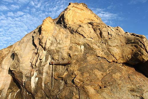
You've probably noticed a 2x4 bolted into the rock at the northern end of that rocky bend. That, coupled with the tiny detail of a little brass knob with the name of a power company on it, helped give substance to a rumor there once was a traffic light there. (Photo above: the rope is actually fairly new, and no one knows who put that there).
The rumors aren't true. Indeed, the two aren't connected. According to Elaine Murdy of the Cannon Beach History Center, there was no electric light and there was apparently no traffic sign.
However, what did come to light when Oregon Coast Beach Connection started asking around is that there is evidence of a flip sign somewhere on or near the road to warn of tides too high for passage. Murdy said that's all vague and not concrete, however.
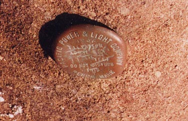 The little knob, embedded in the rock almost in front of the wooden chunk, is a bit more of a mystery. Exactly why it's there isn't known. It has an elevation marking, but also the inscription of Pacific Power and Light on it, which led some to believe it had something to do with electricity. PacificCorp media spokesman Tom Gauntt could not find any documentation about it, but theorized it was originally used by the power company in the 20's as a survey marker.
That still leaves a question, however as there is no line-of-sight to any power lines on Highway 101, nor any structure.
Then what was the wooden board used for? No one is sure there, either. Another small mystery. Oregon State Parks and Recreation spokesman Chris Havel said one guess is that there was once a ladder there for high tide emergencies. That's only a guess, however.
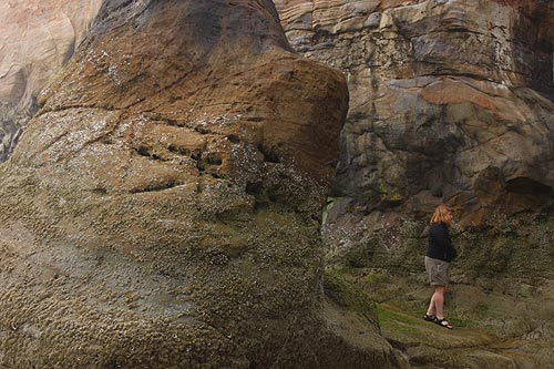
Another surprise that came to light recently – although it's known by many local residents – is that the rock walls of Hug Point also hold remnants of manmade structures perhaps 100's of years old. At the southern tip of the Hug Point road, on the triangular chunk of rock that briefly forms a wall, there are the faint markings of footholds dug into the rock by local tribes. This allowed them to crawl up over the outcropping at high tides, before that section was blasted away.
These are woefully worn down now by time and tide and are disappearing quickly. Photos of the markings in the book “Arch Cape Chronicles” show them more prominently some 20 years ago. In the photo at the bottom of this page from 2014, they've almost completely disappeared.
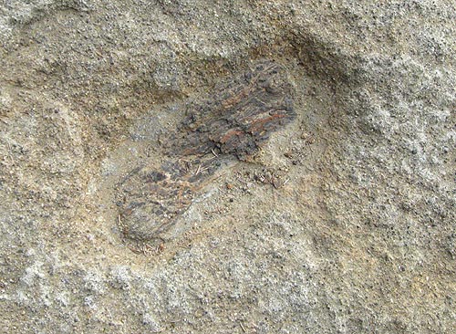
Now for the shocker: it turns out there is petrified wood some 15 million years old embedded at various parts of Hug Point. Oregon Coast Beach Connection won't reveal the actual location of any of them, but one looks like this in the photo above.
Local geologist Tom Horning explains the sandstone here was formed about 15 million years ago when this area was an estuary of the Columbia River. Essentially, little creatures back then burrowed into the wood. Then, over time, sand filled these holes and it hardened into sandstone around the logs over several centuries. This creates actual petrified wood, something normally seen in eastern Oregon. It's a tad rare on the coast.
“This is frequently called toredoite by the sedimentologists,” Horning said. “I have found it in creeks draining the base of Saddle Mountain. It's fairly common. Wood-boring marine clams indicate that the sandstone has a marine influence. Nearby coal tells us that freshwater is present, too.”
As if you need another reason to head to the Oregon coast. But in this case, it gives you reason to pause more often when you're on beaches like Hug Point. You never know what's hiding in plain sight. Cannon Beach Hotels in this area - Where to eat - Map and Virtual Tour. More about Hug Point at the virtual tour, including its geology.
Below: handholds embedded in the rock by local tribes, perhaps even centuries before white settlers. It's visible on the outter wall section seen here.
More About Cannon Beach Lodging.....
More About Oregon Coast Restaurants, Dining.....
Cannon Beach Lodging
Nehalem Bay Lodgings
Manzanita Hotels, Lodging
Three Capes Lodging
Pacific City Hotels, Lodging
Lincoln City Lodging
Depoe Bay Lodging
Newport Lodging
Waldport Lodging
Yachats Lodging
Oregon Coast Vacation Rentals
Oregon Coast Lodging Specials
LATEST Related Oregon Coast Articles
Likely just before dawn best hour but peak happens during daylight. Weather
Dark Sky Week is Prime Along Oregon Coast: Where and Where Not to Go
General guide to dark sky viewing from south to north coast. Astronomy
Sizable Price Drop, Deals in Lincoln City During Quiet of April on Central Or...
20 perc off at A1 Vacation Rentals across its roster, including Gleneden Beach. Lincoln City specials
Upcoming S. Oregon Coast Events Include Gem Show, History: Coos Bay, Bandon
May 6 talk at Coos History Museum, Mayfly Fest May 17, Bandon Rock / Gem Show June 7,8
Washington Coast Cleanup on April 19 - Coinciding with Oregon Coast's SOLVE E...
From the Puget Sound to Long Beach, alongside Oregon's cleanup. Washington coast events, Seaside events
Astoria's Riverwalk Gets New Lighting, More N. Oregon Coast Roadwork
Delays coming this summer, but the riverwalk has a new look. Seaside, Cannn Beach
April Gets Even Cheaper Midweek at Depoe Bay, Lincoln City: Oregon Coast Deals
Off-season rates plus more at Keystone Vacation Rentals. Depoe Bay lodging specials, Lincoln City hotel reviews, Newport hotel reviews
Washington Coast Begins Week of Clam Digs, April 12 Through 18
Long Beach, Twin Harbors, Mocrocks and Copalis at different times. Washington coast events
Back to Oregon Coast
Contact Advertise on BeachConnection.net
All Content, unless otherwise attributed, copyright BeachConnection.net Unauthorized use or publication is not permitted


