King Tides Weekend Big Waves: High Winds S. Oregon Coast, Flooding Washington Coast
Published 12/13/24 at 4:55 a.m.
By Oregon Coast Beach Connection Staff
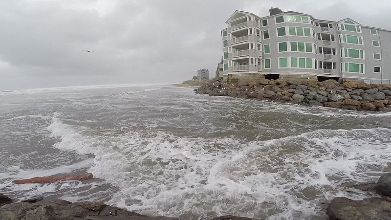
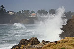
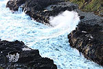
(Cannon Beach, Oregon) – High winds and steep seas along the Oregon coast and maybe flooding on the south Washington coast: this is the melange of meteorological fun to be had along the beaches for king tides weekend. (Photo Rockaway Beach, King Tides Project / Mike Decker)
Includes exclusive listings; some specials in winter
In Cannon Beach:
Includes rentals not listed anywhere else
In Manzanita, Wheeler, Rockaway Beach:
Some specials for winter
In Pacific City, Oceanside:
Some specials for winter
In Lincoln City:
Some specials for winter
In Depoe Bay, Gleneden Beach:
Some specials for winter
In Newport:
Look for some specials
In Waldport
Some specials for winter
In Yachats, Florence
Some specials for winter
Southern Oregon Coast Hotels / Lodgings
Reedsport to Brookings, places to stay; winter deals
What will the waves be doing over this December's king tides event? Some of it will be putting on quite a show and then it will calm considerably, with sizable wave height on Friday and Saturday then subsiding on Sunday. Waves upwards of 15 feet offshore – maybe more than 20 feet – should translate to some good action at places like Cape Disappointment in Washington or Coos Bay's Shore Acres when combined with the high tides, but not guaranteed.
King tides happen December 13 - 15, today through Sunday.
Whatever the outcome, there is some amount of warning of dangerous beaches from the National Weather Service (NWS), and the south coast is under a high wind warning Friday just as the south Washington coast goes under a watch for flooding.
See Oregon Coast Weather (including tides) - Inland Oregon Weather
From Reedsport south to Brookings, there is a high wind warning from 7 a.m. to 7 p.m. Friday (today), with gusts up to 70 mph possible. You'll likely find viewing king tides too unpleasant today and much too difficult to photograph in that stretch.
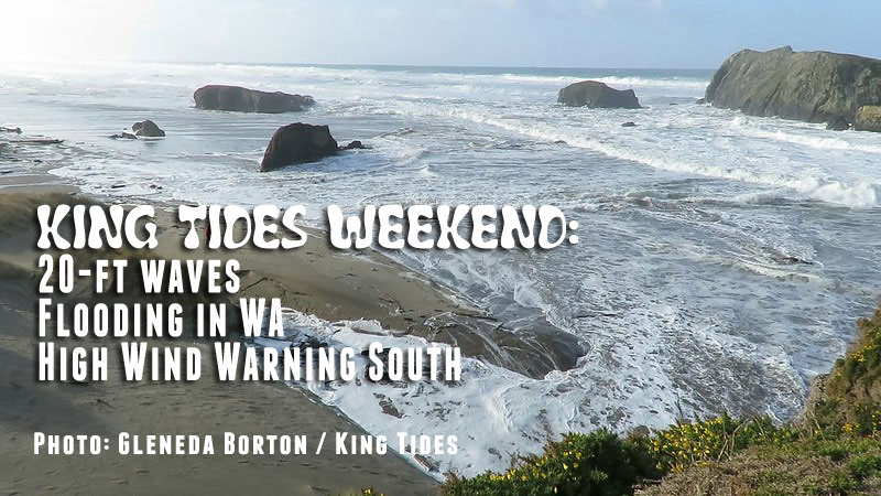
“Remain in the lower levels of your home during the windstorm, and avoid windows. Watch for falling debris and tree limbs. Use caution if you must drive,” the NWS said.
The warning just barely excludes Florence, so count on still-heavy wind conditions there, though not as extreme.
There is a coastal flood watch for today for the south Washington coastline, for areas just north of Long Beach. That is in effect until 1 p.m. today.
“Minor coastal flooding with inundation of around 2 feet above ground level is expected,” the NWS said. “For the Coastal Flood Watch, significant coastal flooding possible. Inundation of 2 to 3 feet above ground level is likely long shorelines and low-lying coastal areas. Large waves of 17 to 19 feet are expected along the coast.”
Along both halves of the coast and southern Washington, waves in excess of 15 to 20 feet are expected Friday and into parts of Saturday.
- See www.oregonkingtides.net - See the Washington King Tides Project for detailed dates.
For Washington's southern area, the NWS office in Portland said they are talking beach hazards even on Saturday, which likely means caution on Oregon's northern shore in areas like Manzanita, Cannon Beach and Seaside.
“Current model data from Toke Point, WA suggests that tidal overflow flooding is possible during high tide around 10 AM to 12 PM Saturday,” the NWS said. Guidance is starting to trend toward minor coastal flooding along the south Washington coast, up to one feet above ground level. Low lying areas near bays, sloughs, and lower reaches of coastal rivers would be more susceptible to flooding.”
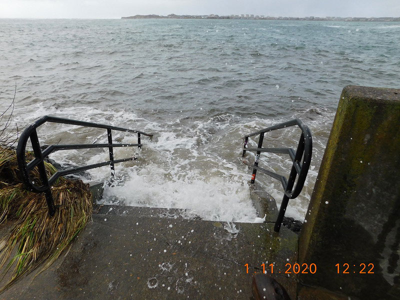
Waldport, Jon French / Oregon King Tides
The NWS said the highest chances of waves exceeding 20 feet are from about Cannon Beach northward.
The NWS office in Medford said offshore waves will likely be 15 to 20 on the southern half as well, but lowering to the mid teens on Saturday before dropping even more on Sunday. This combined with the tidal push of high tide on Saturday should make for some interesting but dangerous sights. Stay off beaches with no quick exit until Sunday.
Oregon Coast Hotels for this event - South Coast Hotels - Oregon Coast Vacation Rentals - Where to eat - Maps - Virtual Tours
Oregon Coast Vacation Rentals
Oregon Coast Lodging Specials
More About Oregon Coast hotels, lodging.....
More About Oregon Coast Restaurants, Dining.....
 Andre' GW Hagestedt is editor, owner and primary photographer / videographer of Oregon Coast Beach Connection, an online publication that sees over 1 million pageviews per month. He is also author of several books about the coast.
LATEST Related Oregon Coast Articles
Oregon State Parks Wants Public Input on Proposed Changes, Including Passes, ...An 8-million-dollar budget shortfall and changes proposed.
First Day Hikes Take Place All Over Oregon and Coast to Start 2026
A special tradition in Yachats, but also Brookings events, Gold Beach events, Port Orford events, Coos Bay events, Bandon events, Florence events, Yachats events, Newport events, Lincoln City events, Rockaway Beach events, Manzanita events, Cannon Beach events, Seaside events, Astoria events
N. Oregon Coast First Day Hikes Include Near Astoria, Pacific City, Waldport
Free self-guided hikes in awesome places: Warrenton events, Coast Range, Portland events, Pacific City events, Waldport events
Oregon coast on the downlow (rates, that is), in Lincoln City and Cannon Beach
Exceptional hotel deals in Cannon Beach and Lincoln City. Cannon Beach reviews, Lincoln City reviews
Video: Notorious Bump on Route to Oregon Coast Replicates - But There's a Hum...
Recent storms have caused more landslides that lead to roadway buckling. Traffic
Old Neskowin in Pictures is Subject of Oregon Coast Event
December 13 in Lincoln City: Neskowin: A Book of Found Photos. Lincoln City events
High Risk of Sneaker Waves on Oregon Coast / Washington Extended to Monday
Stay observant of incoming waves, the NWS said. Weather
Reports of Bird Flu in Washington, Oregon Include Coastlines: States Issue Ad...
One large-scale report from Long Beach still to be determined. Marine sciences
Back to Oregon Coast
Contact Advertise on Oregon Coast Beach Connection
All Content, unless otherwise attributed, copyright © Oregon Coast Beach Connection. Unauthorized use or publication is not permitted


