The Scary Lava Flows of Oregon Coast: Sizzling Northwest History
Published 07/26/2015 at 6:04 PM PDT
By Oregon Coast Beach Connection staff
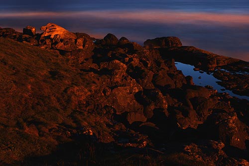
(Oregon Coast) – If you're looking for a really scary disaster movie, one that far outshines the fright factor of something like the recent “San Andreas” movie – or even the creepy quake scare that's made Portland go viral – then look no further than the Oregon coast. In fact, you can look at much of Oregon: from the Columbia Gorge to Silver Falls State Park and other spots. (Above: Yachats at night can look like the lava flows it once was).
You'll have to go back millions and millions of years, however.
Picture this: a massive river of lava erupts in Idaho, so big it covers miles at a time as it marches along around 4 mph. It sears entire forests into ashes and fumes. It builds gigantic damns of molten rock that are perhaps miles long, sometime bulging up to 20 feet high. It marches its way through riverbeds and canyons, snaking its way around mountains, until it slithers its sinister, scorching heat into the ocean – some 300 miles - about seven days later.
It’s hundreds of miles long, spewing out continuously and so fiercely that when it reaches the ocean it fills crevices and muddy areas thousands of feet deep.
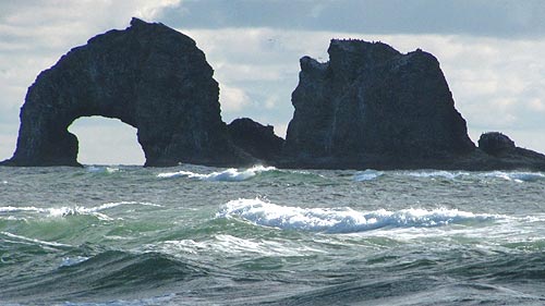
Above: Rockaway Beach's Twin Rocks were born of these fiery rivers, but with a twist (a re-eruption, just like Cannon Beach's Haystack Rock).
This was the scene in Oregon some 15 million years ago, and it was the beginning of the birth of many of the incredible structures and tourist attractions you now see on the scenic Oregon coast.
A colossal fissure in the Earth around Lewiston, Idaho, poured these horrendous flows into this area (it’s the same hot spot that now powers Yellowstone National Park, and has before created the mega-disastrous super volcanoes that have erupted a few times over the millennia). The coast at that time was about 15 miles farther inland than it is now. Sometimes these lava flows poured into the ocean, spread out through the soft marine sediments for dozens of miles, and then managed to re-erupt through thousands of feet of muck, onto the sea floor, essentially making their own eruptions for a brief time (geologically speaking).
After that, time caused these solidified rivers of lava to change drastically, especially on the coast, where erosion can chop up layers of the Earth faster and then show you the cutaway layers.
Over millions of years, some of these massive invasions of lava (solid basalt) were lifted with the sediments above sea level with the rising of the coast range. They in turn were eroded away, until they formed headlands and features we now know as Neahkahnie Mountain near Manzanita or Tillamook Head between Seaside and Cannon Beach.
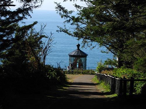
Cape Meares (an intra-canyon flow)
Another kind of lava flow that formed the headlands we know and love is called intra-canyon flows. These snaked their way to the coast through riverbeds and around other features, arriving at the coast to build up and up out of deltas of rubbly submarine pillow basalt, which were capped by sheets of dry-land lava flows. Essentially, the lava filled up these giant spaces, over and over again.
They too were eroded by time and water into shapes we now know as Cape Foulweather, Cape Lookout, Yaquina Head and Cape Meares.
Numerous such lava flows (perhaps around 300) erupted from about 12 million years ago to 17 million years ago, according to Seaside resident and geologist Tom Horning. They happened approximately every 100,000 to 200,000 years, creating their own kind of havoc, but in turn laying the groundwork (pun intended) for the beauty we now see.
Meanwhile, millions of years earlier, Cascade Head was its own volcano, said Horning of the large, looming headland just north of Lincoln City. And what about those mini-eruptions that happened just offshore? Horning said they’re often responsible for many of the coast’s most famous landmarks.
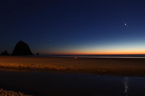
“Haystack Rock in Cannon Beach was one of those,” Horning said. “Sea stacks are often from submarine feeders for the re-erupting lavas. They’re all part of plumbing systems.”
Erosion also plays a major part in what you see with the famous structure (which is one of the most photographed sea stacks in the world), along with the oceans rising, falling and the land doing the same.
“The basalt that Haystack Rock is made of is about 15 million years old,” Horning said. “It was an enormous hill of rock until about 3000 years ago, when rising sea levels allowed the surf to wash away all but the strongest lava/basalt. Some 4000 to 5000 feet of the original submarine volcano is missing from it now, having been eroded for more than 12 million years.”
All those lava flows from prehistoric Idaho also created the Columbia River Gorge and Silver Falls State Park near Silverton. One of the more incredible sights there are the trees frozen in time in the basalt beneath the waterfalls – essentially petrified remnants of the forests these lava flows laid to waste.
Yet another series of epic disasters hit the Northwest, all the way from Missoula, Montana to the edges of Oregon, some 10,000 years ago or so. Numerous times over a few thousand years, a massive ice damn at Missoula broke loose, causing enormous biblical-style floods to wash all over western Oregon and Washington. These were so strong they scoured out the basalts of the Columbia into a gorge.
If you look closely at the tops of many taller rocks in the Gorge, you'll see numerous lateral lines, looking a little like the remnants of a tide line. That's because they are, in a sense: each line represents a a major flood event.
More About Oregon Coast hotels, lodging.....
More About Oregon Coast Restaurants, Dining.....
LATEST Related Oregon Coast Articles
One was a rare orca find; both suspected human interaction. Marine sciences
N. Oregon Coast's 'Cheese War' a Quiet Part of Tillamook-Area History: See th...
History talk in Nehalem on April 26 about Tillamook battles. Manzanita events, Cannon Beach events, Tillamook events
Lyrid Meteors with a Possible Side of Aurora for Washington, Oregon, Coastlines
Lyrids peak on Monday, northern lights possible northern Washington. Weather
Road Work Coming to North Oregon Coast's Gearhart and One of World's Largest ...
Lane closures this summer on the bridge; major work in Gearhart next year. Washington coast
Be Jeweled Returns to Central Oregon Coast, Newport's Dazzling, Arty Jewelry ...
Saturday, May 10, from 10 AM to 4 PM featuring more than 2,000 pieces. Newport events
N. Oregon Coast Bridge Work During Travel Season: Some Traffic Delays on Asto...
Occasional one-lane traffic from June through September at Astoria / Ilwaco. Washington coast
Cape Kiwanda's Colossal Sand Dune: Wild Oregon Coast Rides and How It's Changing
A mix of crazy recreation with science of a crumbling landmark. Sciences, Pacific City, Oceanside
Oregon Coast, Valley and Likely Washington Coast to Get Some Aurora Borealis ...
Likely just before dawn best hour but peak happens during daylight. Weather
Back to Oregon Coast
Contact Advertise on BeachConnection.net
All Content, unless otherwise attributed, copyright BeachConnection.net Unauthorized use or publication is not permitted


