More Snow for Oregon Coast Range - Portland, Vancouver, Salem Get Colder Later This Week
Published 02/03/25 at 4:29 a.m.
By Oregon Coast Beach Connection Staff
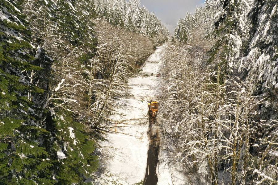
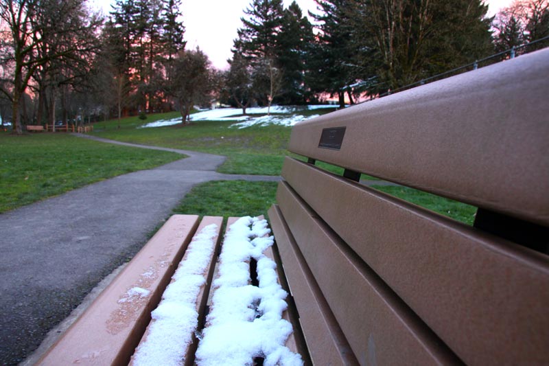
(Tillamook, Oregon) – Snow, snow and more snow: that's what's coming to even the lower elevations of Oregon and Washington this week, including a good chance of light snow on the north Oregon and south Washington coastline later in the week. It's not expected to stick at the lower elevations, but the Cascades and Coast Range will get quite the helping. (Photo ODOT: Neskowin area)
Includes exclusive listings; some specials in winter
In Cannon Beach:
Includes rentals not listed anywhere else
In Manzanita, Wheeler, Rockaway Beach:
Some specials for winter
In Pacific City, Oceanside:
Some specials for winter
In Lincoln City:
Some specials for winter
In Depoe Bay, Gleneden Beach:
Some specials for winter
In Newport:
Look for some specials
In Waldport
Some specials for winter
In Yachats, Florence
Some specials for winter
Southern Oregon Coast Hotels / Lodgings
Reedsport to Brookings, places to stay; winter deals
A variety of winter storm warnings and advisories from the National Weather Service (NWS) expire late Monday morning, with just about all of the northwest corner of Oregon and southwestern Washington seeing snow higher up. Snow already impacted traffic to the north Oregon coast at one point Sunday, and more of that could be on the way.
On the south Oregon coast, there is a freeze warning overnight on Monday into Tuesdau, for areas just inland as well as towns such as Coos Bay, Reedsport, Port Orford, Nesika Beach, and North Bend.
See Oregon Coast Weather (including tides) - Inland Oregon Weather - Washington Coast Weather
“Sub-freezing temperatures as low as 29 degrees expected,” the NWS said.
Oregon Coast. For many areas (such as Lincoln City), Monday sees a likely chance of rain and snow showers early in the day and then again in the overnight hours. Tuesday is similar, with up to 1 to 2 inches of snow possible. On Wednesday, mostly rain kicks back in but some thunder is possible as well.
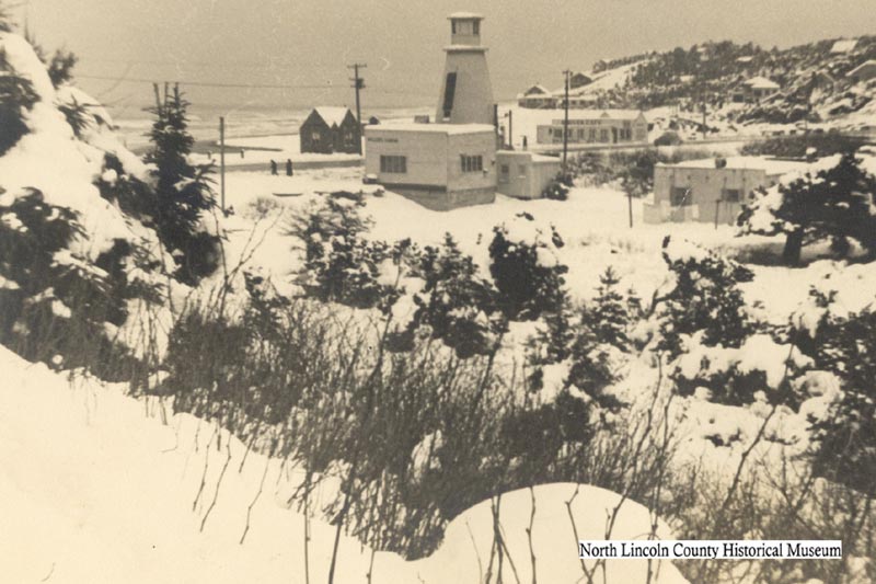
A snowy Lincoln City (Nelscott) in the '40s with its "lighthouse" - courtesy North Lincoln County Historical Museum
Overnight lows get a little higher later in the week for the north coast and south Washington beaches, such as Pacific City, Newport, Manzanita and Seaside. Some amounts of light snow are possible.
On the southern beaches, temps warm up after Tuesday and the area sees only rain.
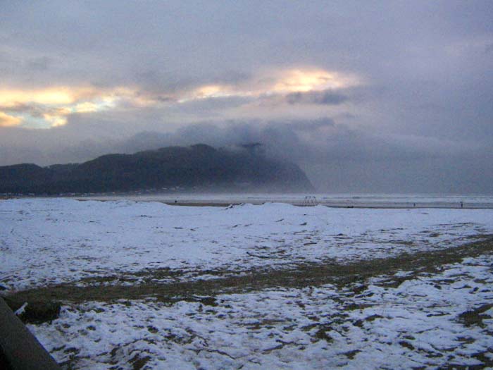
Seaside - Oregon Coast Beach Connection
The NWS said routes to the coastline will actually get colder from Wednesday through the weekend with snow levels dropping considerably.
“More frequent and heavier showers are forecast along the coast, Coast Range, and Willapa Hills, so these areas could receive higher snow amounts depending on where the showers pass through,” the NWS said. “Temperatures get colder Tuesday through the end of the week, with continuing chances for light lowland snow showers. However, forecast snow amounts remain uncertain.”
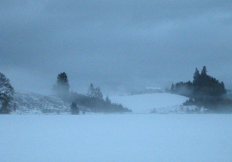
Highway 26 - Oregon Coast Beach Connection
Vancouver / Portland / Willamette Valley. Snow levels wander from 200 to 400 feet in the overnight hours of Monday through Wednesday, but likely creating little to no issues in urban regions. However, things get a little crazier after Wednesday.
“Overnight and morning low temperatures are expected to fall to the mid to upper 20s across most of the area west of the Cascades, with a 20-50% chance of temperatures falling below 25 degrees,” the NWS said. “However, the far northern Oregon Coast Range, Willapa Hills, and SW Washington lowlands could be closer to teens to low 20s with a 50-80% chance of temperatures falling below 25 degrees.”
Oregon Coast Hotels in this area - South Coast Hotels - Oregon Coast Vacation Rentals - Where to eat - Maps - Virtual Tours


Oregon Coast Vacation Rentals
Oregon Coast Lodging Specials

More About Oregon Coast hotels, lodging.....
More About Oregon Coast Restaurants, Dining.....


 Andre' GW Hagestedt is editor, owner and primary photographer / videographer of Oregon Coast Beach Connection, an online publication that sees over 1 million pageviews per month. He is also author of several books about the coast.
LATEST Related Oregon Coast Articles
Hazardous Seas Watch on N. Oregon Coast, S. Washington Coast, Waves Up To 15 FtBeaches will require caution but some good wave shows possible
Seaside Event Brings Sea Rescue History of Oregon / Washington Coast To Life
January 29 at 6 p.m. at Seaside Brewing: the precursor to the US Coast Guard. Seaside events
Washington / Oregon Travel: Gas Prices Jump More Than Usual As War Heightens
Sharper rise because of crude oil and other factors. Traffic, travel tips
Yachats' Little Log Church the Center of Renewal Ceremonies on Oregon Coast
30th annual Valentine's Day Celebration of Renewal and Commitment on Saturday, Feb. 14. Yachats events, Florence events, Waldport events, Newport
Yachats Mushroom Treasure Hunt Returns to Wilds of Oregon Coast Forest Trails
On the trails between Yachats and Heceta Head through February 28. Yachats events
Florence Creates Giveaway of Two Nights at Central Oregon Coast, Gourmet Food...
Lakeside getaway, free food and more through Florence's contest. Florence events
More Changes Coming to Oregon State Parks Rates, Rules, Special Access Passes
Updates include camping reservation policies and special access passes; drone rule changes postponed. Sciences
Numerous Traffic Accidents Near or on Oregon Coast in February, Some Fatal
Incidents around Bandon, Coast Range, Lincoln City, some criminal
Back to Oregon Coast
Contact Advertise on Oregon Coast Beach Connection
All Content, unless otherwise attributed, copyright © Oregon Coast Beach Connection. Unauthorized use or publication is not permitted

Oregon
Coast Hotels
S. Coast Hotels
Astoria/Warrenton Hotels
Seaside Hotels
Cannon
Beach Hotels
Nehalem Bay Lodgings
Manzanita Hotels, Lodging
Rockaway Beach Hotels
Three Capes Lodging
Pacific City Hotels, Lodging
Lincoln
City Lodging
Depoe
Bay Hotels
Newport Hotels
Waldport Lodging
Yachats
Hotels
Florence Hotels
Reedsport Hotels
Coos Bay Hotels
Bandon Hotels
Port Orford Hotels
Gold Beach Hotels
Brookings Hotels
Oregon
Coast Vacation Rentals
Oregon
Coast Lodging Specials
South Coast Hotels
Dining
Guide
Seaside
Cannon
Beach Dining
Manzanita,
Rockaway, Wheeler Dining
Pacific
City, Oceanside, Netarts, Tierra Del Mar Restaurants
Tillamook
Bay Restaurants, Dining
Lincoln
City Dining, Restaurants
Depoe
Bay Restaurants, Dining
Newport Restaurants, Dining
Waldport,
Yachats Restaurants, Dining
Florence Restaurants, Dining
Restaurant
Reviews
Coast
Events Calendar
Astoria
Seaside,
Cannon Beach Calendar
Manzanita,
Rockaway Events
Tillamook,
Pacific City Calendar
Lincoln
City Events Calendar
Newport,
Depoe Bay Events Calendar
Yachats Events Calendar
Oregon Coast Complete Guides every beach access, attraction
Search for Oregon Coast Subjects, Articles
Explore Every Beach Spot


News Headlines from All Over Oregon Need to scan Oregon headlines? Constantly updated news from all over Oregon: a comprehensive, up-to-the-minute display of news headlines from a variety of media
Oregon Coast Oceanfront Lodging, Hotels, Rentals