UPDATE: Winter, Snow Advisory for Portland, Oregon Coast Range, Beaches
Published 02/06/2019 at 11:23 PM PDT - Updated 02/08/2019 at 4 PM PDT
By Oregon Coast Beach Connection staff
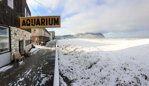
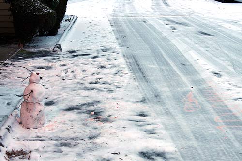
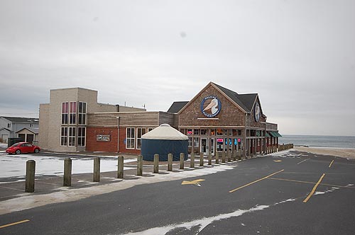
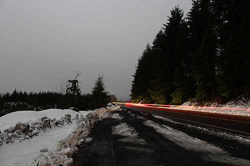
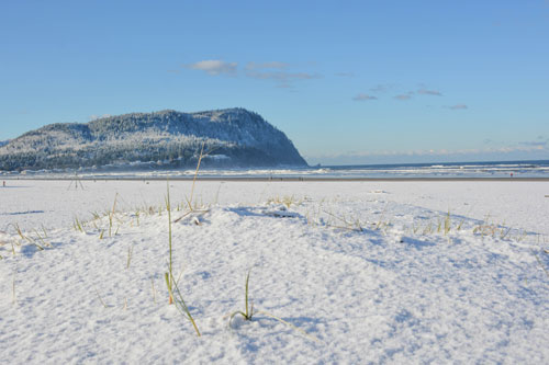
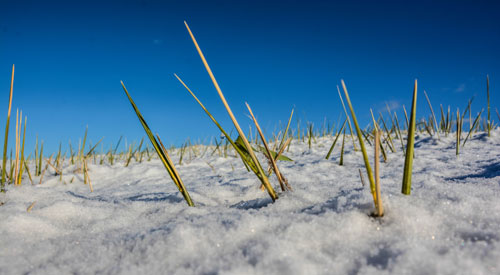
(Portland, Oregon) – UPDATE: Oregon Coast now under a winter weather advisory: Total snow accumulations of 1 to 2 inches expected. Localized areas could see higher amounts, with the best chances at elevations above 500 feet. From 7 p.m. tonight through 4 p.m. Saturday, precipitation will likely begin as a period of rain before changing over to snow this evening, with snow showers continuing into Saturday. Colder temperatures and even more snow are expected for areas around Portland, the inland valley, the Oregon Coast Range and even the beach towns. Thursday through the weekend seems to bring that likelihood for all the northwestern state. (Photo above courtesy Daphne Hoth, Seaside Aquarium).
Includes exclusive listings; some specials in winter
In Cannon Beach:
Includes rentals not listed anywhere else
In Manzanita, Wheeler, Rockaway Beach:
Some specials for winter
In Pacific City, Oceanside:
Some specials for winter
In Lincoln City:
Some specials for winter
In Depoe Bay, Gleneden Beach:
Some specials for winter
In Newport:
Look for some specials
In Waldport
Some specials for winter
In Yachats, Florence
Some specials for winter
The National Weather Service (NWS) issued a special statement for the Oregon coast, Willamette Valley and Portland area, which includes all areas of western Oregon such as the Cascade Foothills from Lane County northward and into the Gorge.
“A cold air mass will remain over the Pacific Northwest through the weekend, and potentially much of next week as well,” the NWS said. “This will likely result in additional chances for low elevation snowfall.”
Thursday into Friday brings the first dustings to the low elevations, but likely no accumulations for many areas. However, there is the possibility of an inch of snow piling up, which could cause commuting issues.
The bigger stuff happens later.
“However, snow levels will be lowering again by early Saturday morning and will potentially be hovering between sea level and 1000 feet through much of Saturday and Saturday night,” the NWS said. “There will likely be heavier bands of precipitation which bring accumulating snowfall to some areas at the lowest elevations, while other low elevation areas will see lighter precipitation and little to no snow accumulation. There is still low confidence as to where the heavier bands will set up, and what what snowfall amounts can be expected. At this time, we advise checking the forecast frequently over the next couple of days as details come into better focus.”
The Oregon Coast Range and the highways to the beaches will present the biggest issues. Current forecasts show as much as one to two inches of snow on Saturday in the upper elevations. From Sunday through at least Wednesday, the NWS is predicting snow and rain mixed in during the daytime, but chances of snow after dark.
Keep a close on Oregon Coast Road Conditions – at this link – during those days, which also features driving issues on the routes to and from the beaches.
Along the Oregon coast itself, accumulation of half an inch is possible on Saturday, but switching to rain and snow mixed later. Sunday through Wednesday appears to feature only rain on the beaches, but with a slight chance of snow / rain mix on Tuesday and Wednesday. See Oregon Coast Weather - Oregon Coast Traffic Conditions.
Oregon Coast Lodgings for this event - Where to eat - Maps - Virtual Tours
Cannon Beach Lodging
Nehalem Bay Lodgings
Manzanita Hotels, Lodging
Three Capes Lodging
Pacific City Hotels, Lodging
Lincoln City Lodging
Depoe Bay Lodging
Newport Lodging
Waldport Lodging
Yachats Lodging
Oregon Coast Vacation Rentals
Oregon Coast Lodging Specials
Photos below courtesy Seaside Aquarium
More About Oregon Coast hotels, lodging.....
More About Oregon Coast Restaurants, Dining.....
LATEST Related Oregon Coast Articles
The sixth in the NW in three weeks; early indications suggest it may have been undernourished. Marine sciences
Now Begins the 'Season of Satellites' Above Oregon, Washington: Summer's Surr...
Not even counting meteors, these satellite trains can create wild colors and streaks in the sky. Astronomy, weather. Brookings events, Gold Beach events, Port Orford events, Coos Bay events, Bandon events, Florence events, Yachats events, Newport events, Lincoln City events, Rockaway Beach events, Manzanita events, Cannon Beach events, Seaside events, Astoria events
7-Day Parking Meters Return to Central Oregon Coast Town, and Now to Nye Beac...
Newport?s Bayfront will charge all week, and the Nye Beach Turnaround will now do the same. Travel tips, traffic
87th Annual Azalea Fest Readies Its Return for Memorial Day Weekend on S. Ore...
Brookings brings back the long-running festival over Memorial Day weekend, May 22?25. Brookings events
Harrowing Accident Scene on S. Oregon Coast Turns Into Search for Driver and ...
Sheriffs found an empty vehicle and searched nearly 24 hours before locating the driver. Traffic
Another Dead Whale Stranding, This Time Near Yachats on Central Oregon Coast
Reports differ on whether it was alive at first; scientists are examining the carcass. Marine sciences
Washington Coast Cleanup Scours Inner and Outer Coast, April 25
Volunteers are needed along the outer coast and throughout the Salish Sea. Washington coast events
4th of July at N. Oregon Coast's Sand Lake Now Requires Pre-Sales for Camping...
Congestion and overcrowding in recent years at Sand Lake Recreation Area near Pacific City. Traffic, travel tips
Back to Oregon Coast
Contact Advertise on BeachConnection.net
All Content, unless otherwise attributed, copyright BeachConnection.net Unauthorized use or publication is not permitted


