 |
Oregon Coast State Park Fire Update; NASA Sees Coast Fires from Space
Published 08/04/2015 at 5:25 AM PDT - Updated: 08/04/2015 at 6:25 PM PDT
By Oregon Coast Beach Connection staff
(Warrenton, Oregon) – UPDATED:
The grass fire at Fort Stevens State Park on the north Oregon coast has grown to 27 acres Tuesday, although authorities say it closing in on being contained.
No structures have been threatened, and no evacuations were issued for the campground, which is still about two miles from the flames. Smoke is still seen billowing for miles around.
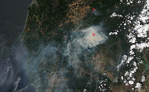
Meanwhile, on the southern Oregon coast, major fires in the coast range there have been picked up satellite and some startling images were released by NASA on Monday. (Above: image credit NASA Goddard's MODIS Rapid Response Team, Jeff Schmaltz.)
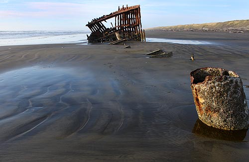
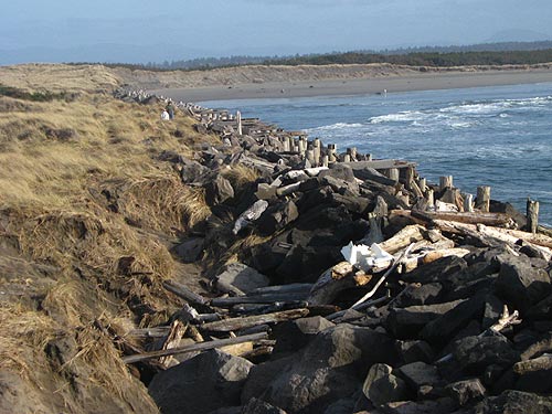
A beach grass started raging Monday evening at Fort Stevens State Park on the north Oregon coast. Smoke from that fire was visible for tens of miles all over the north Oregon coast, including as far south as Seaside. Authorities say it started in an area with brush and trees on the northern area, closer to the sections of the park along the Columbia River. However, southern beach accesses, such as those near the wreck of the Peter Iredale, have been closed to keep them open for firefighters.
Helicopters from the Oregon Department of Forestry have joined the fight at Fort Stevens, along with at least 40 firefighters.
Closer to the southern Oregon coast, two fires on the western side of the southern coast range were visible by satellite in dramatic fashion, seen by NASA images released Monday.
NASA's Aqua satellite captured the Cable Crossing Fire, Stouts Fire and the Potter Mountain Complex Fire in the Deschutes Forest over the weekend. The satellite utilized the Moderate Resolution Imaging Spectroradiometer (MODIS) instrument to photograph them, allowing the public to see smoke from the three fires commingling and drifting off towards Brookings.
On the spookier side, the intense red lines turn out not to be image alterations by NASA, circling the areas to point out the source of the smoke. Rob Gutro, NASA's Goddard Space Flight Center, explained what was really happening.
“The multiple red pixels are heat signatures detected by MODIS,” Gutro said. “The smoke appears to be a light brown color.”
The satellite program coordinates with InciWeb, an interagency all-risk incident information management system that coordinates with federal, state and local agencies to manage wildfires.
More on the Warrenton, Fort Stevens Area below, and at the Astoria, Warrenton Virtual Tour, Map.
More About Oregon Coast hotels, lodging.....
More About Oregon Coast Restaurants, Dining.....
LATEST Related Oregon Coast Articles
Oregon Coast, Valley and Likely Washington Coast to Get Some Aurora Borealis ... |
Back to Oregon Coast
Contact Advertise on BeachConnection.net
All Content, unless otherwise attributed, copyright BeachConnection.net Unauthorized use or publication is not permitted
Secrets of the Season |
Unusual Travel Articles TravelParanormal.com allows you to submit your own creepy tale or debunk one - or see up-to-the-minute news headlines about travel and the paranormal. News Headlines from All Over Oregon Need to scan Oregon headlines? Constantly updated news from all over Oregon: a comprehensive, up-to-the-minute display of news headlines from a variety of media Oregon Coast Oceanfront Lodging, Hotels, Rentals |


