New with Upcoming Oregon Coast King Tides Includes More of Them, Photo Contest, Washington Dates
Published 11/09/23 a 6:35 p.m.
By Oregon Coast Beach Connection staff
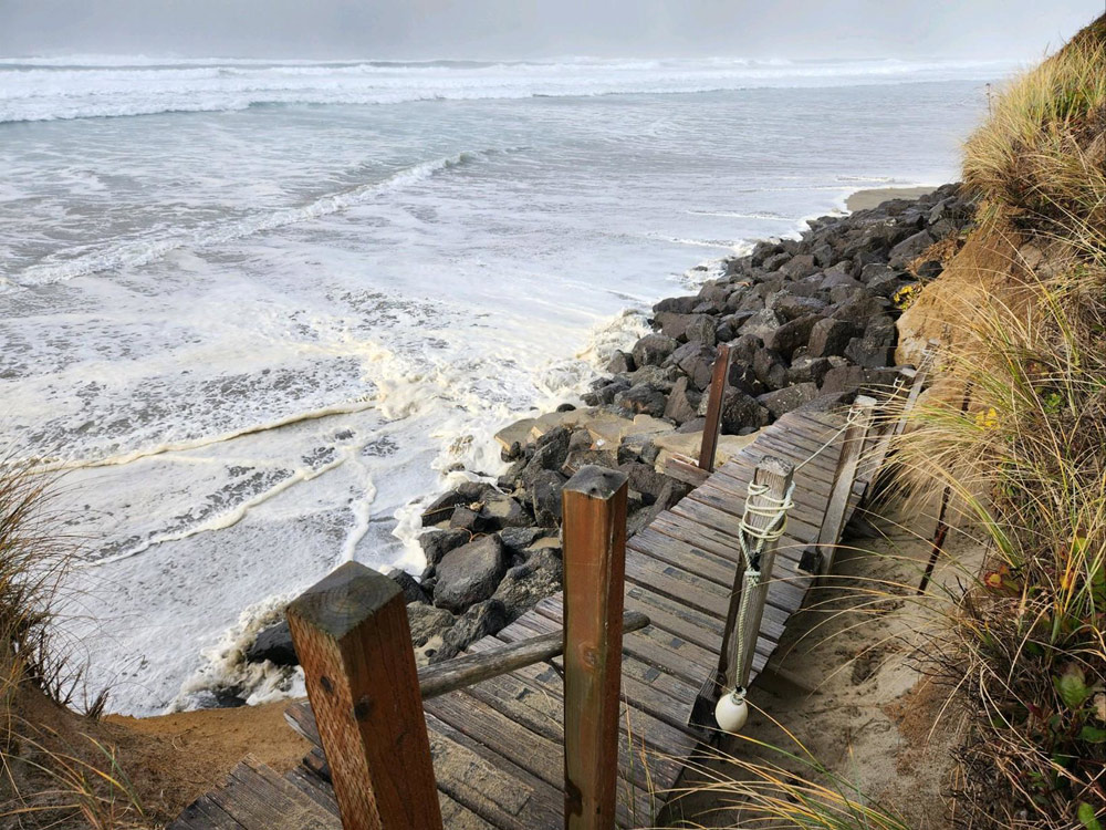
(Oregon Coast) – Once again, king tides are going to make their dramatic appearance up and down the Oregon coast and Washington coast, but there's a few things different this time around. (Photo King Tides Project: Idaho St. at Yachats smothered by dangerous tides)
Also new: if you're wondering how all this photographic information has been put to use, there is now an answer.
Includes exclusive listings; some specials in winter
In Cannon Beach:
Includes rentals not listed anywhere else
In Manzanita, Wheeler, Rockaway Beach:
Some specials for winter
In Pacific City, Oceanside:
Some specials for winter
In Lincoln City:
Some specials for winter
In Depoe Bay, Gleneden Beach:
Some specials for winter
In Newport:
Look for some specials
In Waldport
Some specials for winter
In Yachats, Florence
Some specials for winter
Southern Oregon Coast Hotels / Lodgings
Reedsport to Brookings, places to stay; winter deals
You'll find a photo contest (where you can win prizes) and more king tide dates than usual for Oregon, while Washington has dates a little all over the place.
What are actually known as perigean tides – caused by an alignment of the moon and sun that increases their gravitational tug – begin their run on November 25, with the first set going through November 27 on the Oregon coast and most of the Washington coast.
For Oregon, there's something a little new: there will be four sets of king tides. The second set happens December 13 - 15, 2023. The third is January 11 - 13, 2024, and the fourth hits February 8-10, 2024.
Unusual for the Washington coast: the sets of dates are a little different from area to area.
For the southern Washington coast and northern third, the first set happens November 25 – 27. For Westport and central Washington coast, it's off by a day, at November 26 – 28.
See gallery of King Tides 2022 photos at bottom
The next set for the entire Washington coast is December 13 – 15.
The third happens on January 11 – 13 on the central and north coast, while farther south areas like Ilwaco see it on January 20 – 22.
As usual, both King Tide Projects need the public's help to snap photos of what will be the highest tidal events of the year (barring any unusual storm surges on other dates). They need shots of high tide events at any beach along the coastlines, and hopefully a shot of that same area without the tidal event for comparison.
On the Washington coast, submit them to https://mycoast.org/wa. On the Oregon coast, submit them to www.oregonkingtides.net or the project’s Flickr: https://www.flickr.com/photos/orkingtide/albums.
This year, Oregon Coast Visitors Association (OCVA) is partnering with the Oregon King Tides Project to offer prizes.
Arica Sears with OCVA urges residents and visitors to come out and document the effects of these extreme events. They are hosting a photo contest where you can win $50 worth of Oregon coastal swag through the agency.
“OCVA had an influencer out last year doing this and will do so again this year,” Sears told Oregon Coast Beach Connection. “We also send prizes to winners of the photo contest. There are generally 4 - 5 photo categories.”
Contest information is at this link.
As always, both Washington coast and Oregon officials warn of keeping safety in mind. Always keep your eye on the ocean and stay up high away from all waves. Be aware of areas with rising water, eroding shorelines (stay off cliff edges), flooded roadways or high winds that may coincide.
Have you been wondering where all this sea rise information has been going to all these years?
Photos and data from the Oregon King Tides Project have been put to use over recent years, primarily through the Oregon Department of Land Conservation and Development (DLCD), which has developed a Sea Level Rise Adaptation Planning Toolkit to support local sea level rise adaptation planning along the Oregon coast.
Meg Reed, with the Oregon Coastal Management Program (OCMP), said the toolkit was partially constructed from what was learned from king tides photos, which in turn is utilized by those living on the coast and working in fields that have to do with new construction or land use.
Oregon Coast Hotels for this event - South Coast Hotels - Where to eat - Maps - Virtual Tours
“The Toolkit is intended to assist land use planning staff, property owners, organizations, developers, and public entities in understanding the effects of sea level rise, and in planning for a resilient and equitable future under climate change,” Reed told Oregon Coast Beach Connection. “
Clatsop County – which includes Cannon Beach, Seaside, Gearhart, Warrenton and Astoria – has various sections prone to flooding. DLCD has held workshops and meetings there with residents and decision makers, and found many were concerned about increasing flooding that affected roadways and even isolation from other communities.
Look for more on the surprising science behind the different dates of different areas soon at Oregon Coast Beach Connection.
How big king tides end up is mostly dictated by current ocean conditions, usually known only at last minute. Oregon Coast Beach Connection is the only outlet in the Pacific Northwest that publishes tidal surge updates in the day or two before the event, consulting with the National Weather Service. See the Oregon Coast / Washington Coast News page, follow on Facebook, or if you have the Google News app you can follow there.
Cannon Beach Lodging
Nehalem Bay Lodgings
Manzanita Hotels, Lodging
Three Capes Lodging
Pacific City Hotels, Lodging
Lincoln City Lodging
Depoe Bay Lodging
Newport Lodging
Waldport Lodging
Yachats Lodging
Oregon Coast Vacation Rentals
Oregon Coast Lodging Specials
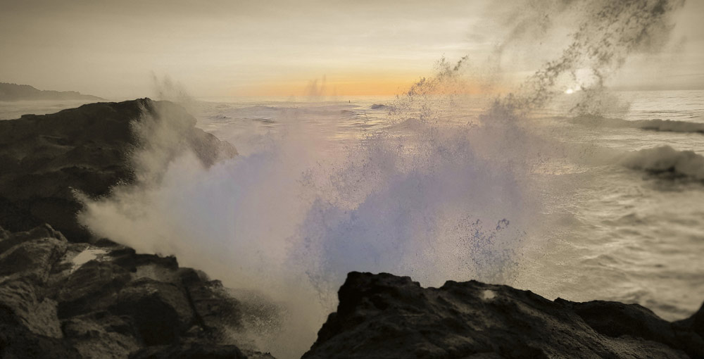
Depoe Bay, King Tides / Kawaji Armitage
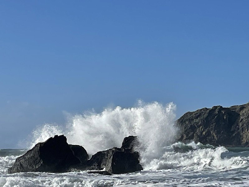
Whaleshead Beach near Brookings, King Tides / Thomas Hanley
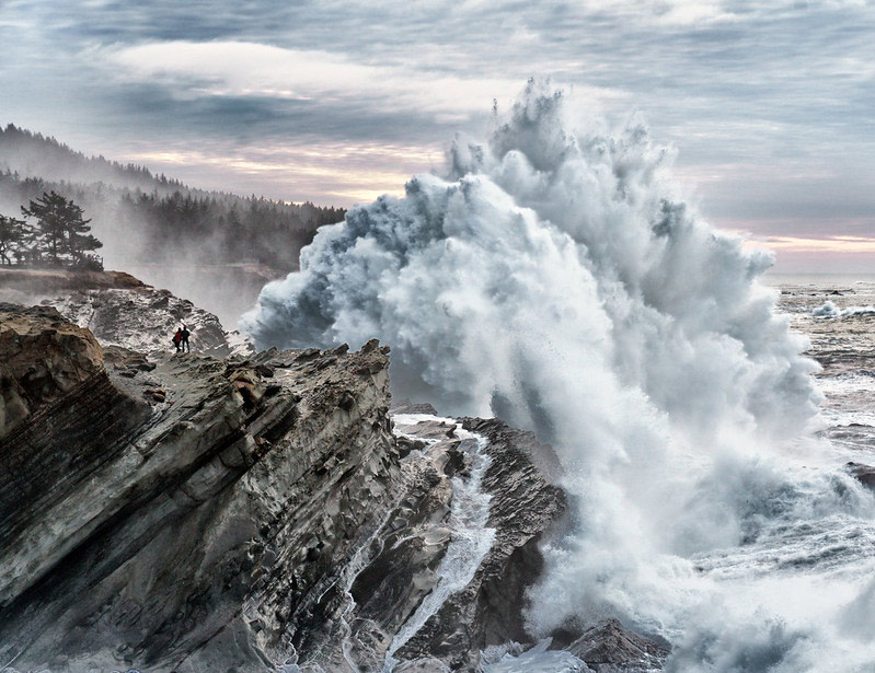
Shore Acres near Coos Bay, King Tides / Paul O'Donovan
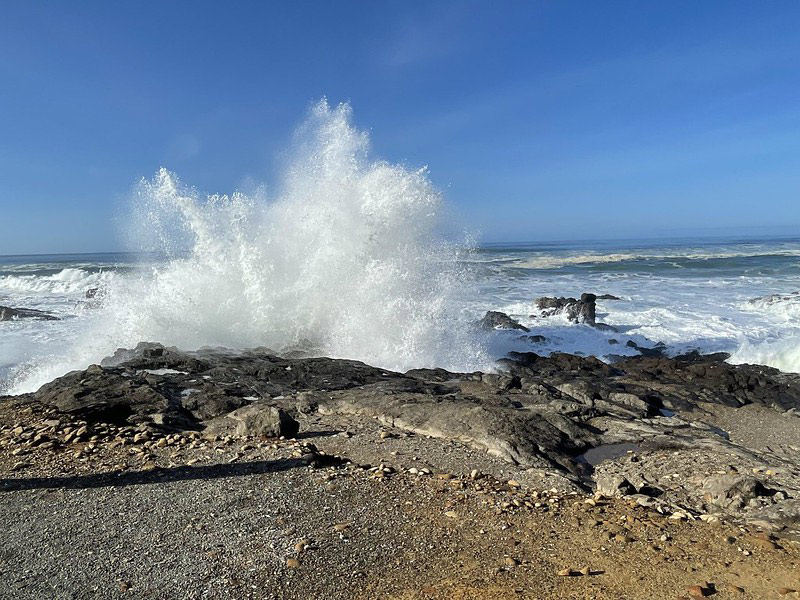
Yachats, King Tides / Carley Dangona
More About Oregon Coast hotels, lodging.....
More About Oregon Coast Restaurants, Dining.....
 Andre' GW Hagestedt is editor, owner and primary photographer / videographer of Oregon Coast Beach Connection, an online publication that sees over 1 million pageviews per month. He is also author of several books about the coast.
LATEST Related Oregon Coast Articles
December 12 at 7 pm, and Saturday, December 13 at 2 pm and 7 pm. Lincoln City events
Oregon Coast Town Looks at Possibility of Life Out There with Yachats Event
Jan 11 at the Yachats Commons examines the moon Europa. Yachats events
Turning Oregon's Greens Into Christmas Gold: Only Days Left in Ornament Hunt
Throughout Willamette National Forest from Cascades towards Salem and Eugene. Detroit, Sweet Home, Albany, Events
Central Oregon Coast Landslide Worsens; How to Report Personal Belongings Finds
The Go-Now order still in effect; personal belongings sought. Lincoln City, Newport, Depoe Bay
Driver Arrested on Oregon Coast After Narrowly Missing Construction Crew, The...
Driving up to 110 mph on Highway 101, endangering crews before that. Safety
Flood Advisories, Warnings, Watches All Over Washington / Oregon Coast
Advisories, watches and warnings in various areas except the central Oregon coast. Weather, traffic
Oregon / Washington King Tides Misconceptions: Not Always a Supermoon Involved
Not the same as high wave events, don't always include a supermoon. Astronomy
N. Oregon Coast First Day Hikes Include Near Astoria, Pacific City, Waldport
Free self-guided hikes in awesome places: Warrenton events, Coast Range, Portland events, Pacific City events, Waldport events
Back to Oregon Coast
Contact Advertise on Oregon Coast Beach Connection
All Content, unless otherwise attributed, copyright Oregon Coast Beach Connection. Unauthorized use or publication is not permitted


