 |
Oregon Coast Fun Facts: Oceanside's Mysteries and Histories
Published 07/12/2015 at 5:04 AM PDT
By Oregon Coast Beach Connection staff
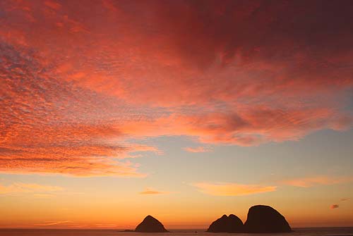
(Oceanside, Oregon) – One tiny town has never provided so many means of fun and distraction. And it's all done without a single commercialized attraction.
Oceanside, on the north Oregon coast, almost at the very northern tip of the Three Capes Tour, has so much more than meets the eye. It would literally take you two or more days to truly explore everything (and even then, the tides wouldn't necessarily allow that).
History of the place goes all the way back before the 1880's, but Oceanside really made the books in 1903 when a pair of naturalists presented President Theodore Roosevelt with their observations on the large sea stacks that dominate the view. They were a wonderland of wildlife, and locals had been using them and their animals for target practice for a long time. Roosevelt declared Three Arch Rocks a national wildlife reserve in 1907.
The town actually came into being the day after the Fourth of July in 1922. At least it was named on that day. Two brothers – H.H. and J.H. Rosenberg – bought the land from a man named Maxwell the year before, and he had it as a farm from about 1885 onward. At least one major business in Tillamook still bears the Rosenberg name.
These days, there's not even a gas station or grocery in Oceanside (the closest is nine miles away at Tillamook). But back in the almost-roaring twenties of the Oregon coast, the pair built a dance hall, a grocery, and a hotel or two. Meanwhile, a massive tent city was erected – which was the standard form of lodging at the time for tourists. It clocked in at 500 or so tents.
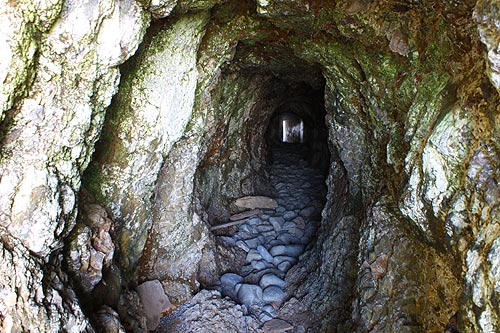
That famous tunnel now going through Maxwell Point was created in 1926 by the Rosenberg brothers. But it was the year before that really caused Oceanside to skyrocket with travelers, when they built a wooden plank road between there and Netarts.
Another popular feature was what would be now considered a vastly dangerous and unwise construct: a wooden platform elevated above the waves that allowed people to wander around the big basalts from the beach beyond the tunnel. Sometimes called an “angel walk,” it crumbled after a short time in existence.
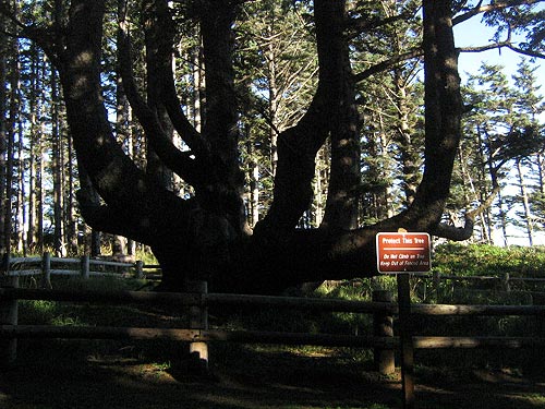
Meanwhile, just two miles up the road, the Cape Meares Lighthouse sprang into existence, and an unusual feature in that area made the Ripley's Believe It Or Not books for decades. Called the Octopus Tree, it had eight massive limbs (one was torn away in the 90's by a windstorm) in a candelabra-like shape. Local native tribes called it Council Tree, and it is believed to have been the burial tree for the prestigious of the tribe. Apparently, some members were buried with their canoes in that tree, and the limbs grew around it – giving it that odd shape.
That has not been proven, however, so the true nature of Octopus Tree's shape is not certain.
Other fun and funky facts about Oceanside:
- During World War 2, troops were billeted all over Oceanside, including the spot now known as Radar Road, just off the road running behind Oceanside.
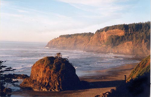
- That road overlooks an incredible hidden spot called Short Beach. Until the early 2000's, entrance to that beach was via a muddy, unstable and slippery slope. Many were injured there so locals got together and created the “stairway of 1000 steps.” It's much safer now.
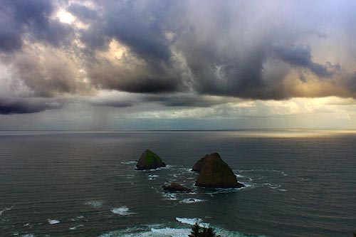
- Keep driving up the hill through Oceanside's little neighborhoods and you'll encounter some unique homes. Keep exploring this steep road and you'll eventually end up above Maxwell Point at a favorite launching pad for hang gliders. You'll find yourself looking down on Three Arch Rocks.
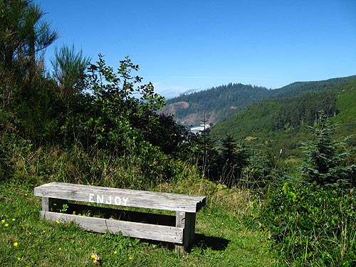
- Explore these tiny streets at the top and you may run into this gem: a bench looking out on the mini-mountains and out to sea. It's incredible.
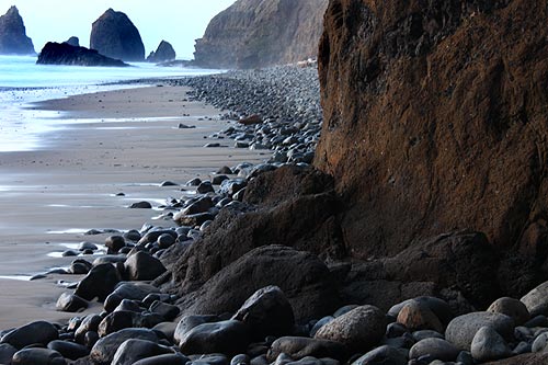
- The beach on the other side of the tunnel was referred to as Tunnel Beach, but in recent years it's been called Star Trek Beach because some of the structures there looked like objects from the first TV series. One of those rock structures fell apart in the early 2000's.
On the other side of Star Trek Beach lurks Lost Boy Beach, which is rarely accessible – only when really low tides allow. It's called Lost Boy for a reason.
- Many summers see sand levels get incredibly high int his area and this keeps the tide farther out. This, in turn, sometimes allows clear passage around Maxwell Point without using the tunnel. Even more on Oceanside at the Oceanside, Pacific City, Three Capes Virtual Tour, Map.
More About Pacific City, Oceanside, Netarts, Tierra Del Mar Lodging.....
More About Oregon Coast Restaurants, Dining.....
LATEST Related Oregon Coast Articles
Oregon Coast, Valley and Likely Washington Coast to Get Some Aurora Borealis ... |
Back to Oregon Coast
Contact Advertise on BeachConnection.net
All Content, unless otherwise attributed, copyright BeachConnection.net Unauthorized use or publication is not permitted
Secrets of the Season |
Unusual Travel Articles TravelParanormal.com allows you to submit your own creepy tale or debunk one - or see up-to-the-minute news headlines about travel and the paranormal. News Headlines from All Over Oregon Need to scan Oregon headlines? Constantly updated news from all over Oregon: a comprehensive, up-to-the-minute display of news headlines from a variety of media Oregon Coast Oceanfront Lodging, Hotels, Rentals |


