A Tale of Two Otter Rock / Points on Oregon Coast
Published 03/28/21 at 6:25 AM PDT
By Oregon Coast Beach Connection staff
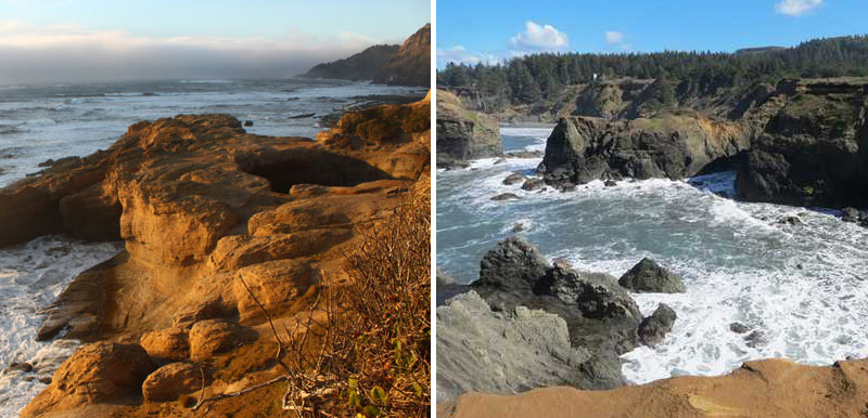
(Gold Beach, Oregon) – If you get confused by an Otter Rock on the central coast and an Otter Point on the south coast, you probably would not be alone. But yes, Virginia, there are two Otter Rock / Points on the Oregon coast. One is the more familiar, near Depoe Bay; the other farther down, close to the California border. (Above: Otter Rock at left; Otter Point at right, the latter photo courtesy OPRD)
To add even more confusion, both Otter Rock and Otter Point have an Agate Beach near them. There are two of those as well, but that’s another story.
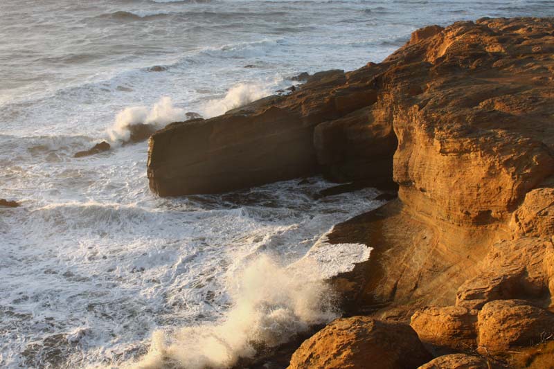
Otter Rock. In a way there’s definitely more than one Otter Rock or Otter-something on the central Oregon coast, near Depoe Bay. There is an Otter Rock sea stack just west of Beverly Beach, there’s the village and the point called Otter Rock, which houses the Devil’s Punchbowl. And then there’s the Otter Loop Road: a winding, stunning little one-way road that connects a hidden viewpoint near Depoe Bay to Cape Foulweather.
Includes exclusive listings; some specials in winter
In Cannon Beach:
Includes rentals not listed anywhere else
In Manzanita, Wheeler, Rockaway Beach:
Some specials for winter
In Pacific City, Oceanside:
Some specials for winter
In Lincoln City:
Some specials for winter
In Depoe Bay, Gleneden Beach:
Some specials for winter
In Newport:
Look for some specials
In Waldport
Some specials for winter
In Yachats, Florence
Some specials for winter
Southern Oregon Coast Hotels / Lodgings
Reedsport to Brookings, places to stay; winter deals
Otter Rock got its name more or less from the original tribes of the area, which had something similar in their language, and that was translated into English by European settlers, then kept because of its prolific otter hunting. They went extinct in the area about 1900, however.
Now, the village of Otter Rock is a few interlacing streets of homes, with the actual point being a parking lot with a handful of businesses, including the long-standing Flying Dutchman Winery. Others are sometimes only open in the busy season.
Otter Rock State Scenic Viewpoint encompasses the overlook to the sometimes-wild Devil’s Punchbowl. In actuality it’s not very chaotic very often, only during heavier, stormier tides. Still, it’s a mesmerizing feature, knowing it’s a cave that once had the top fall in.
To the south, another viewpoint lets you look at the surfing hotspot just below Otter Rock and then towards the vast beaches of northern Newport.
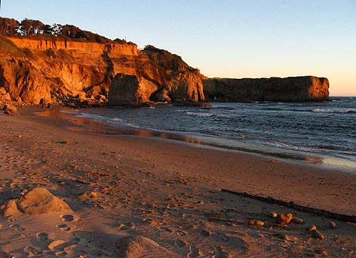
Back a bit east is another, larger parking lot and restrooms. Here, you get to walk down to the marine gardens of Otter Rock and maybe – if tides allow – parts of the beach directly below the Inn at Otter Crest. This rugged and untamed beach lets you peak at parts of the Devil’s Punchbowl from below, and there are some fascinating, intricate rock structures there.
The one part you can never get to, however, is what’s known as Elephant Rock, the enigmatic chunk which sits on the other side of a point just to the south of the hotel’s direct beach access. That point, even if tidal conditions allow, is way too slippery with sea lettuce and other marine algae. It’s worse and much more dangerous than walking on ice.
Elephant Rock once had an arch on it that made it look like an elephant. It’s a weird story, see Elephant Rock History.
Hotels in Depoe Bay - Where to eat - Depoe Bay Maps and Virtual Tours
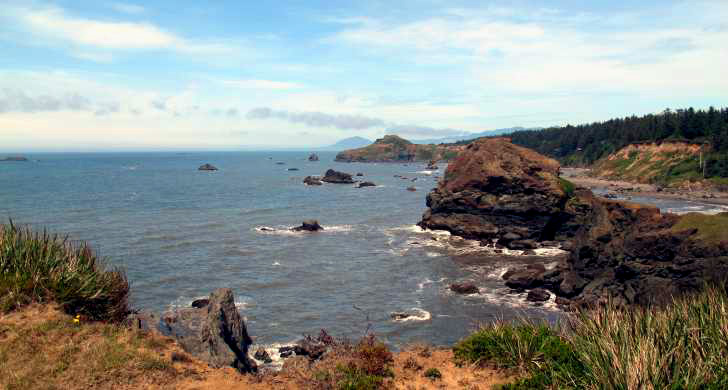
Otter Point State Recreational Site. Just a few miles north Gold Beach on the southern Oregon coast sits a definite, eye-popping wonder that is also normally bereft of people. In fact, Oregon State Parks and Recreation Department (OPRD) has said it is among some of the least visited of its state parks.
You’ll have to look carefully for it: there’s almost no signage indicating where it is from Highway 101.
There is an actual Otter Point with its own parking lot, and then farther south there is a somewhat long but pleasant beach access walkway from the state park area. The promontory lets you walk out over this pastiche of darker and brighter rock structures, where a vast expanse of sea rolls out in front of you. On this truly rugged, untamed bit of rock there’s a section where the cliffs are split, almost creating a secret cove. Another section features a fascinating, alien shape: a blob of soil with a hole in it where the brush folds over in a weird way, making it almost look like a primitive hut. Or something out of Star Wars.
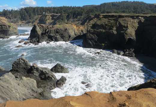
Photo courtesy OPRD
Down on the beach – called Bailey Beach – it goes for about two miles to the south. These are darker sands often typical of the Gold Beach area, hinting at the presence of gold in them thar stretches.
Otter Point the outcropping and Otter Point State Recreational Site's cliffs are an intriguing mix of super soft and often bright sandstone along with harder, darker mudstone-like rocks – likely a time-traveling mixture of geologic processes and types of rock. Like much of the southern coast, it too has complex origins, and you can see that in parts of the beach below. There is that up-tilt you see, such as around Coos Bay, and then other parts surrounding that are showing the jagged and rounded edges of different processes going on. Then below that gray cliff of bundled, random shapes there are light brown sandstone pieces lying around, sometimes with honeycomb patterns in them.
If it’s like so many other parts of the south coast – especially Bandon’s Face Rock – you’re seeing a lot of different things happening over millions and millions of years all crammed into one rocky wall.
While these sandstone and other cliff areas completely catch fire at sunset, bringing on brilliant colors, you should be warned they're extremely soft in the yellow sections. Stay off the edges there. In fact, if you look down at some of the big indentations in the sandstone, you can see enormous, scary holes there. These are fragile cliffs and not to be trifled with.
Oregon Coast Hotels in this area - South Coast Hotels - Where to eat - Maps - Virtual Tours
Cannon Beach Lodging
Nehalem Bay Lodgings
Manzanita Hotels, Lodging
Three Capes Lodging
Pacific City Hotels, Lodging
Lincoln City Lodging
Depoe Bay Lodging
Newport Lodging
Waldport Lodging
Yachats Lodging
Oregon Coast Vacation Rentals
Oregon Coast Lodging Specials
More About Oregon Coast hotels, lodging.....
More About Oregon Coast Restaurants, Dining.....
LATEST Related Oregon Coast Articles
The building had also been robbed of pipes and copper by other thieves. True Crime, Astoria, Warrenton
Oregon Coast Crabbing Petition Denied, Rulemaking Process Remains on Course
A petition on procedural matters denied; no major changes yet. Whale
S. Oregon Coast Wind Warnings, Waves Up To 23 Feet
Gusts up to 65 and high waves for the weekend from Reedsport to Brookings. Weather
Newport Latest Oregon Coast Town to Ban Personal Fireworks Year-Round
City countcil voted this week; the pro fireworks display goes on as usual
Hazardous Seas Watch on N. Oregon Coast, S. Washington Coast, Waves Up To 15 Ft
Beaches will require caution but some good wave shows possible
Annual 'Maine' Event Returns to N. Oregon Coast's Seaside Aquarium
February 22 brings the fundraiser to Seaside. Seaside events
From Taking In Cool Oregon Coast Colors on the Patio to Seaside's Action
Review of Seaside's Seashore Inn on the Beach: spectacle with breakfast and your dog. Seaside hotel reviews
Oregon US Coast Guard Team Assists in Olympic National Forest Rescue
Helicopter team from Astoria rescued hikers on Washington's Mount Ellinor
Back to Oregon Coast
Contact Advertise on BeachConnection.net
All Content, unless otherwise attributed, copyright BeachConnection.net Unauthorized use or publication is not permitted
Keywords: Oregon Coast, travel, beaches, Coos Bay, Otter Rock, Otter Point, Newport, Bandon, Pacific City, Lincoln City, Depoe Bay, Port Orford, Gold Beach, Brookings


