Vibrant Views Abound from Top of Cape Perpetua, Near Yachats, Oregon
Published 12/10/2012
Includes exclusive listings; some specials in winter
In Cannon Beach:
Includes rentals not listed anywhere else
In Manzanita, Wheeler, Rockaway Beach:
Some specials for winter
In Pacific City, Oceanside:
Some specials for winter
In Lincoln City:
Some specials for winter
In Depoe Bay, Gleneden Beach:
Some specials for winter
In Newport:
Look for some specials
In Waldport
Some specials for winter
In Yachats, Florence
Some specials for winter
(Yachats, Oregon) - Soaring upwards at a height of nearly 700 feet, Cape Perpetua is one of the highest points along the Oregon coast that's accessible to the general tourist public. In fact, it's the highest spot that you can drive to, with the top of Manzanita's 1600-foot Neahkahnie Mountain requiring a trail to reach its top. It sits a few miles south of Yachats, requiring a rather white-knuckled drive full of tight turns and twists in the road to get up there.
Lodgings in Yachats - Where to eat - Yachats Maps and Virtual Tours
Upper Lane County Maps and Virtual Tours
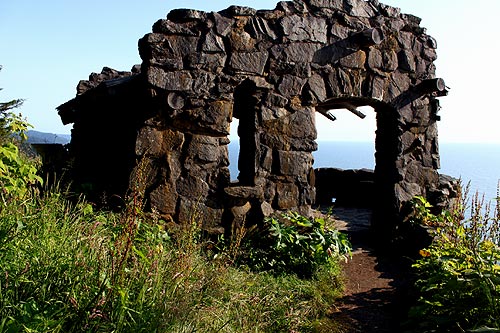
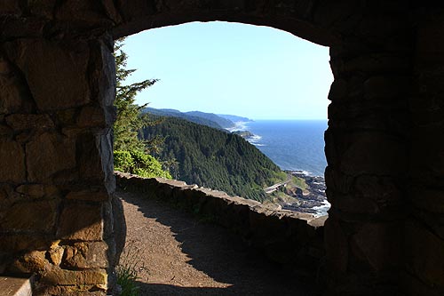
Once there, you get a bird's eye view to plenty of fascinating things. Starting with the famed stone shelter that was built there in the 30's as part of Roosevelt's plans to reboot the U.S economy after the Great Depression. It was built by the Civilian Conservation Corps, who also constructed the series of trails around Perpetua, the public campground that's still used today and then the West Shelter that you come across near the top of the mountain.
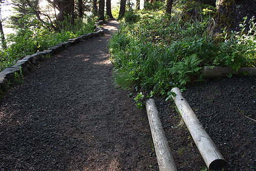
First, however, you need to get here. From the main parking lot, covered in a heavy canopy of trees that seriously creak and shudder when the wind kicks in, you wander down a pleasant wooded path to the sound of the ocean hundreds of feet below. It's all a bit rustic, even medieval. It wouldn't be surprising to be surprised by a gnome or some other mythical woodsy creature.
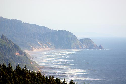
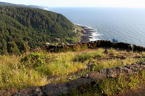
Initially you come upon a a series of lookout points, all stunning and jaw-dropping in various ways. You can even see the other side of Heceta Head from here – about 15 miles away – the side that doesn't have the lighthouse. That structure is not far from Florence.
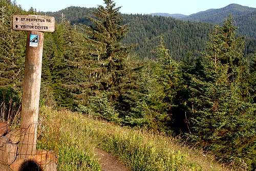
Various trails snake around this headland, once a former volcano in its own right.
Other bits of history about the area are quite notable as well. Back in 1778, this continent was known as New Albion by the British explorer Captain James Cook. He writes about spotting this peak on March 11, though he apparently spotted it on March 7 – the same day he spotted and named Cape Foulweather by Depoe Bay.
Of the area he wrote:
"Each extreme of the land seemed to shoot out into a point; the one to the north we saw on the 7th it was called Cape Perpetua, on account of its first being seen on that day. The one to the south I called Cape Foul Weather from the very bad weather we soon after met with. I judge it to lie in the latitude of 44° 55' North, longitude 235° 54' East".
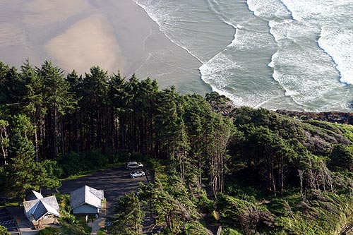
Now, things are a lot less primitive than they were then, although in some spots, thankfully, not much. Among the bits of civilized comfort is the Cape Perpetua Visitors Center, which you can look down on from the overlooks on top of Perpetua.
Just below Cape Perpetua is the ever-fascinating Devil's Churn, and nearby is the awe-inspiring Cook's Chasm – named after the explorer – where you can see incredible oceanic geyser action from perhaps the most impressive spouting horn on the entire Oregon coast.
Lodgings in Yachats - Where to eat - Maps - Virtual Tours
Cannon Beach Lodging
Nehalem Bay Lodgings
Manzanita Hotels, Lodging
Three Capes Lodging
Pacific City Hotels, Lodging
Lincoln City Lodging
Depoe Bay Lodging
Newport Lodging
Waldport Lodging
Yachats Lodging
Oregon Coast Vacation Rentals
Oregon Coast Lodging Specials
More About Oregon Coast hotels, lodging.....
More About Oregon Coast Restaurants, Dining.....
LATEST Related Oregon Coast Articles
Likely just before dawn best hour but peak happens during daylight. Weather
Dark Sky Week is Prime Along Oregon Coast: Where and Where Not to Go
General guide to dark sky viewing from south to north coast. Astronomy
Sizable Price Drop, Deals in Lincoln City During Quiet of April on Central Or...
20 perc off at A1 Vacation Rentals across its roster, including Gleneden Beach. Lincoln City specials
Upcoming S. Oregon Coast Events Include Gem Show, History: Coos Bay, Bandon
May 6 talk at Coos History Museum, Mayfly Fest May 17, Bandon Rock / Gem Show June 7,8
Washington Coast Cleanup on April 19 - Coinciding with Oregon Coast's SOLVE E...
From the Puget Sound to Long Beach, alongside Oregon's cleanup. Washington coast events, Seaside events
Astoria's Riverwalk Gets New Lighting, More N. Oregon Coast Roadwork
Delays coming this summer, but the riverwalk has a new look. Seaside, Cannn Beach
April Gets Even Cheaper Midweek at Depoe Bay, Lincoln City: Oregon Coast Deals
Off-season rates plus more at Keystone Vacation Rentals. Depoe Bay lodging specials, Lincoln City hotel reviews, Newport hotel reviews
Washington Coast Begins Week of Clam Digs, April 12 Through 18
Long Beach, Twin Harbors, Mocrocks and Copalis at different times. Washington coast events
Back to Oregon Coast
Contact Advertise on BeachConnection.net
All Content, unless otherwise attributed, copyright BeachConnection.net Unauthorized use or publication is not permitted


