Rockaway Beach's 7 Miles of Sights and Sites with Oregon Coast Historical Roots
Published 4/25/24 at 7:35 p.m.
By Andre' Hagestedt, Oregon Coast Beach Connection
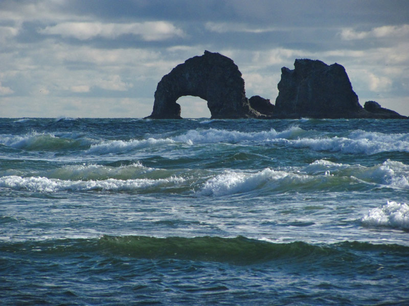
(Rockaway Beach, Oregon) – With one foot in history and the other foot – well, it's just a sandy foot – Rockaway Beach goes back a ways. In fact, it's actually more than one little town, a collection of two or three burghs clumped together, though you wouldn't know the difference driving through, all of which date back a little more than 100 years. (All photos Oregon Coast Beach Connection)
Includes exclusive listings; some specials in winter
In Cannon Beach:
Includes rentals not listed anywhere else
In Manzanita, Wheeler, Rockaway Beach:
Some specials for winter
In Pacific City, Oceanside:
Some specials for winter
In Lincoln City:
Some specials for winter
In Depoe Bay, Gleneden Beach:
Some specials for winter
In Newport:
Look for some specials
In Waldport
Some specials for winter
In Yachats, Florence
Some specials for winter
Southern Oregon Coast Hotels / Lodgings
Reedsport to Brookings, places to stay; winter deals
These seven miles are somewhat unique on the north Oregon coast, as it's the only beach on the northern half where there's a town surrounding rather unpopulated sands. It's atypical for a town, though some beaches in between the villages are desolate. It's managed to stay a low key and pleasantly calm tourism destination, in spite of it trying to be otherwise.
Delve into the history books and you'll see it was once called Garibaldi Beach, and dotting it were various other little “resorts” with names like Saltair (also known as Tillamook Beach), Manhattan Beach, Lake Lytle and so on. They're names you'll recognize now. Not unlike another seven miles of beach on this coastline – Lincoln City – Rockaway Beach was also comprised of different villages that coalesced together into one name. See Beginning of Rockaway Beach: N. Oregon Coast History Includes a Science Mystery
In some ways, Twin Rocks and Manhattan Beach are still considered different communities at opposite ends of town.
This little community had a post office started in 1914. It closed in 1954. The history of Rockaway Beach includes the town first getting named as such in 1909, and Twin Rocks was incorporated somewhere after 1914. Twin Rocks got its name from Twin Rocks just offshore. Those rocks, in turn, were named by the fact that from a boat on the other side of the basalt structures they looked rather identical.

Starting at the southern end, what is still called Twin Rocks, the famed rock structures by the same name take on a different shape than they do farther north. The giant, gaping arch is not as obvious here, but the rocks themselves are much closer. More on the geology of Twin Rocks Weird Science of Rockaway Beach's Twin Rocks, N. Oregon Coast: Video

The most obvious beach access in Twin Rocks in Minnehaha Street. But there are a couple of beach accesses even farther south, such as at Shand Ave. These can be exceptionally bereft of people and full of wonders. Shand is actually part of Twin Rocks, and there is a pleasant little stream emptying into the ocean here.
Is there such a thing as Twin Rocks State Park or Twin Rocks State Natural Wayside? No. Sometimes a net search will yield that, but it is incorrect. Beach accesses here are all under the Twin Rocks banner - if such a loose association can be applied. Actually, it's all Rockaway Beach.
Head north and most of the streets that jut off westward from the highway include lovely little beach accesses. Along Highway 101 here you start to encounter more and more businesses, including several curiosity and antique shops, some made out of older buildings or former churches.
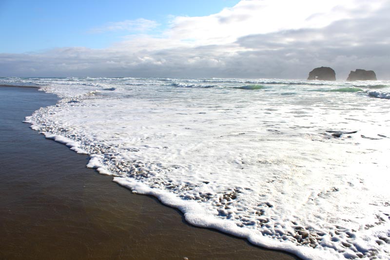
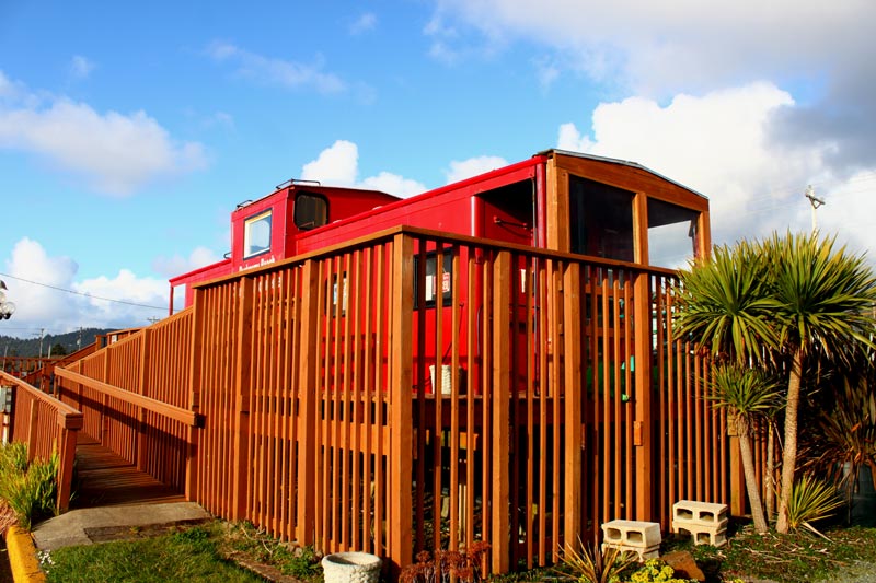
Soon you reach Ocean Edge Wayside, the most visible access in Rockaway Beach. Here, Twin Rocks shows its arch much more clearly. The big red caboose is here, and a sizable grouping of restaurants, vacation rental offices and lodgings are clustered along this part of Rockaway's downtown district. See N. Oregon Coast's Rockaway Beach Has a Geologic, Land-Altering Surprise It turns out, that pair of sea stacks is creating a structure we can't see, and bending the beach around it
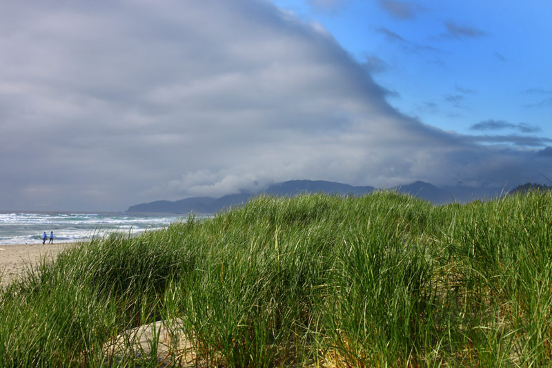
Wander north of here and the beach accesses start to lie along N. Pacific St., which runs along the length of much of this side of town. Most of the beach accesses at the northern end include large boulders – rip rap – which sometimes makes traversing them difficult. Luckily, most of these have steps of some sort.
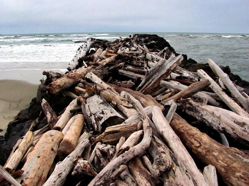
At the very northern end, Rockaway Beach dead-ends at Nedonna Beach, which includes the dramatic south jetty of the Nehalem Bay. Stand on top of this and you'll see some fascinating watery action, with the southern face being walloped by waves and the northern side – looking to the bay – considerably calmer.
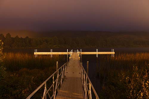
On the east side of Highway 101 through this part of the north Oregon coast, numerous little lakes sit either in plain view as well as some hidden ones tucked away along roads heading away from the ocean. Spring Lake in Twin Rocks and Lake Lytle are most prominent. Lytle has a grand fishing platform.
More details are at the Rockaway Beach, Oregon Coast Virtual Tour, Map, which contains a huge array of tourism information.
Hotels in Rockaway Beach - Where to eat - Rockaway Beach Maps and Virtual Tours
Cannon Beach Lodging
Nehalem Bay Lodgings
Manzanita Hotels, Lodging
Three Capes Lodging
Pacific City Hotels, Lodging
Lincoln City Lodging
Depoe Bay Lodging
Newport Lodging
Waldport Lodging
Yachats Lodging
Oregon Coast Vacation Rentals
Oregon Coast Lodging Specials
More About Oregon Coast hotels, lodging.....
More About Oregon Coast Restaurants, Dining.....
 Andre' GW Hagestedt is editor, owner and primary photographer / videographer of Oregon Coast Beach Connection, an online publication that sees over 1 million pageviews per month. He is also author of several books about the coast.
LATEST Related Oregon Coast Articles
Last Night's Aurora Shots from Oregon CoastA strong storm seen from Newport, Bandon, Port Angeles, Florence, Pacific City, Cannon Beach and more. Astronomy. Sciences
N. Oregon Coast Rescuers Assist Boaters with No Life Vests at Netarts Bay
N. Oregon Coast rescuers discovered boaters at Netarts Bay with no life vests. Beach safety
First Day Hikes Take Place All Over Oregon and Coast to Start 2026
A special tradition in Yachats, but also Brookings events, Gold Beach events, Port Orford events, Coos Bay events, Bandon events, Florence events, Yachats events, Newport events, Lincoln City events, Rockaway Beach events, Manzanita events, Cannon Beach events, Seaside events, Astoria events
Waves 17 to 26 Ft Along Oregon Coast: Surf Advisories, Sneaker Waves
A good show from Washington southward but some deadly possibilities. Weather
More Video Released of Dramatic South Oregon Coast Vessel Rescue
Watch rescuer hoist a crewmember up and onto the beach. Weather
Newport Police Investigate Two Stabbings and a Shooting Near Oregon Coast's H...
A man was shot as he was allegedly stabbing his second victim
Lassoing a Wayward Sea Lion Just Part of the Gig for Oregon Coast Deputies
Sea lion wandering near Newport / South Beach streets got some interesting looks. Marine sciences
Driver Arrested on Oregon Coast After Narrowly Missing Construction Crew, The...
Driving up to 110 mph on Highway 101, endangering crews before that. Safety
Back to Oregon Coast
Contact Advertise on Oregon Coast Beach Connection
All Content, unless otherwise attributed, copyright © Oregon Coast Beach Connection. Unauthorized use or publication is not permitted


