 |
A Safer Oregon Coast: Big Yellow Signs Assist Responders
Published 05/25/2015 at 5:31 PM PDT
By Oregon Coast Beach Connection staff
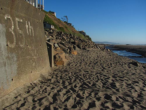
(Oregon Coast) – Oregon Parks and Recreation recently finished a massive project up the entire 360-mile length of Oregon's beaches, in the form of big, bright yellow signs that will assist first responders in case of an emergency. (Above: the old school sign at Lincoln City's SW 35th st. access, before the yellow ones, such as below).
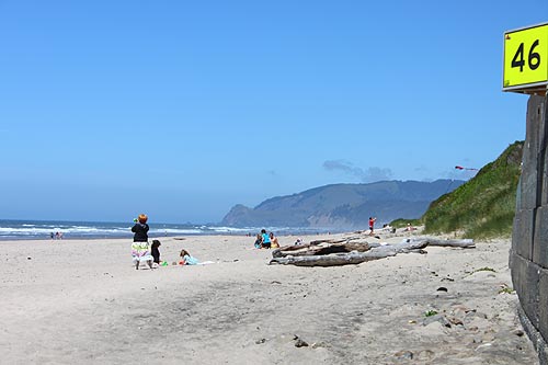
The massive signs with those large, black block numbers are set at most beach accesses under federal, state and county jurisdictions. Some 424 signs are at over 200 beach accesses along the Oregon coast, there to help those calling 911 with an emergency better relay their exact location. They are numbered one through 97, and you'll find them at the very northern tip of the state at the Columbia River jetty all the way down to Crissey Field at the California border.
Now, there is an easily visible means to figure out your location, if you have an emergency on the beach. Dispatchers have GPS coordinates for these areas and then can better pass that along to the first responders in the area.
The first went up in Lincoln City, rather mysteriously, in 2008. One of the first was at the SW 35th Street access, which is a bit off the beaten path. Since then, they have been continually popping up around the entire Oregon coast.
North Lincoln Fire & Rescue Captain Jim Kusz is a member of the planning committee that began meeting in 2004 on this project. A vocal advocate for beach safety, he said this will take much of the guesswork out of finding people in emergency situations and make response much faster.
“It can be confusing locating a victim offshore or on the beach,” Kusz said. “The beach numbered signs have helped tremendously in our ability to respond promptly in an emergency. The signs have proven to be an excellent aid for our Water Rescue Team and in coordinating our rescue efforts with United States Coast Guard and other agencies.”
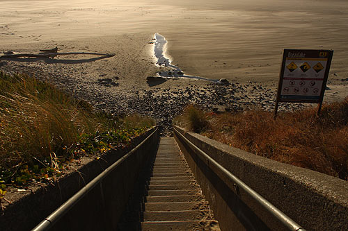
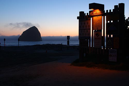
Beyond these large numbered indicators, more than 200 beach safety signs have been set even more beach accesses, warning the public about possible hazards such as rip currents and sneaker waves. These also list prohibited activities including littering and lighting fireworks. The signs convey information using internationally-recognized symbols. The signs clearly convey information that will keep visitors safe, like staying back from cliff edges and staying off logs.
Calum Stevenson, the Ocean Shore specialist for Oregon Parks and Recreation Department (OPRD), said that authorities can't overstate the need to look out for various hazards, and the public needs to be reminded or informed all the time.
“Unfortunately, accidents happen on the beach. Rolling logs, rip tides and unstable cliffs are all potentially dangerous,” said Stevenson.
Near population centers, the signs are as close as 1/4 mile apart. In more remote areas the signs are up to two miles apart or more where there are fewer beach accesses.
Some areas do not have signs, such as private accesses. Also missing is about 45 miles of beaches between Coos Bay and Florence. This stretch is under U.S. Forest Service (USFS) jurisdiction, but OPRD said it is working with the USFS to resolve archaeological and other issues on federal land before proceeding.
The $78,000 project was funded by a combination of visitor fees and Oregon lottery dollars that are dedicated to state parks. Some coastal cities have shared in the cost of creating and installing signs. Private communities, such as Salishan in Lincoln City are paying for their own signs.
More About Oregon Coast hotels, lodging.....
More About Oregon Coast Restaurants, Dining.....
LATEST Related Oregon Coast Articles
Decay Hits Beloved Oregon Coast Tree, Now the Newport Icon Must Be Cut Down |
Back to Oregon Coast
Contact Advertise on BeachConnection.net
All Content, unless otherwise attributed, copyright BeachConnection.net Unauthorized use or publication is not permitted
Secrets of the Season |
Unusual Travel Articles TravelParanormal.com allows you to submit your own creepy tale or debunk one - or see up-to-the-minute news headlines about travel and the paranormal. News Headlines from All Over Oregon Need to scan Oregon headlines? Constantly updated news from all over Oregon: a comprehensive, up-to-the-minute display of news headlines from a variety of media Oregon Coast Oceanfront Lodging, Hotels, Rentals |


