Short Beach on N. Oregon Coast Has Tales to Tell: Historical Oceanside Fun Facts
Published 06/22/2016 at 7:11 PM PDT - Published 06/23/2016 at 8:21 PM PDT
By Oregon Coast Beach Connection staff
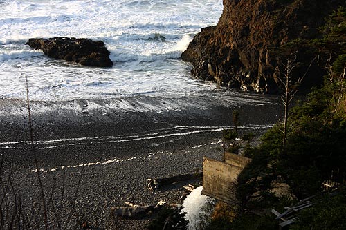
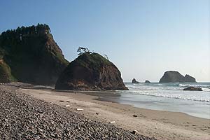
(Oceanside, Oregon) – Short Beach, near Oceanside on the north Oregon coast, is an enticing hidden spot sitting along that backroad between Oceanside and the headland known as Cape Meares. Typified by a kind of manmade waterfall, an intriguing blob of basalt at the tide line, and about a quarter mile of clandestine attractions, there's a lot going on here.
Yet there's even more behind the scenes at this hotspot found next to Radar Road. Short Beach has a bit of baggage – historically speaking. It has some tales to tell: some pleasant, some not so.
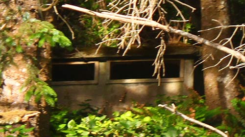
The name Radar Road is your first clue. During World War II, there was a radar post here, keeping an eye out (or a ping, if you will) for enemy aircraft. The road entrance is a ways south of the actual radar bunker, and yes, the bunker is still there. The old construct still lurks behind the trees, barely visible up on what is surely now unstable hillside territory. You can't find it unless someone actually points it out to you – or if you're involved in geocaching. It's sometimes used for that treasure hunting hobby.
A mushy and even treacherous semi-trail can lead you up there, but it's rickety at best and not advisable.
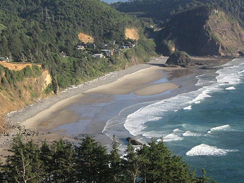
By the '90s, Short Beach was becoming a rather hot little hidden spot. Those wandering that back road between Cape Meares and Oceanside are immediately struck by the mysterious stretch of sand below and that massive blob, which resembles Proposal Rock at Neskowin (close to Pacific City). Who in their right mind would not want to explore this little Oregon coast wonder?
The problem was this delicious beach tidbit had no real access. Getting to it meant half-crawling and half-sliding on your butt down a slippery, slimy cliff face: one that had little regard for your safety. The giant spillway had a small platform that was fairly easily accessible, which served as a nice viewpoint. But if you really wanted to see the beach, you had to take your chances.
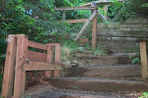
And many did, with plenty not faring so well. Enough people literally cracked their heads on this slope that neighbors pooled their resources and had this stairway built, nicknamed “stairway of 100 steps.” This happened about 2000 or so. There was a sign at the trail entrance talking about this community project, but it seems to have disappeared in the last ten years.
Now it's a sprawling wonder and leg cramp-inducer (but it's better than a split skull). Made of railroad ties, the stairway takes a slightly meandering path down and now includes benches – and that viewpoint above the spillway still exists. It's harsh on the way down, but it's a real bear coming back up.
Next to Short Beach, on the southern side of that towering basalt cliff, is Lost Boy Beach. So named because – according to legend – a boy was drowned there when the tide came into that extremely hidden spot and trapped him. No one seems to know if the tale is true, and the name goes back about 100 years or so. But if nothing else, it serves as a warning built right into the name – and rightly so.
Getting to Lost Boy Beach is out-of-control dangerous. From this northern side, you're almost guaranteed to get walloped. Extreme low tide events are about all that would make it even vaguely possible, and usually not even then.
The slightly more accessible side is from Oceanside via Tunnel Beach (sometimes known as Star Trek Beach). But the safety level is here is only higher by tiny degrees. Again, don't even think about it unless you're there during a rare extreme low tide situation. These probably don't happen more than twice a year and then for only an hour or less.
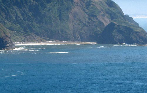
Instead, grab a binoculars or good zoom lens for your camera and check out Lost Boy Beach from the viewpoints at Cape Meares.
The final somewhat sad tale about the area is the northernmost tip of the Three Capes Tour: that road has been shut down for years now. You can only get to Oceanside and the Cape Meares lighthouse via a slightly longer route from Tillamook, taking you first through Netarts. Before, you could go straight from Tillamook to Bayocean Road, and then the northernmost entrance to the Three Capes Loop Road. Cape Meares and its lighthouse are less than a mile from there.
 The area had been prone to landslides for decades. There were numerous winters since the late '80s where that road was shut down because of a spot next to a scenic viewpoint that had slid away. Always it be repaired eventually, but often there would be less and less of a road available. It kept shrinking.
By January 2013, one last slide was the straw that broke the camel's back and Tillamook County shut down the road indefinitely.
This time around, the county is waiting for funds for a permanent fix, not just a patch.
Tillamook Coast executive director Nan Devlin described the politics involved.
“And the state is reluctant to help fund the fix,” Devlin said. “So, the county is looking for major grant money to help get the road redone - and by that I mean moved.”
Reinstating that road would shave off about ten minutes from the drive to Oceanside from Tillamook, and even more to the Cape Meares headland. Pacific City Hotels, Lodging in this area - Where to eat - Maps and Virtual Tours
More About Pacific City, Oceanside, Netarts, Tierra Del Mar Lodging.....
More About Oregon Coast Restaurants, Dining.....
Cannon Beach Lodging
Nehalem Bay Lodgings
Manzanita Hotels, Lodging
Three Capes Lodging
Pacific City Hotels, Lodging
Lincoln City Lodging
Depoe Bay Lodging
Newport Lodging
Waldport Lodging
Yachats Lodging
Oregon Coast Vacation Rentals
Oregon Coast Lodging Specials
LATEST Related Oregon Coast Articles
Advisories, watches and warnings in various areas except the central Oregon coast. Weather, traffic
N. Oregon Coast Rescuers Assist Boaters with No Life Vests at Netarts Bay
N. Oregon Coast rescuers discovered boaters at Netarts Bay with no life vests. Beach safety
Oregon Coast This Week: Grisly 'Globster' Stuck in Devil's Punchbowl, Rescue ...
A whale carcass is floating around Devil's Punchbowl; an injured hiker was rescued at Bayocean. Marine sciences
Video: Notorious Bump on Route to Oregon Coast Replicates - But There's a Hum...
Recent storms have caused more landslides that lead to roadway buckling. Traffic
Ice Skating Rink at South Oregon Coast's North Bend A Big Hit and New Tradition
In downtown North Bend through January 31, 2026. Coos Bay events
This Week's Oregon / Washington Coast King Tides: What It Brings, What It Doe...
No large waves expected, but still interesting conditions in both states. Weather
Central Oregon Coast Silent Disco - and Newport Seafood Wine Fest 2026 Preview
Silent Disco at NPAC on January 10; Seafood Wine Fest runs February 19?22. Newport events
Newport Gets Rescue Copter Back After Lawsuit, Still Fighting ICE Dentention ...
The move would have left the closest helicopter rescue 100 miles away. Safety
Back to Oregon Coast
Contact Advertise on BeachConnection.net
All Content, unless otherwise attributed, copyright BeachConnection.net Unauthorized use or publication is not permitted


