Caution Urged on Oregon Coast: Sneaker Wave Dangers This Weekend
Published 10/01/21 at 10:26 PM PDT
By Oregon Coast Beach Connection staff
Includes exclusive listings; some specials in winter
In Cannon Beach:
Includes rentals not listed anywhere else
In Manzanita, Wheeler, Rockaway Beach:
Some specials for winter
In Pacific City, Oceanside:
Some specials for winter
In Lincoln City:
Some specials for winter
In Depoe Bay, Gleneden Beach:
Some specials for winter
In Newport:
Look for some specials
In Waldport
Some specials for winter
In Yachats, Florence
Some specials for winter
Southern Oregon Coast Hotels / Lodgings
Reedsport to Brookings, places to stay; winter deals
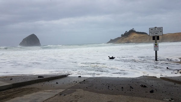
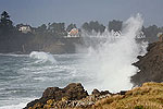
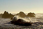
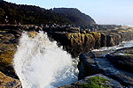
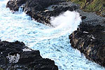
(Oregon Coast) – Lots of sun will be giving way to some more clouds this weekend on the Oregon coast, but some slightly dangerous conditions are coming with an increased chance of sneaker waves from the south coast up through the southern Washington coast.
The National Weather Service (NWS) offices in Portland and Medford are talking about extra rough seas offshore as storm fronts approach the continent, bringing increased west winds and swells ahead of them.
“Those planning on taking advantage of the mild Fall weather or the abundance of razor clams by recreating along the beaches this weekend, need to be extra careful along the water line,” the NWS office in Portland said Friday night. “The ocean conditions are favorable for sneaker waves this weekend, especially on Sunday.”
On the southern Oregon coast, the Medford office of the NWS offered a similar warning.
“At the coast, surf will increase as west swell builds, so use caution at the beaches. Never turn your back on the ocean.”
Offshore, the swells will be reaching 10 to 12 feet by Sunday morning, although the NWS did not say if there was a particularly long timing between swells. They could not be reached on Friday night, but this is often what dictates a threat of sneaker waves. If the period between swells is a long time, perhaps longer than 15 seconds, that means they can build up considerably as they head onto shore, erupting in larger waves or sneaker waves.
Much of the Oregon coast is under one kind of offshore seas warning or another, with the upper part of the south coast under a small craft advisory and the bottom section under a hazardous seas warning. The border between the two lies at Cape Blanco.
The NWS said seas will rise to around 10-foot swells on Saturday but then die down.
“This break will be short lived, as a northwesterly swell increases seas back to 10 to 12 feet by Sunday morning,” the NWS said. “Seas will then stay up around 10 feet through Monday afternoon. In addition, northerly winds could gust as high as 20-25 kt Sunday afternoon and evening as a weak cold front pushes inland.”
See Oregon Coast Weather - Washington Coast Weather
Plenty of winds will be hitting the regions off the Oregon coast, but the beach towns won't see heavy winds.
“The strongest winds and very steep seas are expected to be south of Bandon and will last into Saturday morning,” the NWS said.
In general, weather on the Oregon coast beaches will remain rather pleasant and mostly dry, even getting more so in the early week. However, a somewhat stormy period will return, especially offshore.
“A frontal system will then arrive Tuesday, producing gusty, south winds, elevated seas and periods of rain,” the NWS said.
Oregon Coast Hotels for this - South Coast Hotels - Where to eat - Maps - Virtual Tours
Cannon Beach Lodging
Nehalem Bay Lodgings
Manzanita Hotels, Lodging
Three Capes Lodging
Pacific City Hotels, Lodging
Lincoln City Lodging
Depoe Bay Lodging
Newport Lodging
Waldport Lodging
Yachats Lodging
Oregon Coast Vacation Rentals
Oregon Coast Lodging Specials
Photo courtesy Oregon Coast Parks

More About Oregon Coast hotels, lodging.....
More About Oregon Coast Restaurants, Dining.....
LATEST Related Oregon Coast Articles
The sixth in the NW in three weeks; early indications suggest it may have been undernourished. Marine sciences
Now Begins the 'Season of Satellites' Above Oregon, Washington: Summer's Surr...
Not even counting meteors, these satellite trains can create wild colors and streaks in the sky. Astronomy, weather. Brookings events, Gold Beach events, Port Orford events, Coos Bay events, Bandon events, Florence events, Yachats events, Newport events, Lincoln City events, Rockaway Beach events, Manzanita events, Cannon Beach events, Seaside events, Astoria events
7-Day Parking Meters Return to Central Oregon Coast Town, and Now to Nye Beac...
Newport?s Bayfront will charge all week, and the Nye Beach Turnaround will now do the same. Travel tips, traffic
87th Annual Azalea Fest Readies Its Return for Memorial Day Weekend on S. Ore...
Brookings brings back the long-running festival over Memorial Day weekend, May 22?25. Brookings events
Harrowing Accident Scene on S. Oregon Coast Turns Into Search for Driver and ...
Sheriffs found an empty vehicle and searched nearly 24 hours before locating the driver. Traffic
Another Dead Whale Stranding, This Time Near Yachats on Central Oregon Coast
Reports differ on whether it was alive at first; scientists are examining the carcass. Marine sciences
Washington Coast Cleanup Scours Inner and Outer Coast, April 25
Volunteers are needed along the outer coast and throughout the Salish Sea. Washington coast events
4th of July at N. Oregon Coast's Sand Lake Now Requires Pre-Sales for Camping...
Congestion and overcrowding in recent years at Sand Lake Recreation Area near Pacific City. Traffic, travel tips
Back to Oregon Coast
Contact Advertise on BeachConnection.net
All Content, unless otherwise attributed, copyright BeachConnection.net Unauthorized use or publication is not permitted


