Snow on Oregon Coast Range Likely, Some Chance for Portland - Other Alerts
Published 01/27/25 at 8:26 p.m.
By Oregon Coast Beach Connection Staff
(Portland, Oregon) – Heaps of interesting weather is about to descend on southern Washington and most of Oregon. There is a freeze warning in effect for part of Tuesday on the south coast (along with an air stagnation advisory), and the Portland area is currently under a cold weather advisory.
Includes exclusive listings; some specials in winter
In Cannon Beach:
Includes rentals not listed anywhere else
In Manzanita, Wheeler, Rockaway Beach:
Some specials for winter
In Pacific City, Oceanside:
Some specials for winter
In Lincoln City:
Some specials for winter
In Depoe Bay, Gleneden Beach:
Some specials for winter
In Newport:
Look for some specials
In Waldport
Some specials for winter
In Yachats, Florence
Some specials for winter
Southern Oregon Coast Hotels / Lodgings
Reedsport to Brookings, places to stay; winter deals
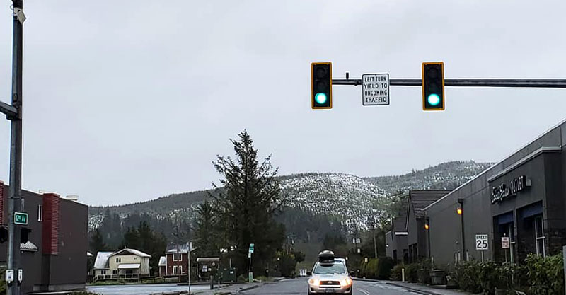
However, there is a possibility of snow along the I-5 Corridor from Vancouver, Washington, into Portland, Salem and Eugene early next week – and there is a likelihood the Oregon Coast Range will see some snow at the top elevations later.
The National Weather Service (NWS) issued the various weather alerts for the state. The south coast - including the towns Reedsport, Coquille, Coos Bay, Bandon, Myrtle Point, Powers, and North Bend – are under a freeze warning until 9 a.m. as well as an air stagnation advisory through noon on Thursday.
“A strong inversion and stagnant air conditions near the surface will trap pollutants possibly leading to poor air quality,” the NWS said.
The freeze warning ends at 9 a.m. Tuesday for those areas.
See Oregon Coast Weather (including tides) - Inland Oregon Weather
Portland and other metro areas nearby are under a cold weather advisory overnight, from Yacolt through Eugene, and including towns like Molalla, Hillsboro, Brownsville, Philomath, Silverton, Camas and Albany. Temperatures as low as 25 are expected.
“Hypothermia can occur with prolonged exposure to these temperatures,” the NWS said. “Easterly winds through the Columbia River Gorge with gusts to 25-30 mph in the far eastern Portland/Vancouver Metro area will lead to warmer temperatures, but the wind chill will be close to 25 degrees.”
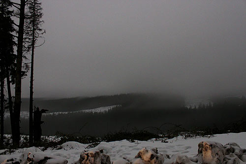
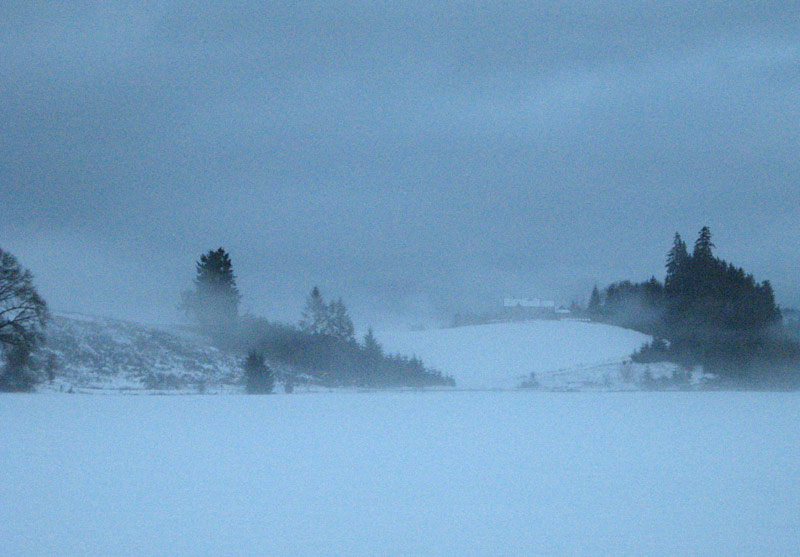
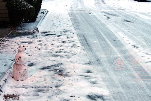
Then there's the possibilities of snow in those urban and rural areas – and a very good chance you'll encounter some snow in the Oregon Coast Range starting Thursday. Snow levels are expected to get down to 1,000 feet over the weekend or just before.
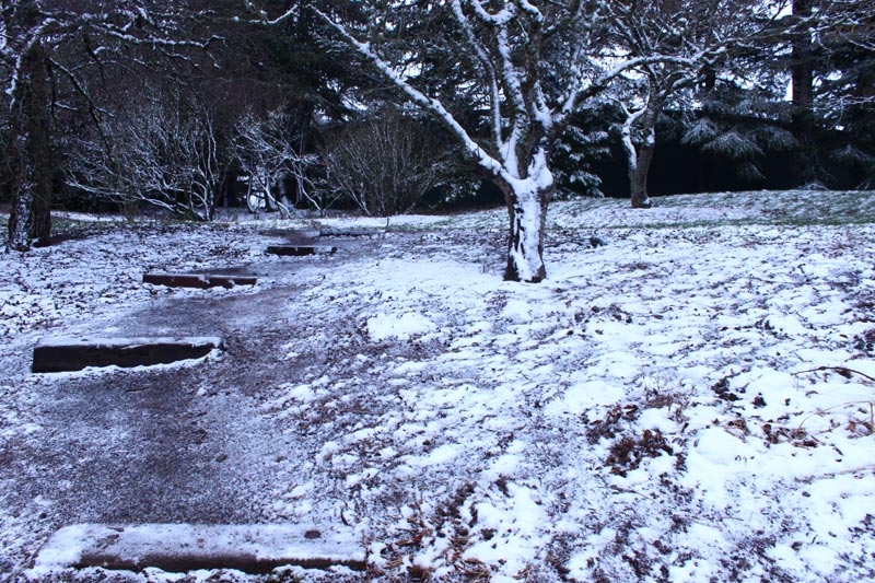
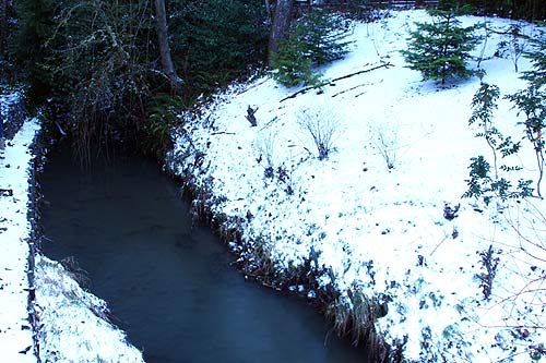
Snow outside of Seaside - photo Angi D Wildt Gallery
“For now, the current forecast depicts snow levels falling to 1000-2000 Saturday to Sunday, with a rain/snow mix possible for the Willamette Valley floor and southwest Washington lowlands Saturday night through Sunday night,” the NWS said. “Chances for accumulating snow at the valley floor during this time are around 15-25%, with accumulations favoring grassy spots and elevated surfaces.”
Beyond Sunday, the NWS right now thinks there's a 40 - 60% chance for temps below normal temperatures Feb 4 – 7, and an off chance for accumulating snow in the valley. However, they believe the forecasts will change. MORE SNOW PHOTOS BELOW
Oregon Coast Hotels for this event - South Coast Hotels - Oregon Coast Vacation Rentals - Where to eat - Maps - Virtual Tours


Oregon Coast Vacation Rentals
Oregon Coast Lodging Specials

More About Oregon Coast hotels, lodging.....
More About Oregon Coast Restaurants, Dining.....

 Andre' GW Hagestedt is editor, owner and primary photographer / videographer of Oregon Coast Beach Connection, an online publication that sees over 1 million pageviews per month. He is also author of several books about the coast.
LATEST Related Oregon Coast Articles
Two Paddle Boarders Rescued at S. Oregon Coast's Secret BeachOne had a broken arm and hypothermia. Near Brookings. Beach safety
Oregon's Tillamook Coast Hosts Rigorous Kayaking, Hiking Events in May
Netarts events May 17 and 31; Manzanita events May 14
Cannon Beach Sandcastle Contest 2025: N. Oregon Coast Tradition Happens June 21
Started in '64 after a tsunami hit town. Newport events Manzanita events, Cannon Beach events, Seaside events, Astoria events
Nehalem State Park Mostly Reopens, Other Oregon Coast Landmarks Follow Soon
Those at Bandon and near Depoe Bay are coming. Travel tips, hotels, camping
Sip and Stroll Yachats Returns, Filling Oregon Coast Town with Vino and Delights
Saturday, April 19, 2025 going from 12 to 5 p.m. Yachats events
Gnarly Lancetfish Found on N. Oregon Coast - and No, It's Not a Barracuda
Found in Seaside still intact, they were able to examine it. Marine sciences, Seaside Aquarium
Washington Coast Gets Another Green Light for Razor Clamming, April 26 - May 3
Long Beach, Copalis, Twin Harbors and Mocrocks. Washington events
A Less Expensive May in Newport: Handful of Oregon Coast Inns Still Offering ...
Inn at Nye Beach, Nye Beach Cottages, Ocean House BnB: Newport hotel specials. Newport hotel reviews
Back to Oregon Coast
Contact Advertise on Oregon Coast Beach Connection
All Content, unless otherwise attributed, copyright © Oregon Coast Beach Connection. Unauthorized use or publication is not permitted

Oregon
Coast Hotels
S. Coast Hotels
Astoria/Warrenton Hotels
Seaside Hotels
Cannon
Beach Hotels
Nehalem Bay Lodgings
Manzanita Hotels, Lodging
Rockaway Beach Hotels
Three Capes Lodging
Pacific City Hotels, Lodging
Lincoln
City Lodging
Depoe
Bay Hotels
Newport Hotels
Waldport Lodging
Yachats
Hotels
Florence Hotels
Reedsport Hotels
Coos Bay Hotels
Bandon Hotels
Port Orford Hotels
Gold Beach Hotels
Brookings Hotels
Oregon
Coast Vacation Rentals
Oregon
Coast Lodging Specials
South Coast Hotels
Dining
Guide
Seaside
Cannon
Beach Dining
Manzanita,
Rockaway, Wheeler Dining
Pacific
City, Oceanside, Netarts, Tierra Del Mar Restaurants
Tillamook
Bay Restaurants, Dining
Lincoln
City Dining, Restaurants
Depoe
Bay Restaurants, Dining
Newport Restaurants, Dining
Waldport,
Yachats Restaurants, Dining
Florence Restaurants, Dining
Restaurant
Reviews
Coast
Events Calendar
Astoria
Seaside,
Cannon Beach Calendar
Manzanita,
Rockaway Events
Tillamook,
Pacific City Calendar
Lincoln
City Events Calendar
Newport,
Depoe Bay Events Calendar
Yachats Events Calendar
Oregon Coast Complete Guides every beach access, attraction
Search for Oregon Coast Subjects, Articles
Explore Every Beach Spot


News Headlines from All Over Oregon Need to scan Oregon headlines? Constantly updated news from all over Oregon: a comprehensive, up-to-the-minute display of news headlines from a variety of media
Oregon Coast Oceanfront Lodging, Hotels, Rentals