Snow on Tuesday for Western Oregon, Washington, Coast Range: Portland to Seattle
Published 01/26/21 at 12:06 AM PDT
By Oregon Coast Beach Connection staff
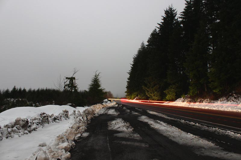
(Portland, Oregon) – Low level snow will make an appearance in parts of northwestern Oregon up through much of Washington Tuesday - including Seattle. The coast range of Oregon and the Willapa Hills of Washington are expected to get the heaviest amounts of snow, while higher elevations of Portland are expected to get a mix of rain and snow during the day and evening.
It’s not expected to be a large snow event for the Portland area and largely limited to the northern Willamette Valley, but towns close to the coast range will likely get a few inches.
Includes exclusive listings; some specials in winter
In Cannon Beach:
Includes rentals not listed anywhere else
In Manzanita, Wheeler, Rockaway Beach:
Some specials for winter
In Pacific City, Oceanside:
Some specials for winter
In Lincoln City:
Some specials for winter
In Depoe Bay, Gleneden Beach:
Some specials for winter
In Newport:
Look for some specials
In Waldport
Some specials for winter
In Yachats, Florence
Some specials for winter
Southern Oregon Coast Hotels / Lodgings
Reedsport to Brookings, places to stay; winter deals
The National Weather Service (NWS) issued a special weather statement Monday for all of northwest Oregon, ranging from the Cascade foothills of Lane County and Eugene, the Columbia Gorge and over to the central and northern coast range as well as southwest Washington.
“A weakening frontal system will move across western Oregon and southwest Washington Tuesday afternoon and evening,” the NWS said. “This front will spread a widespread area of precipitation across most of the area for a few hours beginning early afternoon Tuesday along the coast, and spreading to areas farther east into the Cascades by Tuesday evening.”
Snow levels could reach below 500 feet for Salem, Portland and Vancouver, starting mid afternoon on Tuesday. No snow is expected for the Oregon or Washington coastline.
“Confidence is moderate to high that areas in the Portland/Vancouver Metro will see a 1-3 hour period of light to perhaps moderate snow,” the NWS said. “However, confidence is lower in any appreciableaccumulation amounts across the northern Willamette Valley.”
The west hills of Portland and areas north and east of Vancouver are the most likely to see accumulation. The Seattle area is set to see a snow / rain mix through Wednesday.
See Oregon Coast Weather - Washington Coast Weather
Areas of 500 to 700 feet are looking at a greater chance of slushy accumulation.
“Locations in the Coast Range and Cascades Foothills above 500 feet could see 2 to 5 inches of accumulation,” the NWS said. “Higher elevations above 1200-1500 feet in the Coast Range and Cascades will likely see even higher snow accumulations from 5 to 8 inches.”
Up to four inches of snow are expected in the Columbia River Gorge.
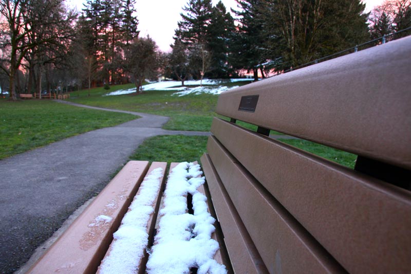
The NWS said most inland roadways will have minimal to no amount of accumulation, but higher spots like bridges could wind up with some and there may be slick spots around the valley. Any snow below 500 feet is expected to taper off in the evening and be replaced by rain.
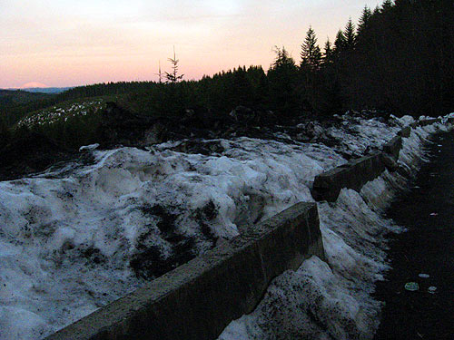
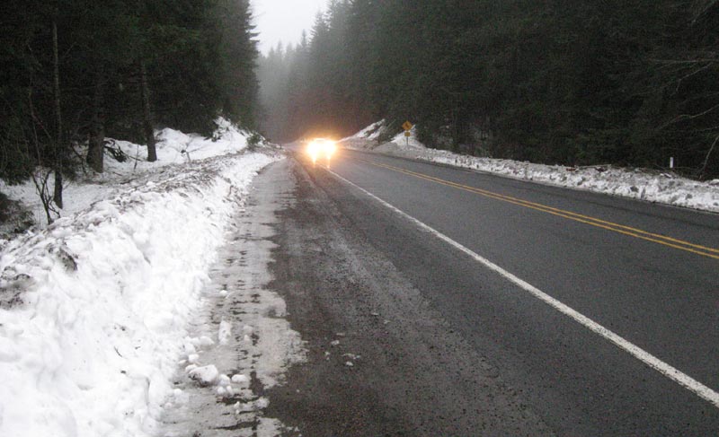
Oregon’s Coast Range was already hit with a few inches of snow in the upper elevations on Monday, making driving difficult in areas. Many coastal towns like Cannon Beach reported a “quiet day.”
The southern Oregon coast range has a snow level of 1600 feet, making for little to nothing on that route to the beach.
“Anyone with travel plans Tuesday afternoon and evening should be prepared for the possibility of winter driving conditions at low elevations, with winter driving conditions a virtual certainty in the mountains above 500 - 1000 feet elevation, and in the Columbia River Gorge,” the NWS said.
See Oregon Coast Road, Traffic Conditions, Updates
Oregon Coast Hotels in this area - Where to eat - Maps - Virtual Tours
Cannon Beach Lodging
Nehalem Bay Lodgings
Manzanita Hotels, Lodging
Three Capes Lodging
Pacific City Hotels, Lodging
Lincoln City Lodging
Depoe Bay Lodging
Newport Lodging
Waldport Lodging
Yachats Lodging
Oregon Coast Vacation Rentals
Oregon Coast Lodging Specials
More About Oregon Coast hotels, lodging.....
More About Oregon Coast Restaurants, Dining.....
LATEST Related Oregon Coast Articles
The sixth in the NW in three weeks; early indications suggest it may have been undernourished. Marine sciences
Now Begins the 'Season of Satellites' Above Oregon, Washington: Summer's Surr...
Not even counting meteors, these satellite trains can create wild colors and streaks in the sky. Astronomy, weather. Brookings events, Gold Beach events, Port Orford events, Coos Bay events, Bandon events, Florence events, Yachats events, Newport events, Lincoln City events, Rockaway Beach events, Manzanita events, Cannon Beach events, Seaside events, Astoria events
7-Day Parking Meters Return to Central Oregon Coast Town, and Now to Nye Beac...
Newport?s Bayfront will charge all week, and the Nye Beach Turnaround will now do the same. Travel tips, traffic
87th Annual Azalea Fest Readies Its Return for Memorial Day Weekend on S. Ore...
Brookings brings back the long-running festival over Memorial Day weekend, May 22?25. Brookings events
Harrowing Accident Scene on S. Oregon Coast Turns Into Search for Driver and ...
Sheriffs found an empty vehicle and searched nearly 24 hours before locating the driver. Traffic
Another Dead Whale Stranding, This Time Near Yachats on Central Oregon Coast
Reports differ on whether it was alive at first; scientists are examining the carcass. Marine sciences
Washington Coast Cleanup Scours Inner and Outer Coast, April 25
Volunteers are needed along the outer coast and throughout the Salish Sea. Washington coast events
4th of July at N. Oregon Coast's Sand Lake Now Requires Pre-Sales for Camping...
Congestion and overcrowding in recent years at Sand Lake Recreation Area near Pacific City. Traffic, travel tips
Back to Oregon Coast
Contact Advertise on BeachConnection.net
All Content, unless otherwise attributed, copyright BeachConnection.net Unauthorized use or publication is not permitted


