Snowy Hazards in Oregon Coast Range as Portland, Eugene, SW Washington Get Dusting
Published 01/31/25 at 4:56 a.m.
By Oregon Coast Beach Connection Staff
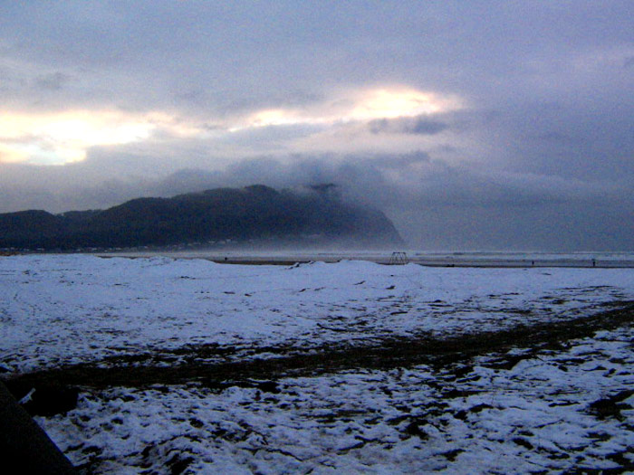
(Pacific City, Oregon) – Most parts of western Washington and Oregon are staring down the likelihood of some amounts of snow over the weekend and into the early week, with a good chance the lower and higher elevations of Vancouver, Portland and Eugene get a dusting. The Oregon Coast Range and Willapa Hills are definitely going to get hit by snow, and parts are under a winter weather storm warning.
Includes exclusive listings; some specials in winter
In Cannon Beach:
Includes rentals not listed anywhere else
In Manzanita, Wheeler, Rockaway Beach:
Some specials for winter
In Pacific City, Oceanside:
Some specials for winter
In Lincoln City:
Some specials for winter
In Depoe Bay, Gleneden Beach:
Some specials for winter
In Newport:
Look for some specials
In Waldport
Some specials for winter
In Yachats, Florence
Some specials for winter
Southern Oregon Coast Hotels / Lodgings
Reedsport to Brookings, places to stay; winter deals
Altogether, however, the National Weather Service (NWS) does not expect travel to be impacted along the I-5 Corridor or even the Coast Range. Mostly, it's going to be rain for valley towns and the Oregon / Washington coast, but some inland cities will see a harmless dusting – and usually overnight.
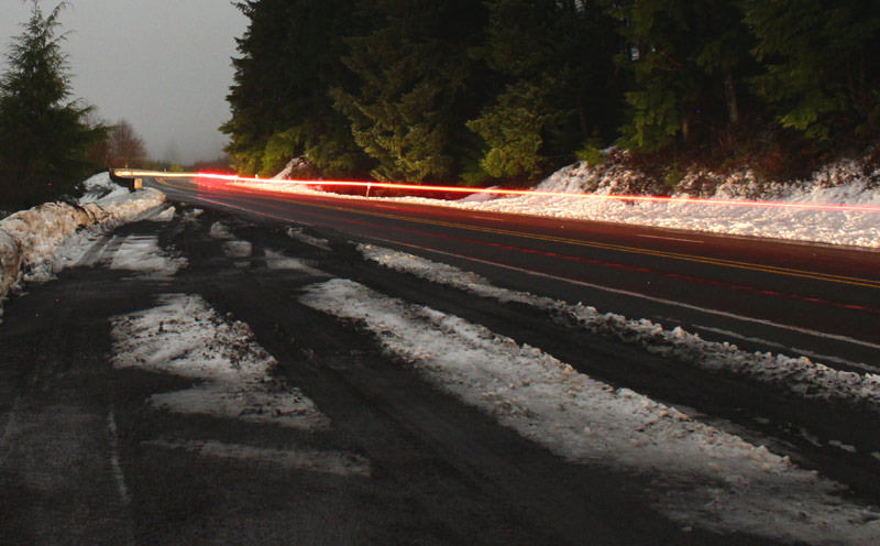
The timeline starts Friday, with a winter storm warning for the north Oregon Coast Range and Willapa Hills, in effect from late Friday through late Saturday. That includes Highway 26 and Highway 6, with total accumulation of four inches at the upper areas, and snow levels reaching down as low as 500 feet on Saturday.
See Oregon Coast Weather (including tides) - Inland Oregon Weather
Roads may get icy and hazardous then, the NWS said.
Snow starts in earnest inland about Saturday night and goes through Monday and Tuesday.
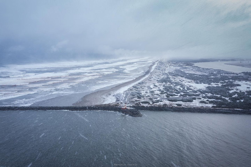
Bandon in the snow, courtesy Manuela Durson - see Manuela Durson Fine Arts for more
For Washington's central coast and Lower Chehalis Valley Area, the winter storm watch is in effect from Saturday through Monday morning, bringing 2 to 9 inches of snow at times.
On the southern Oregon coast and Coast Range, the forecast is similar, with snow levels dropping down to 1100 feet on Monday but then down to 900 feet Tuesday. Areas like Bandon, Gold Beach and Brookings will get some rather strong winds over the weekend, with gusts as high as 45 mph.
“Currently there are no signs of a high impact snowstorm for the Cascades or Coast Range,” the NWS said. “While the Cascades and Coast Range will see snow, the lowland will deal with persistent rain. Storm total precipitation for the Willamette Valley look to range from 0.75 to 1.50 inches with 1.30 to 2.25 inches along the coast.”
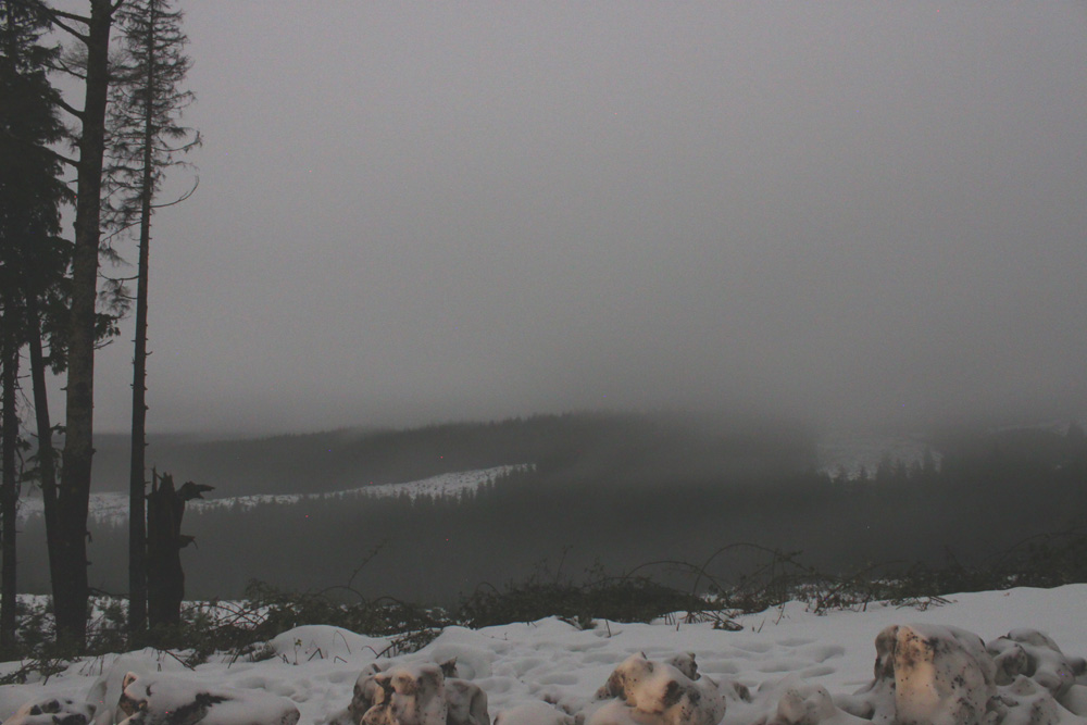
Highway 26, Oregon Coast Beach Connection
The NWS said the majority of snowfall in the valley will be overnight and generally sticking only to grassy areas. It will melt after sunrise.
“The West Hills in Portland are more likely to see 1-2 inches of snow (worst case scenario would be 3-4 inches; however the chance of this occurring is only at 10%),” the NWS said.
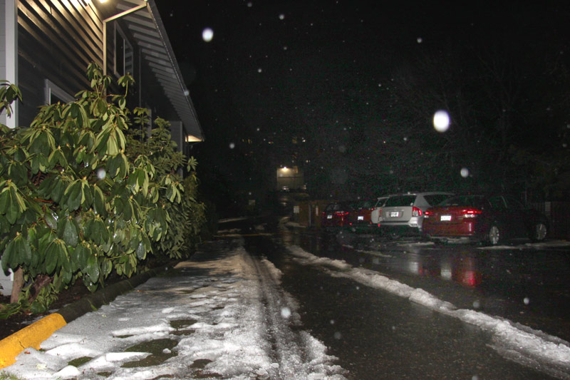
Portland
There are greater chances for snow farther south along the I-5 corridor in the early week.
“The long term forecast is highlighted by a cool and showery weather pattern with low snow levels, likely down to the valley floor or very near the valley floor at times (500 ft or less, except 500-1000 ft in the southern Willamette Valley and for the central Oregon coast),” the NWS said.
Areas above 1000 feet will see more snow that sticks.
Overall, travel shouldn't be affected in urban areas, although there is a slim chance some spots could see the moisture on the street freeze early in the day and become ice.
Oregon Coast Hotels in this area - South Coast Hotels - Oregon Coast Vacation Rentals - Where to eat - Maps - Virtual Tours


Oregon Coast Vacation Rentals
Oregon Coast Lodging Specials

More About Oregon Coast hotels, lodging.....
More About Oregon Coast Restaurants, Dining.....


 Andre' GW Hagestedt is editor, owner and primary photographer / videographer of Oregon Coast Beach Connection, an online publication that sees over 1 million pageviews per month. He is also author of several books about the coast.
LATEST Related Oregon Coast Articles
Lincoln City Fall Kite Festival Returns with Night Flights Over Central Orego...Sept 19 - 21 there's a new addition and some extra glass floats. Lincoln City events
Early September and Oregon Coast's Second Summer: Rentals That Are Still Open...
Still a couple vacation rentals with availability but getting thin. Cannon Beach hotel reviews, hotel availability
Central Oregon Coast's Alsea Bay Under Clam Advisory Due to Saxitoxin
Not the typical paralytic shellfish poisoning. Sciences
Brewing Issue with Salmonberry Trail May Close Part of Oregon Coast Scenic Ra...
Construction of the trail could mean removing half the run. Garibaldi, Rockaway Beach, Wheeler, Tillamook, history
High Threat of Sneaker Waves This Weekend on N. Oregon / S. Washington Coast
Fri - Sun, dangers possible Florence through Westport. Weather
NASA Announces First Evidence of Life on Mars in Possible Biosignature
In a former riverbed billions of years old, they found spots with interesting compounds. Astronomy
Washington Coast's Cape Disappointment Will Close Parts of Operation Until Sp...
Will undergo significant infrastructure upgrades starting September 16
Latest on Shellfish Fun Along Oregon Coast - Pacific Halibut Angling
Crabbing, mussels, razor clams and ocean fishing. Marine sciences
Back to Oregon Coast
Contact Advertise on Oregon Coast Beach Connection
All Content, unless otherwise attributed, copyright © Oregon Coast Beach Connection. Unauthorized use or publication is not permitted

Oregon
Coast Hotels
S. Coast Hotels
Astoria/Warrenton Hotels
Seaside Hotels
Cannon
Beach Hotels
Nehalem Bay Lodgings
Manzanita Hotels, Lodging
Rockaway Beach Hotels
Three Capes Lodging
Pacific City Hotels, Lodging
Lincoln
City Lodging
Depoe
Bay Hotels
Newport Hotels
Waldport Lodging
Yachats
Hotels
Florence Hotels
Reedsport Hotels
Coos Bay Hotels
Bandon Hotels
Port Orford Hotels
Gold Beach Hotels
Brookings Hotels
Oregon
Coast Vacation Rentals
Oregon
Coast Lodging Specials
South Coast Hotels
Dining
Guide
Seaside
Cannon
Beach Dining
Manzanita,
Rockaway, Wheeler Dining
Pacific
City, Oceanside, Netarts, Tierra Del Mar Restaurants
Tillamook
Bay Restaurants, Dining
Lincoln
City Dining, Restaurants
Depoe
Bay Restaurants, Dining
Newport Restaurants, Dining
Waldport,
Yachats Restaurants, Dining
Florence Restaurants, Dining
Restaurant
Reviews
Coast
Events Calendar
Astoria
Seaside,
Cannon Beach Calendar
Manzanita,
Rockaway Events
Tillamook,
Pacific City Calendar
Lincoln
City Events Calendar
Newport,
Depoe Bay Events Calendar
Yachats Events Calendar
Oregon Coast Complete Guides every beach access, attraction
Search for Oregon Coast Subjects, Articles
Explore Every Beach Spot


News Headlines from All Over Oregon Need to scan Oregon headlines? Constantly updated news from all over Oregon: a comprehensive, up-to-the-minute display of news headlines from a variety of media
Oregon Coast Oceanfront Lodging, Hotels, Rentals