 |
Views of Central Oregon Coast from International Space Station
Published 05/13/2011
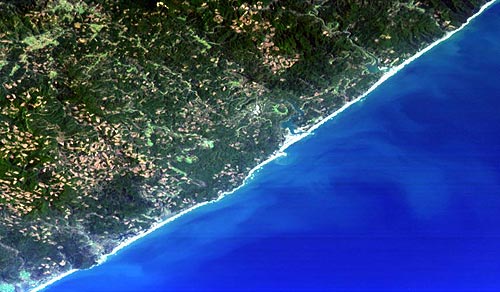
Newport from space, courtesy OSU and HICO
(Newport, Oregon) – If you've ever wondered what parts of the Oregon coast looked like from space, a new imaging system called HICO – for Hyperspectral Imager for the Coastal Ocean – is giving us awesome glimpses.
The imaging system was put aboard the International Space Station in 2009, and it’s the first one sensor in space made specifically for looking at the coastal areas of the planet. While not used for the Oregon coast alone, some of the scientists utilizing it are located at Oregon State University in Corvallis, such as Curtiss O. Davis, an OSU oceanographer and the project scientist.
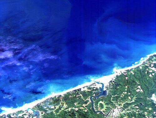
Newport from space, courtesy OSU and HICO
Davis said the system allows scientists to better analyze human impacts and climate change effects on the world’s coastal regions.
“What HICO does that other ocean imaging systems like NASA’s MODIS cannot is provide color sensor data down to the human scale,” Davis said. “Whereas the normal resolution for an ocean imager is about one kilometer, HICO provides resolution down to 90 meters. And instead of having just nine channels like MODIS, it has 90 channels.”
It's also been used over the Astoria area, specifically to gather information about tides and currents in the lower Columbia River. Jasmine Nahorniak, with OSU’s College of Oceanic and Atmospheric Sciences, said they have a list of about 500 targets from around the world that are being studied.
“However, only one scene (image) can be collected per orbit because of downlink limitations, and there are only 16 orbits per day,” Nahorniak said. “So each week, only a subset is chosen for collection.”
Studies of the Oregon coast weren’t done for any particular event or occasion – simply a general study.
“There are two locations currently on the HICO target list from Oregon: Newport and the Columbia River mouth,” Nahorniak said. “The waters in both of these regions are studied routinely by researchers from Oregon State University and Hatfield Marine Science Center, among others. Satellite images help researchers better understand the dynamics of the region. HICO provides much higher spectral and spatial resolution than other ocean satellite sensors, providing invaluable information about these coastal regions.”
In any case, the images are a whole new take on the idea of a scenic photograph of the coast.
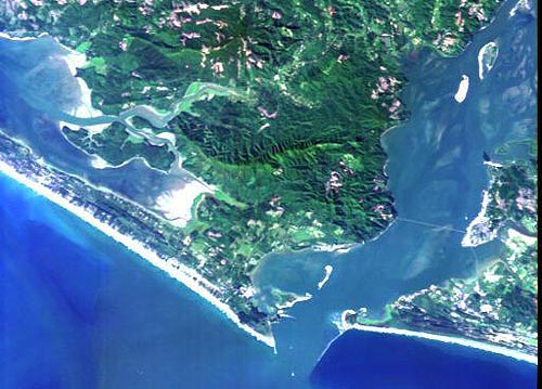
Astoria and its bay from space, courtesy OSU and HICO
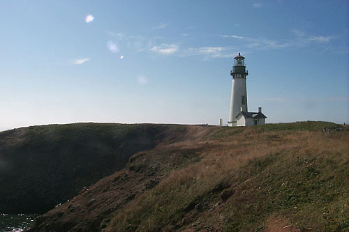
Newport seen from the usual vantage point
More About Oregon Coast hotels, lodging.....
More About Oregon Coast Restaurants, Dining.....
 |
 |
 |
LATEST OREGON COAST NEWS STORIES
Whale Body Parts Found on Oregon Coast - Two Whales Strand on Washington Coast |
Secrets of the Season |
Unusual Travel Articles TravelParanormal.com allows you to submit your own creepy tale or debunk one - or see up-to-the-minute news headlines about travel and the paranormal. News Headlines from All Over Oregon Need to scan Oregon headlines? Constantly updated news from all over Oregon: a comprehensive, up-to-the-minute display of news headlines from a variety of media |
Back to Oregon Coast


