 |
New Way of Counting Whales from Space May Help Oregon Coast Scientists
Published 02/13/2014
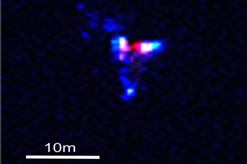
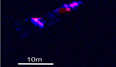
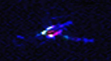
(Cambridge, England) - The photographs are surreal, beautiful and engaging, and they look like something taken way out in the galaxy. But they are, in fact, of the very Earthbound whale – although they were taken from space. (Above: satellite image of a whale using blue spectrum light. Photos courtesy BAS).
Scientists working out of England and Antarctica have discovered a method of accurately counting whales from space, and whale researchers on the Oregon coast could wind up benefiting in some surprising ways.
The British Antarctic Survey (BAS) just released their findings. The group works out of Cambridge, England and Antarctica, using a method that involved various aspects of satellites orbiting the Earth. Very High Resolution (VHR) images from satellites were used alongside image processing software to quickly identify whales and differentiate them from other objects at sea.
The satellite WorldView-2, launched October 2009, was used for this project.
Several automated methods were used to test accuracy in counting whales, but the winner was a “thresholding” of the Coastal Band of the WorldView2. This part of the process uses light from the far blue end of the spectrum which penetrates the water column deeper and allows us to see more whales. This technique found 89% of probable whales identified in the manual count. This is a semi automated technique that needs some user input to identify the best threshold.
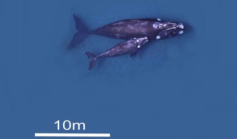
This new method gave BAS scientists a good look at breeding behaviors of whales off the Argentine coast.
Peter Fretwell from BAS is the lead author of the paper that was published this week in the journal PLoS ONE. He said marine mammals are extremely difficult to count on a large scale. Traditional methods, such as counting them from platforms or by land, can be costly and inefficient.
“This is a proof of concept study that proves whales can be identified and counted by satellite,” Fretwell said. “Whale populations have always been difficult to assess; traditional means of counting them are localized, expensive and lack accuracy. The ability to count whales automatically, over large areas in a cost effective way will be of great benefit to conservation efforts for this and potentially other whale species.”
Even here on the Oregon coast, in spite of all the electronic tagging done by the Hatfield Marine Science Center in Newport or the multitude of eyes pointed at sea by other volunteer groups, this new method would be helpful.
Charlie Plybon, head of the Surfrider Foundation in Oregon, sees a lot of possible ways this kind of technology could assist researchers along the Oregon coast. Not just in counting the number of whales but knowing more about whale behaviors in this area under varied circumstances could prove vital.
“Where they were moving, where they were spending time feeding,” Plybon said. “But I think especially with respect to some technologies, as in how whales behave around wave energy sites. There's already a lot of research going on about EMF or hydrophones, how what's emitted from them affects the whales.”
Plybon added some areas around the Oregon coast are too remote to see whales very clearly or accurately from shore as well.
Future satellite platforms will provide even high quality imagery and Worldview3 is planned to be launched this year. This will allow for greater confidence in identifying whales and differentiating mother and calf pairs. Such technological advancements may also allow scientists to apply this method to other whale species.
More about Oregon coast science, and more about Oregon coast whales.
More About Oregon Coast hotels, lodging.....
More About Oregon Coast Restaurants, Dining.....
LATEST Related Oregon Coast Articles
Oregon Coast, Valley and Likely Washington Coast to Get Some Aurora Borealis ... |
Back to Oregon Coast
Contact Advertise on BeachConnection.net
All Content, unless otherwise attributed, copyright BeachConnection.net Unauthorized use or publication is not permitted
Secrets of the Season |
Unusual Travel Articles TravelParanormal.com allows you to submit your own creepy tale or debunk one - or see up-to-the-minute news headlines about travel and the paranormal. News Headlines from All Over Oregon Need to scan Oregon headlines? Constantly updated news from all over Oregon: a comprehensive, up-to-the-minute display of news headlines from a variety of media Oregon Coast Oceanfront Lodging, Hotels, Rentals |


