Oregon Coast Safety: Helpful Tricks to Spotting Sneaker Waves
Published 04/19/2018 at 6:46 PM PDT - Updated 04/19/2018 at 7:06 PM PDT
By Oregon Coast Beach Connection Staff
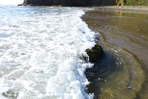
(Oregon Coast) – It doesn’t take winter storms to get in trouble with sneaker waves on the Oregon coast. They can happen even in what seems like fairly calm conditions. To the more trained eye it’s often obvious when conditions are ripe for this, but not always.
That’s why they’re called “sneaker waves,” after all.
Sneaker waves can be deadly. When they strike, not only can they knock you down and suck you out to sea, but they can lob large objects at you. Logs are another hazard these can bring, and sometimes unseen.
The spring months of April and May can pose such dangers as well. Wave height can be a bit bonkers, while it may seem otherwise calm.
Strangely, there is a little trick to spotting them, especially handy in the months when it’s sometimes hard to tell if the ocean is unruly or not.
Tom Horning, a geologist from the north Oregon coast, looks at waves carefully as well. He said there are sometimes signs one of these unpleasant surges is coming – but it’s only a partial guideline and not a guarantee. Never turn your back on the ocean - nothing is substitute for that.
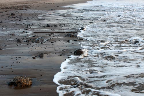
A big clue, Horning said, is that the ocean may suddenly retreat. Usually, the tide line is fairly consistent within a range of 30 feet or so. But if you see it abruptly back off farther than usual, that’s a sign a sneaker wave may be coming.
“The clue that a sneaker wave is coming is a large withdrawal of the ocean after a period of smaller waves,” Horning said. “The withdrawal represents a magnified trough preceding a magnified peak - a big wave - that is following. If the ocean pulls out an abnormal distance, keep an eye on it and plan your escape route if you are in an area that can be flooded by the coming big surge.”
A good rule of thumb is to simply watch the ocean for awhile before stepping onto a beach, certainly if it’s even slightly stormy conditions. If it’s an actual winter storm, definitely watch for as much as ten minutes before venturing onto the sands.
Horning said another trick here is sticking to dry ground, as that area probably isn’t getting swamped by waves. However, if it’s been raining, that’s hard to discern. So again, you need to look first at what the waves are doing. By watching for at least a few minutes, you can see how far the farthest waves are traveling up the beach.
Includes exclusive listings; some specials in winter
In Cannon Beach:
Includes rentals not listed anywhere else
In Manzanita, Wheeler, Rockaway Beach:
Some specials for winter
In Pacific City, Oceanside:
Some specials for winter
In Lincoln City:
Some specials for winter
In Depoe Bay, Gleneden Beach:
Some specials for winter
In Newport:
Look for some specials
In Waldport
Some specials for winter
In Yachats, Florence
Some specials for winter
“If it has been raining, you have to study the site to see if it has foam or bits of debris from waves,” Horning said. “You should also keep in mind when the tide will peak. A site can be dry early in the tidal cycle, but can be hit by waves as the tide rises. Caution and a close eye on the ocean is needed.”
Horning said sneaker waves are more likely on low-lying beaches or rocky ledges during much of the winter. So it’s best to stay clear of these kinds of beaches during these conditions – it's that simple.
“Sneaker waves sneak up on you and can carry away the unprepared,” Horning said. “Sneaker waves are formed by at least two wave trains that are moving at slightly different speeds and that are out of phase. As a result, they produce a complex wave train that can double the heights of the waves every few minutes, with smaller waves happening in between.”
Always stay off jetties in any weather. See more Oregon coast beach safety tips here. Oregon Coast Lodgings for this - Where to eat - Maps - Virtual Tours
Cannon Beach Lodging
Nehalem Bay Lodgings
Manzanita Hotels, Lodging
Three Capes Lodging
Pacific City Hotels, Lodging
Lincoln City Lodging
Depoe Bay Lodging
Newport Lodging
Waldport Lodging
Yachats Lodging
Oregon Coast Vacation Rentals
Oregon Coast Lodging Specials
More About Oregon Coast hotels, lodging.....
More About Oregon Coast Restaurants, Dining.....
LATEST Related Oregon Coast Articles
Likely just before dawn best hour but peak happens during daylight. Weather
Dark Sky Week is Prime Along Oregon Coast: Where and Where Not to Go
General guide to dark sky viewing from south to north coast. Astronomy
Sizable Price Drop, Deals in Lincoln City During Quiet of April on Central Or...
20 perc off at A1 Vacation Rentals across its roster, including Gleneden Beach. Lincoln City specials
Upcoming S. Oregon Coast Events Include Gem Show, History: Coos Bay, Bandon
May 6 talk at Coos History Museum, Mayfly Fest May 17, Bandon Rock / Gem Show June 7,8
Washington Coast Cleanup on April 19 - Coinciding with Oregon Coast's SOLVE E...
From the Puget Sound to Long Beach, alongside Oregon's cleanup. Washington coast events, Seaside events
Astoria's Riverwalk Gets New Lighting, More N. Oregon Coast Roadwork
Delays coming this summer, but the riverwalk has a new look. Seaside, Cannn Beach
April Gets Even Cheaper Midweek at Depoe Bay, Lincoln City: Oregon Coast Deals
Off-season rates plus more at Keystone Vacation Rentals. Depoe Bay lodging specials, Lincoln City hotel reviews, Newport hotel reviews
Washington Coast Begins Week of Clam Digs, April 12 Through 18
Long Beach, Twin Harbors, Mocrocks and Copalis at different times. Washington coast events
Back to Oregon Coast
Contact Advertise on BeachConnection.net
All Content, unless otherwise attributed, copyright BeachConnection.net Unauthorized use or publication is not permitted


