Warm, Sunny Portland and Oregon Coast This Week; Spring Break Starts Wet, Large Waves
Published 03/18/2019 at 5:53 AM PDT
By Oregon Coast Beach Connection staff
Includes exclusive listings; some specials in winter
In Cannon Beach:
Includes rentals not listed anywhere else
In Manzanita, Wheeler, Rockaway Beach:
Some specials for winter
In Pacific City, Oceanside:
Some specials for winter
In Lincoln City:
Some specials for winter
In Depoe Bay, Gleneden Beach:
Some specials for winter
In Newport:
Look for some specials
In Waldport
Some specials for winter
In Yachats, Florence
Some specials for winter
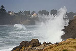
(Portland, Oregon) – UPDATES: REVISED WAVE HEIGHTS - Unusually warm temperatures for the inland portions of the state are happening this week, and the Oregon coast also gets unseasonably warm. While large waves have made a spectacle this week, these calm down but return again over the weekend.
This is where the bad news begins for the valley and the Oregon coast: spring break will start off wet and windy. The large wave action won’t bode well for spotting whales, and the National Weather Service (NWS) is looking at somewhat rainy conditions on Saturday, the day of the SOLVE Spring Beach Cleanup.
For the coastline, today and Tuesday will be magnificently sunny and warm and in the low 70s. Farther north, around Cannon Beach, 73 may well be the daytime highs. Part of this is due to a large dose of east winds, which which will be heavy at a steady 20 mph and with gusts around 30 mph. This could cool things off in spite of the spring-like conditions.
On Wednesday, the coast gets mostly cloudy and dives down towards 60 degrees, but winds become very light. Thursday also looks at mostly cloudy conditions and temps down to around 55.
“High pressure and offshore flow will persist across the forecast area through Tuesday, along with unseasonably warm temperatures,” the NWS said. “Several valley locations climbed into the lower 70s already Sunday; more should do so today as offshore flow increases and the air mass remains warm. Most areas will start off the day a few degrees warmer than Sunday morning, providing a higher floor for temperatures to warm from. This should allow lower 70s to be a bit more widespread this afternoon, and some locations may even push into the mid 70s.”
Similar temperatures are expected Tuesday in the inland valley, but temps will remain above 60 the rest of the week. Just as spring break begins, things get a little wet for both areas. Saturday gets rainy, but Sunday opens the skies to slightly sunnier conditions.
“The next and better chance for rain comes with the next shortwave ejecting out of the northeast Pacific low Friday and Friday night,” the NWS said. “Without a ridge preceding it, this system appears more likely to retain its strength, pushing a cold front inland Friday and Friday night. Chances for precipitation then diminish Saturday into Sunday as the wave slowly moves northeast.”
Waves have been quite large along the Oregon coast in recent days but they are subsiding. However, sizable east winds are still expected to develop, which is causing the NWS to issue a small craft advisory for everything north of Lincoln City.
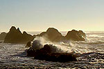
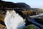
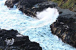
Combined seas are still at a respectable 10 feet over the next two days, lowering to just below ten feet for a little while, but then possibly rising to as much as 18 feet on Friday and 17 feet on Saturday. Those heavy waves will make for some impressive storm watching along the rocky ledges.
How long those large waves last is not clear yet, but such conditions hide whales from view. Saturday is the beginning of Whale Watch Week. Those combined high seas of 17 feet seem as if they could jeopardize the SOLVE Spring Beach Cleanup as well, but SOLVE told Oregon Coast Beach Connection this does not alter the event at all.
Oregon Coast Beach Connection will provide spring break weather updates early in the week. See Oregon Coast Weather.
Oregon Coast Lodgings for this event - Where to eat - Maps - Virtual Tours
Cannon Beach Lodging
Nehalem Bay Lodgings
Manzanita Hotels, Lodging
Three Capes Lodging
Pacific City Hotels, Lodging
Lincoln City Lodging
Depoe Bay Lodging
Newport Lodging
Waldport Lodging
Yachats Lodging
Oregon Coast Vacation Rentals
Oregon Coast Lodging Specials
More About Oregon Coast hotels, lodging.....
More About Oregon Coast Restaurants, Dining.....
LATEST Related Oregon Coast Articles
The sixth in the NW in three weeks; early indications suggest it may have been undernourished. Marine sciences
Now Begins the 'Season of Satellites' Above Oregon, Washington: Summer's Surr...
Not even counting meteors, these satellite trains can create wild colors and streaks in the sky. Astronomy, weather. Brookings events, Gold Beach events, Port Orford events, Coos Bay events, Bandon events, Florence events, Yachats events, Newport events, Lincoln City events, Rockaway Beach events, Manzanita events, Cannon Beach events, Seaside events, Astoria events
7-Day Parking Meters Return to Central Oregon Coast Town, and Now to Nye Beac...
Newport?s Bayfront will charge all week, and the Nye Beach Turnaround will now do the same. Travel tips, traffic
87th Annual Azalea Fest Readies Its Return for Memorial Day Weekend on S. Ore...
Brookings brings back the long-running festival over Memorial Day weekend, May 22?25. Brookings events
Harrowing Accident Scene on S. Oregon Coast Turns Into Search for Driver and ...
Sheriffs found an empty vehicle and searched nearly 24 hours before locating the driver. Traffic
Another Dead Whale Stranding, This Time Near Yachats on Central Oregon Coast
Reports differ on whether it was alive at first; scientists are examining the carcass. Marine sciences
Washington Coast Cleanup Scours Inner and Outer Coast, April 25
Volunteers are needed along the outer coast and throughout the Salish Sea. Washington coast events
4th of July at N. Oregon Coast's Sand Lake Now Requires Pre-Sales for Camping...
Congestion and overcrowding in recent years at Sand Lake Recreation Area near Pacific City. Traffic, travel tips
Back to Oregon Coast
Contact Advertise on BeachConnection.net
All Content, unless otherwise attributed, copyright BeachConnection.net Unauthorized use or publication is not permitted


