 |
Oregon Coast Ends Year with Powerful Waves and Wind
Published 12/31/2009
 |
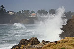
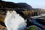
| Wave sights like this will be common place over the weekend (pictured: Devil's Punchbowl) |
(Oregon Coast) – High tides, monster swells, and sizable gusts are all in store for the Oregon coast on New Year's Eve through much of the weekend, making for some unforgettable stormwatching possibilities as the old year gives way to the new.
Those heading out to the beaches – especially on the north coast – should get to witness some of the biggest ocean swells in a while on Thursday and Friday. The only hitch is you’ll have to brave the winds at times.
A high wind warning was issued by the National Weather Service (NWS) for the Oregon coast, in effect through early evening on Thursday. There is also a special weather statement from the NWS regarding possible flooding on the coast on Friday, as high winds, big tides and heavy rains combine to make for some wild conditions to end the year with. More Oregon Coast weather here.
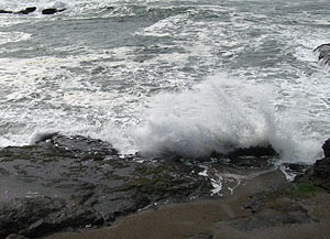 |
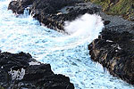
| Fun with wild waves in Yachats |
On top of it all, it’s also a “blue moon” – meaning the second full moon within the month. It’s unlikely coastal revelers will be able to see that with what will probably be heavy cloud cover.
Sustained south winds of 35 to 45 mph with gusts of 55 to 65 mph are expected.
“A strong warm front will lift north across the region on Thursday,” the NWS said. “Once this front moves north...strong southerly winds will develop. South winds will increase rapidly between 7 a.m. and 9 a.m. Thursday morning, with the strongest winds expected between 10 a.m. and 3 p.m.
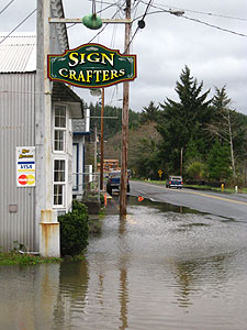 |
| Flooding sights like this in Nehalem may be in abundance. |
High surf conditions are happening Friday, helping to create a threat of flooding along the coast from Thursday through Saturday, the NWS said. What they called “increasingly high astronomical tides” will combine with the heavy winds. It is in fact the highest tides of the year on Thursday.
“A second episode will develop around midday Friday and continue through Saturday morning,” the NWS said. “Large westerly swells will arrive along the coast on Friday, possibly generating hazardous surf conditions as well as adding to the coastal flooding potential.”
Swells may hit 20 to 25 feet on New Year’s Day, making for a wild show. These could continue through Friday night, with sizable high tide swells happening Saturday as well.
All this means it’ll be perfect stormwatching conditions from your car or from oceanfront lodgings (a list of weekend openings is here).
 |
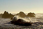
| Seal Rock |
This is not a time to actually go on the beach, as such large swells will have your name written on them.
A list of perfect stormwatching spots from your car include:
Nye Beach, in Newport, where the turnaround allows you a good vantage point, although it’s mostly a flat beach.
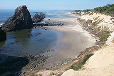
Parking lots above Seal Rock, just south of Newport, let you look down with safety on the rocky structures getting slammed.
Most of the road behind Yachats yields views of rocky beaches that are pretty spectacular year-round, but at this time you’ll see some unbelievably wild oceanic fireworks.
 |
| Storm waves reach the Seaside Turnaround (photo Seaside Aquarium) |
The Devil's Punchbowl between Depoe Bay and Newport will be in rare demonic form. Much of Depoe Bay is a front row seat to such wave action in the first place, and the town’s spouting horn should be in full gear, shooting up dozens of feet into the air.
The D River access in Lincoln City is like a great big parking lot for a drive-in theater with its expansive views of the surf.
Cape Lookout State Park will have exceptionally large wave action to ogle.
The main access at Rockaway Beach – with the caboose – will also provide safe viewing of massive waves.
The road alongside Manzanita’s beach will be always spectacular, and about ten miles up the road, Arch Cape has some nice vantage points as well.
 |
 |
 |
RELATED STORIES
Unusual Travel Articles TravelParanormal.com allows you to submit your own creepy tale or debunk one - or see up-to-the-minute news headlines about travel and the paranormal.
Watching Transformations of Oregon Coast Beaches Seasons change and so do beaches, revealing different sides and a variety of eye-popping sights
Staggeringly Cool Ideas for Oregon Coast Romance Be it the season of Valentine's or be it any time of the year, Oregon's coastline has essentially cornered the market for cuddle-inducing possibilities and gushy activities for the hand-holding set
Day or Night Mysteries and Merriment on Oregon Coast It's more than just nightlife that comes to life, but the beaches offer major opportunities
News Headlines from All Over Oregon Need to scan Oregon headlines? Constantly updated news from all over Oregon: a comprehensive, up-to-the-minute display of news headlines from a variety of media.
Secrets of the Season |


