Surf Warnings, High Wind Warnings, Flooding for Oregon / Washington Coast: UPDATES
Updated 10/23/21 at 4:56 PM PDT
By Oregon Coast Beach Connection staff
Includes exclusive listings; some specials in winter
In Cannon Beach:
Includes rentals not listed anywhere else
In Manzanita, Wheeler, Rockaway Beach:
Some specials for winter
In Pacific City, Oceanside:
Some specials for winter
In Lincoln City:
Some specials for winter
In Depoe Bay, Gleneden Beach:
Some specials for winter
In Newport:
Look for some specials
In Waldport
Some specials for winter
In Yachats, Florence
Some specials for winter
Southern Oregon Coast Hotels / Lodgings
Reedsport to Brookings, places to stay; winter deals
(Portland, Oregon) – [UPDATE: POSSIBILTIES OF WATERSPOUTS / TORNADOES ON SUNDAY] ---- A wide array of storm warnings and watches have been issued for both the Oregon and the Washington coast, as another weather system is set to kick in and bring flooding, dangerous surf, and high winds to the beach towns of almost the entire Pacific Northwest.
The National Weather Service (NWS) offices in Seattle, Medford and Portland have issued these, including a high wind watch for the Washington coast and upper half of Oregon’s coast, a high wind warning for the south Oregon coast, and coastal flooding and high surf warnings for the entire Oregon coast and southern Washington coast. These are largely for Sunday through Tuesday. This now includes the possibility of waterspouts or tornadoes forming in the region, although the NWS said it is not a high likelihood.
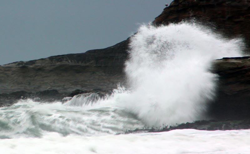
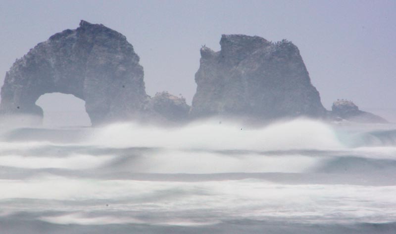
It will be extremely dangerous on beaches, with more than 30-foot waves expected onshore in many areas.
High Wind Warnings Oregon / Washington Coast. From the tip of Washington’s Olympic Peninsula down through Brookings, the NWS offices in both states have issued high wind warning in effect for Sunday and Monday.
Southeast winds of 40 mph with gusts to 60 mph are possible along the upper Washington coast. From Ocean Park down through the central Oregon coast, south winds 25 to 35 mph with gusts up to 65 mph are possible near beaches and headlands. A high wind warning is effect for the southern Oregon coast on Sunday, with gusts up to 70 mph.
High Surf Warnings Oregon Coast Through South Washington Coast. The NWS has issued a more direct high surf warning for the southern Oregon coast, in effect from 7 p.m. Sunday through 5 a.m. on Tuesday. That covers Brookings through roughly Reedsport.
However, the NWS has taken the unusual step of issuing a surf warning for the south Washington coast and northern half of Oregon’s coast by embedding it in the coastal flood warning for that area, making it not quite as clear. Conditions will be more severe up north, with the NWS saying 30 to 35-foot swells will be hitting the area from about Florence up through at least Wesport.
“Very hazardous sea conditions will exist on Sunday and Monday," the NWS said. “A large westerly swell will produce hazardous beach conditions with waves crashing over jetties, water moving logs on beaches & sneaker waves running much higher up the beach than usual."
It all begins far offshore.
See Oregon Coast Weather - Washington Coast Weather
“A large building west-southwesterly swell most likely somewhere on the order of 25-30 feet will push onto the coast late Sunday into Monday," the NWS said. “This will result in combined seas building towards 30-35 feet. As a result, expect very high surf that could result in property damage along the coast Sunday evening/night and a very dangerous sneaker wave threat lingering into Monday."
On the southern Oregon coast, it will still be extremely dangerous with large, breaking waves of 28 to 35 feet.
The NWS referred to all of this as “life-threatening."
Along the northern Washington coast, the NWS there has not issued any beach warnings just yet but has indicated surf will be extremely high there.
Coastal Flooding Warning For Northern Half of Oregon Coast, Southern Third of Washington. The Coastal Flood Warning is in effect from 8 p.m. Sunday through 5 a.m. Tuesday, with high tides around 4:30 a.m. and 3 p.m. Monday.
“Major flooding, up to one foot above ground level, during high tides is expected along the immediate coast as well as low lying areas near bays, sloughs, and the lower reaches of the coastal rivers," the NWS said.
Unpredictable and destructive waves may swamp beaches and other areas – including lookouts, parking lots and jetties – with no warning. The NWS said beach erosion is quite possible.
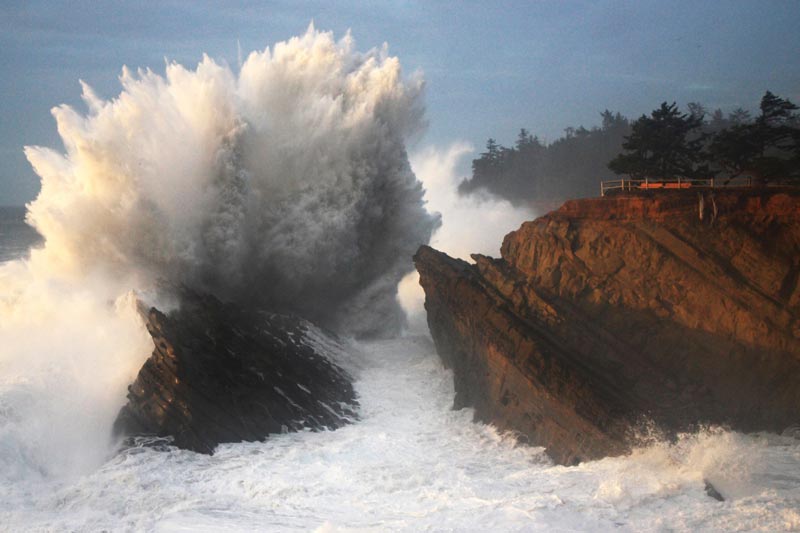
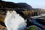
Shore Acres near Coos Bay, photo courtesy Oregon's Adventure Coast
“In southwest Washington similar conditions in the past have resulted in significant flooding in Raymond, erosion to homes and roads near Washaway Beach along Highway 105 near North Cove, and/or erosion to campsites near Cape Disappointment," the NWS said. “In northwest Oregon similar conditions in the past have resulted in severe erosion near the south jetty of the Columbia River in Clatsop county, and/or flooding in Seaside, Cannon Beach, Neskowin, and/or the Pacific City Airport. On the central Oregon coast similar conditions in the past have resulted in severe erosion in Neskowin and/or Yachats, and flooding in Lincoln City."
This will be one of those infamous storm watch weekends where it will be unusually easy to get hurt, yet it will attract more visitors. Be sure to stay off all beaches during this period. Considering the wind conditions, you will want to find a place where you can waves from inside your car.
The period just before and after this event may be a better time to go look at places like Depoe Bay, Westport or Shore Acres near Coos Bay, where storm waves will likely still be putting on some kind of show.
Oregon Coast Hotels for this event - South Coast Hotels - Where to eat - Maps - Virtual Tours
Cannon Beach Lodging
Nehalem Bay Lodgings
Manzanita Hotels, Lodging
Three Capes Lodging
Pacific City Hotels, Lodging
Lincoln City Lodging
Depoe Bay Lodging
Newport Lodging
Waldport Lodging
Yachats Lodging
Oregon Coast Vacation Rentals
Oregon Coast Lodging Specials
More About Oregon Coast hotels, lodging.....
More About Oregon Coast Restaurants, Dining.....
 Andre' GW Hagestedt is editor, owner and primary photographer / videographer of Oregon Coast Beach Connection, an online publication that sees nearly 1 million pageviews per month. He is also author of several books about the coast.
LATEST Related Oregon Coast Articles
The sixth in the NW in three weeks; early indications suggest it may have been undernourished. Marine sciences
Now Begins the 'Season of Satellites' Above Oregon, Washington: Summer's Surr...
Not even counting meteors, these satellite trains can create wild colors and streaks in the sky. Astronomy, weather. Brookings events, Gold Beach events, Port Orford events, Coos Bay events, Bandon events, Florence events, Yachats events, Newport events, Lincoln City events, Rockaway Beach events, Manzanita events, Cannon Beach events, Seaside events, Astoria events
7-Day Parking Meters Return to Central Oregon Coast Town, and Now to Nye Beac...
Newport?s Bayfront will charge all week, and the Nye Beach Turnaround will now do the same. Travel tips, traffic
87th Annual Azalea Fest Readies Its Return for Memorial Day Weekend on S. Ore...
Brookings brings back the long-running festival over Memorial Day weekend, May 22?25. Brookings events
Harrowing Accident Scene on S. Oregon Coast Turns Into Search for Driver and ...
Sheriffs found an empty vehicle and searched nearly 24 hours before locating the driver. Traffic
Another Dead Whale Stranding, This Time Near Yachats on Central Oregon Coast
Reports differ on whether it was alive at first; scientists are examining the carcass. Marine sciences
Washington Coast Cleanup Scours Inner and Outer Coast, April 25
Volunteers are needed along the outer coast and throughout the Salish Sea. Washington coast events
4th of July at N. Oregon Coast's Sand Lake Now Requires Pre-Sales for Camping...
Congestion and overcrowding in recent years at Sand Lake Recreation Area near Pacific City. Traffic, travel tips
Back to Oregon Coast
Contact Advertise on BeachConnection.net
All Content, unless otherwise attributed, copyright BeachConnection.net Unauthorized use or publication is not permitted


