Three Oregon Coast Wonders Bigger Than They Look: Lincoln County
Published 6/17/24 at 6:25 p.m.
By , Oregon Coast Beach Connection
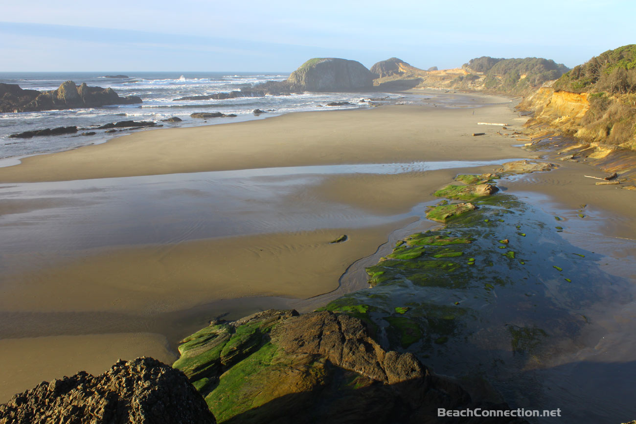
(Oregon Coast) – At first glance it's one thing - walk a bit and there's even more.
Includes exclusive listings; some specials in winter
In Cannon Beach:
Includes rentals not listed anywhere else
In Manzanita, Wheeler, Rockaway Beach:
Some specials for winter
In Pacific City, Oceanside:
Some specials for winter
In Lincoln City:
Some specials for winter
In Depoe Bay, Gleneden Beach:
Some specials for winter
In Newport:
Look for some specials
In Waldport
Some specials for winter
In Yachats, Florence
Some specials for winter
Southern Oregon Coast Hotels / Lodgings
Reedsport to Brookings, places to stay; winter deals
Every now and then, the coolest of clandestine spots and wowing finds are hiding in plain sight. Stumbling across one of these discoveries can make you feel special, like a grand explorer of old, and all it took was walking a tad longer or keeping a closer eye on the pullouts. No massive sailing ship and a crew of hardy trekkers: just the family car and a handful of companions ready to take a little more time. (Above: Seal Rock.)
Some of these delights are fairly well-known accesses along the Oregon coast, but the rewards are found in exploring just a little more and then finding they are bigger than they look. Here are three such natural attractions in the Lincoln County area in a relatively short drive from each other. There's other sides to these parks.
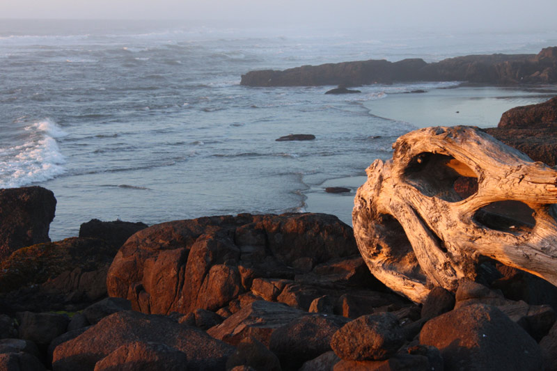
Smelt Sands State Recreation Site. This park at the northern edge of Yachats sports a lot more action than most areas along the Oregon coast, primarily because it's one big rocky shelf where the waves smash and crash with perpetual anger and energy.
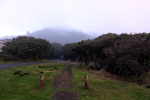
It all starts with the parking lot and the thickly wooded surroundings, giving way to the mile or so of the paved 804 Trail, which stretches along the shoreline, just far back enough to keep it wild and mesmerizing and yet completely safe. It plops you somewhere in the middle of that trail, so there's much more going on there than you realize.
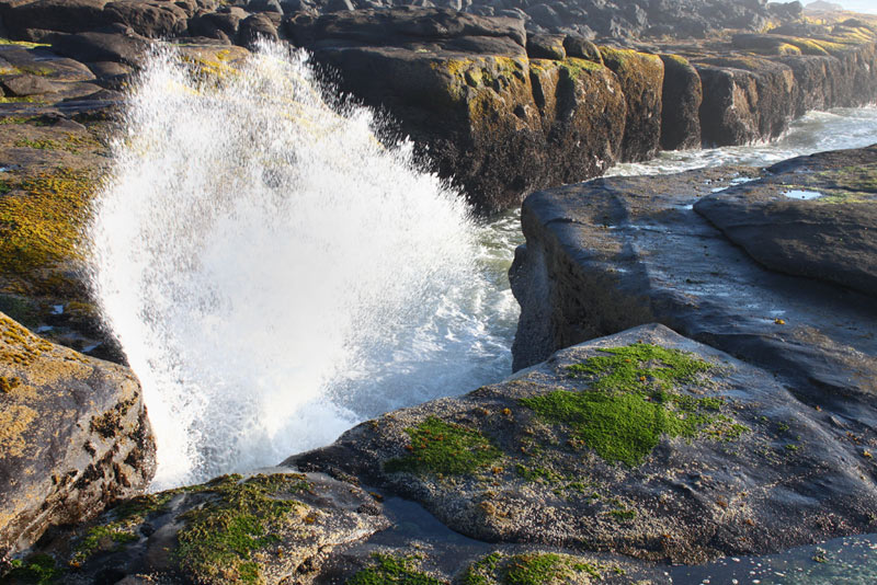
Even Smelt Sands, however, seems to go on and on. It's not clear where its northern border is, but almost a half mile north of the parking lot the trail suddenly ends in a surprising change of landscape: everything becomes soft, sandy beach. Hotels in Yachats - Where to eat - Yachats Maps and Virtual Tours
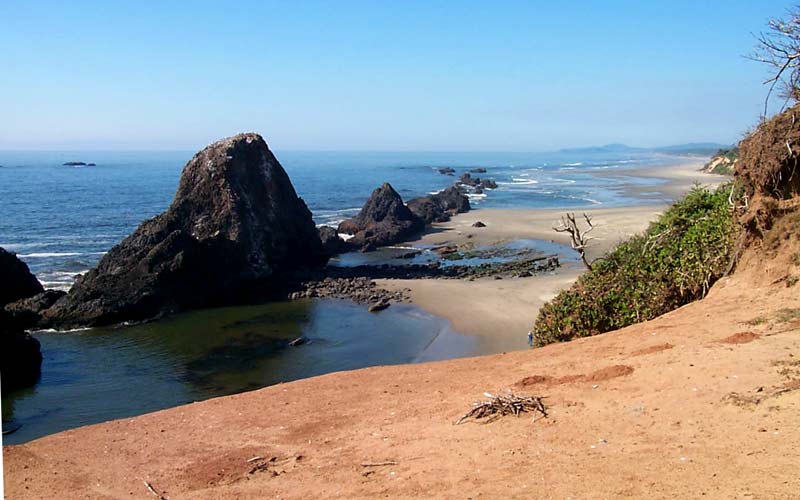
At Seal Rock State Recreational Site, about halfway between Newport and Waldport, the much-visited park stretches on for about a half mile – maybe more. The main access is right in the middle of the tiny community of Seal Rock, sometimes known as Seal Rocks (apparently its original name about 100 years ago). But other accesses are nearby - a tad tucked away from sight.
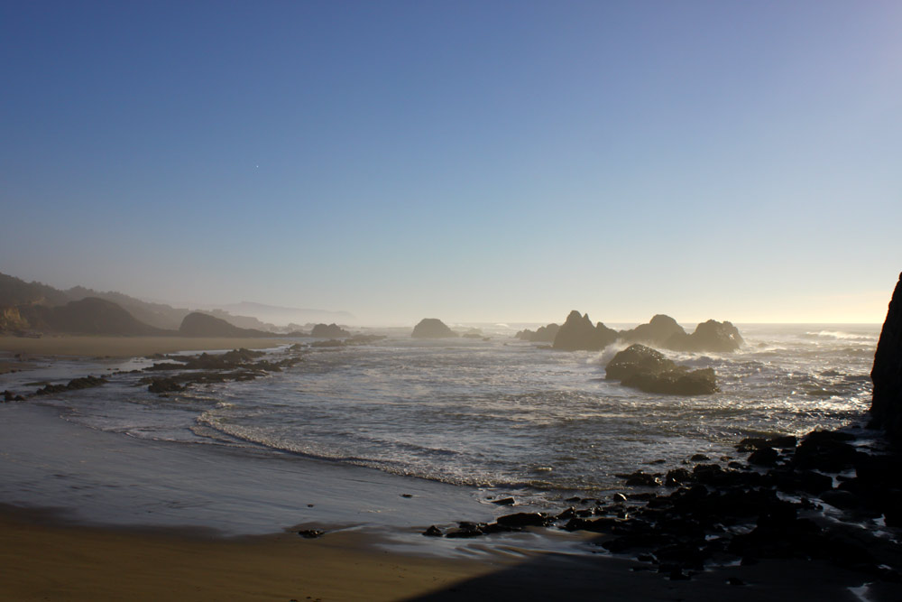
The main section boasts the sizable parking lot, restrooms and the forested path that everyone is familiar with. A slightly twisting, winding walkway takes you either down to the boulder-ridden beach or you can skirt around the cliffs and keep an almost birds-eye view. A couple of benches and lookout spots are good reason for pause.
This part of the beach features that famed massive crevice that is so inviting to explore, but be cautious here as the tide doesn't always cooperate.
You can keep walking a ways south here to encounter the tidepool areas, or find the pullover spot about a quarter mile down the road that has a fairly quick and easy trail through bushes that gets you there faster. During summer's higher sand levels there are not always a lot of tidepools, but when sand levels lower after a storm or two you get quite a labyrinth of interesting features poking out of the sand. Agates are good here as well.
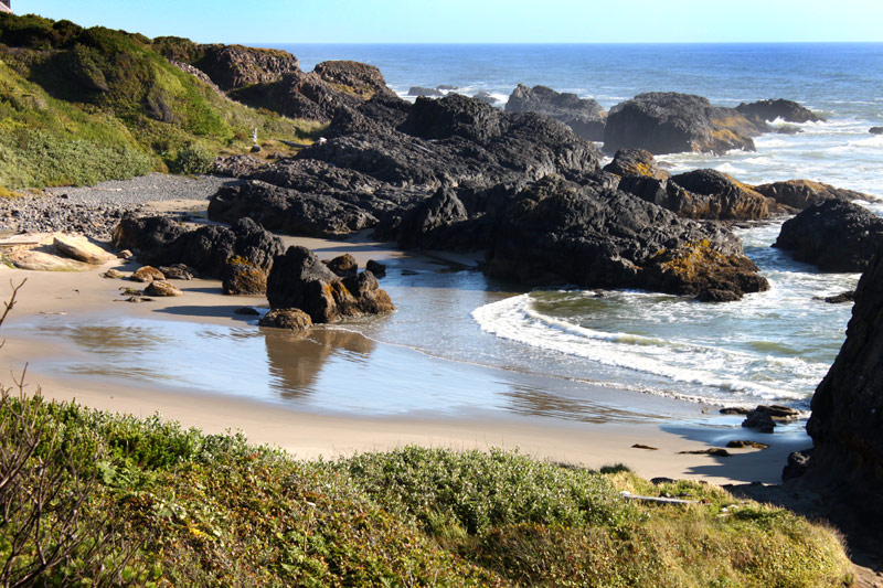
At that same parking lot, the southern end contains yet another unmarked path down to the beach, where it's rockier and harder to tread, and the beach more or less dead-ends here with big sea stacks. Hotels in Waldport - Where to eat - Waldport, Seal Rock Maps and Virtual Tours
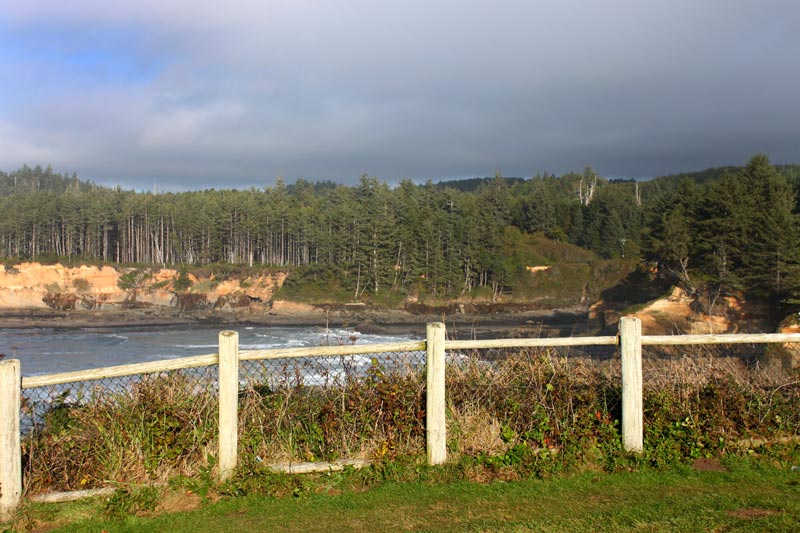
Boiler Bay State Viewpoint. Boiler Bay is the famed destination just north of Depoe Bay, and it's actually comprised of two big sections. One is the headland and park known as Boiler Bay State Viewpoint, but another smaller section lies just north of it.
The sprawling park is a grassy chunk of land that meets the rocky promenade of wild waves and the somewhat damp moments they (delightfully) can bring. Especially when you don't expect it this high up. Some sections are more prone to exploding ocean than others, and these can change with tidal conditions. So make sure you take a gander at the full length of this dramatic shoreline.
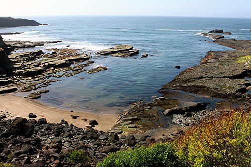
Drive about a half mile north and you'll find the diminutive gravel parking lot that is also called Boiler Bay, where – if tidal conditions are right – you can see the actual boiler from an old shipwreck that gave the bay its name. This section features a really rough and slightly dangerous trail down to the tidal areas that isn't advisable, unless you're more than a little on the rugged side. Don't even attempt this tiny cove beach if the tide is unruly at all. People have died here during stormier conditions.
On the very northern edge of Boiler Bay, you'll notice a tiny pocket beach beneath the forested cliffs. Sometimes this is accessible via a very hidden and long path from near the aforementioned gravel parking lot. But not always. Hotels in Depoe Bay - Where to eat - Depoe Bay Maps and Virtual Tours
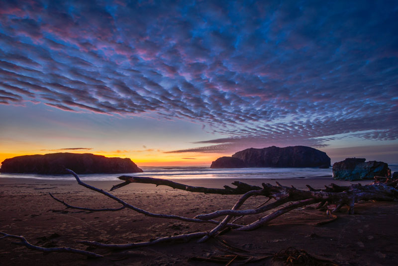
(Above: China Creek at Bandon. Photo courtesy Manuela Durson - see Manuela Durson Fine Arts for more)
Though on the southern coast and nowhere near Lincoln County, it's notable as a kind of oddball, honorable mention: China Creek the Beach at Bandon. The access known as China Creek sits at the southern end of Bandon State Natural Area, found by roaming Beach Loop Road after Devil's Kitchen viewpoint. It's rather remote, so much so it's getting you closer to the seriously off-the-beaten-path Floras Lake beaches.
You get there and it it looks like one access, but it's part of a much bigger area – and chock full of surprises. Will the Real China Creek of Oregon Coast Please Stand Up: Bandon, Near Florence
Cannon Beach Lodging
Nehalem Bay Lodgings
Manzanita Hotels, Lodging
Three Capes Lodging
Pacific City Hotels, Lodging
Lincoln City Lodging
Depoe Bay Lodging
Newport Lodging
Waldport Lodging
Yachats Lodging
Oregon Coast Vacation Rentals
Oregon Coast Lodging Specials
More About Oregon Coast hotels, lodging.....
More About Oregon Coast Restaurants, Dining.....
 Andre' GW Hagestedt is editor, owner and primary photographer / videographer of Oregon Coast Beach Connection, an online publication that sees over 1 million pageviews per month. He is also author of several books about the coast.
LATEST Related Oregon Coast Articles
The Ghosts Near Waldport / Seal Rock Beneath These Oregon Coast Sands - VideoSeal Rock's Curtis St. and Lost Creek host something ancient below. Geology, sciences
The Colorful, Even Psychedelic China Rockfish of Oregon Coast / Washington Coast
They're freaky but they're also tasty, as well as gorgeous. Marine sciences
Majority of Central Oregon Coast Back Open to Razor Clamming
Reopened from Florence's Siuslaw River to Seal Rock
Will the Real China Creek of Oregon Coast Please Stand Up: Bandon, Near Florence
One sits at Bandon, the other near Florence
Mussel Harvesting Closed on Part of Oregon Coast Due to Biotoxin: Cape Lookou...
Unsafe levels of paralytic shellfish poisoning (PSP)
Parts of South Oregon Coast Reopen to Razor Clamming - But Not Much
From Cape Blanco to Brookings; Seal Rock to Florence. Marine sciences
Scenic Surprises in 15 Miles of Central Oregon Coast Include Watery Explosions
One stretch of central Oregon coast presents an especially varied and rugged face: Seal Rock, Waldport, Yachats, Cape Perpetua
Deceptively Simple Oregon Coast Beach Spots: Bandon, Seal Rock, Lane County
Beaches aren't always what they seem at first glance
Back to Oregon Coast
Contact Advertise on Oregon Coast Beach Connection
All Content, unless otherwise attributed, copyright © Oregon Coast Beach Connection. Unauthorized use or publication is not permitted


