Variety of Ice, Cold and Snow Advisories for Oregon, Washington, Even Coastal Areas
Published 02/12/25 at 7:29 a.m.
By Oregon Coast Beach Connection Staff
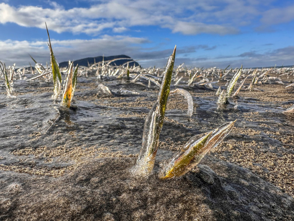
(Portland, Oregon) – Any minute now, many Oregonians will get to use that beginning line from the old Led Zeppelin song: “We come from the land of the ice and snow.” Some of the discordant wailing from that tune may also be appropriate. The vast majority of Washington and Oregon are going under a deep freeze – from the coastlines to the Cascades and the Idaho border. (Photo Seaside Aquarium: frozen beach at Seaside)
Includes exclusive listings; some specials in winter
In Cannon Beach:
Includes rentals not listed anywhere else
In Manzanita, Wheeler, Rockaway Beach:
Some specials for winter
In Pacific City, Oceanside:
Some specials for winter
In Lincoln City:
Some specials for winter
In Depoe Bay, Gleneden Beach:
Some specials for winter
In Newport:
Look for some specials
In Waldport
Some specials for winter
In Yachats, Florence
Some specials for winter
Southern Oregon Coast Hotels / Lodgings
Reedsport to Brookings, places to stay; winter deals
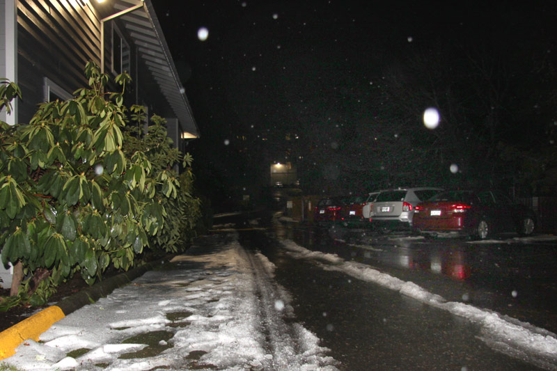
It's a few days of overnight lows in the 20s or even lower, and at least some snow with an icy layer coming on eventually, causing a commute problem early Thursday for many areas.
You will, at least for a small time, encounter frozen beaches like above.
There are an enormous array of winter storm warnings or advisories sent out by the National Weather Service (NWS). A freeze warning expires this morning for the southern Oregon coast, but that area and much of the rest of the state go under a cold weather advisory through at least Thursday morning. That, among other places, is in effect for Portland, Vancouver, Salem, Eugene, the Oregon Coast Range, Seaside, Astoria, Long Beach, Westport, Coos Bay, Manzanita, Silverton, Medford, Newport and more.
- Washington Coast Weather - Oregon Coast Weather - Inland Oregon Weather
It's certainly going to be extremely cold both day and night, but not all areas will get snow or ice in the same manner.
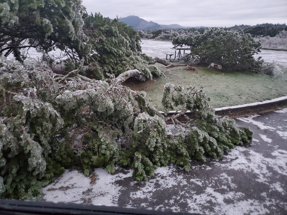
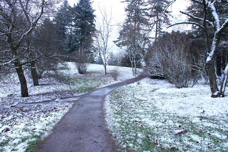
Nehalem Bay State Park, file photo OPRD
“Cold Weather Advisories and Extreme Cold Warnings have been issued for the area,” the NWS said in a bulletin. “Be prepared for these colder temperatures by taking proper precautions to maintain warmth. Frostbite and hypothermia may occur if unprotected skin is exposed to these temperatures. Wind chills will drop into the teens for most beginning this evening (2/11) and continue into tomorrow (2/12).”
Much of the Portland metro area is under a slightly more urgent winter weather advisory lasting through Valentine's Day (Friday). The worry in this area is a mix of freezing rain and sleet before 11 a.m., effectively icing over the commute. By the afternoon, snow levels soar well beyond even the Oregon Coast Range summits.
Portland - Oregon Coast Beach Connection
More mixes of rain and snow are coming Friday.
For the Oregon and Washington beach towns, temps won't drop as low, sticking to around the freezing point. It's the roads to and from the coast that will be the problem.
There's a light at the end of this weather tunnel, however – for just about everyone.
“Wednesday daytime hours remain dry, with cold morning temperatures, the NWS said. “Widespread snow, freezing rain/sleet, and rain are expected late Wednesday night/early Thursday morning. Also, very cold overnight temperatures and breezy easterly winds are expected. This will result in very hazardous conditions across the forecast area through the end of this week.”
Then, the forecast turns more to the wet side for inland Oregon and Washington, with the coastal areas simply getting a bit windy.
“A pattern change with slightly warmer temperatures and rain/snow is possible Sunday and looks to continue into the start of next week,” the NWS said.
Oregon Coast Hotels in this area - South Coast Hotels - Oregon Coast Vacation Rentals - Where to eat - Maps - Virtual Tours


Oregon Coast Vacation Rentals
Oregon Coast Lodging Specials

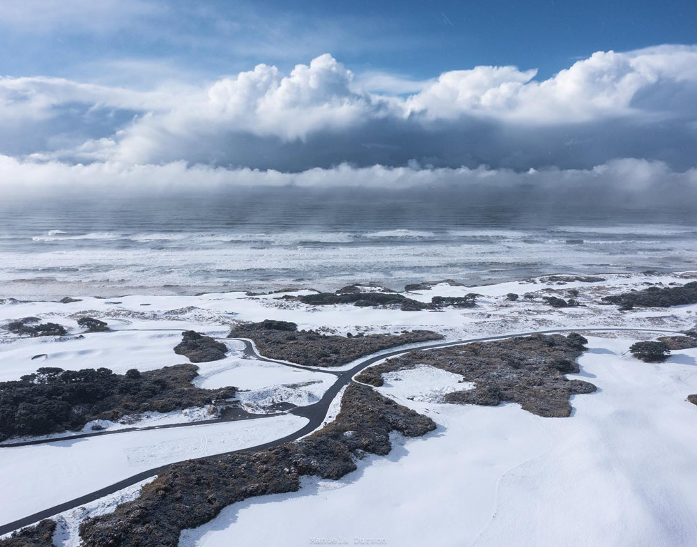
Bandon, courtesy Manuela Durson - Manuela Durson Fine Arts
More About Oregon Coast hotels, lodging.....
More About Oregon Coast Restaurants, Dining.....


 Andre' GW Hagestedt is editor, owner and primary photographer / videographer of Oregon Coast Beach Connection, an online publication that sees over 1 million pageviews per month. He is also author of several books about the coast.
LATEST Related Oregon Coast Articles
Deadliest Shipwreck in Oregon Coast History: Nehalem Event Talks About the Le...Sat. March 14 at the NCRD. Manzanita events, Nehalem events, Cannon Beach events
Destructive Road Rage in NW Oregon and South Coast Case End Horribly for Dogs
Dog in Coos Bay shot and left for dead. Hillsboro vehicle kills dog in bizarre act of road rage. Crime, safety
March 30 is 132nd-Year Celebration at Oregon Coast's Beloved Heceta Head Ligh...
Food, live music and history, but no trip to the top. Florence events, Yachats events
Beach Access With No Name on Central Oregon Coast Leads to Other Yachats Myst...
With a tunnel-like path through trees there's a mystical vibe. Travel tips. Waldport, Newport, Florence
Cannon Beach Talk Looks Into Adorable N. Oregon Coast Wonders Like Rhinoceros...
Pelican Brewery in Cannon Beach on Sunday, April 12, at 4 p.m. Cannon Beach events
Deceased Whale on Oregon Coast: Scientists May Already Have Clue in Cause of ...
Gray whale in Florence may be connected to 'skinny whales' issue of decade. Marine sciences
Horsing Around with History: Oregon Coast Event Looks at Horse 'n Buggies
Seaside Museum will host this talk on old transporation. Seaside events
Arizona Visitor Rescued from South Oregon Coast Beach After Breaking Ankle
Rescuers from Curry County brought a happy ending. Safety, Gold Beach, Secret Beach
Back to Oregon Coast
Contact Advertise on Oregon Coast Beach Connection
All Content, unless otherwise attributed, copyright © Oregon Coast Beach Connection. Unauthorized use or publication is not permitted

Oregon
Coast Hotels
S. Coast Hotels
Astoria/Warrenton Hotels
Seaside Hotels
Cannon
Beach Hotels
Nehalem Bay Lodgings
Manzanita Hotels, Lodging
Rockaway Beach Hotels
Three Capes Lodging
Pacific City Hotels, Lodging
Lincoln
City Lodging
Depoe
Bay Hotels
Newport Hotels
Waldport Lodging
Yachats
Hotels
Florence Hotels
Reedsport Hotels
Coos Bay Hotels
Bandon Hotels
Port Orford Hotels
Gold Beach Hotels
Brookings Hotels
Oregon
Coast Vacation Rentals
Oregon
Coast Lodging Specials
South Coast Hotels
Dining
Guide
Seaside
Cannon
Beach Dining
Manzanita,
Rockaway, Wheeler Dining
Pacific
City, Oceanside, Netarts, Tierra Del Mar Restaurants
Tillamook
Bay Restaurants, Dining
Lincoln
City Dining, Restaurants
Depoe
Bay Restaurants, Dining
Newport Restaurants, Dining
Waldport,
Yachats Restaurants, Dining
Florence Restaurants, Dining
Restaurant
Reviews
Coast
Events Calendar
Astoria
Seaside,
Cannon Beach Calendar
Manzanita,
Rockaway Events
Tillamook,
Pacific City Calendar
Lincoln
City Events Calendar
Newport,
Depoe Bay Events Calendar
Yachats Events Calendar
Oregon Coast Complete Guides every beach access, attraction
Search for Oregon Coast Subjects, Articles
Explore Every Beach Spot


News Headlines from All Over Oregon Need to scan Oregon headlines? Constantly updated news from all over Oregon: a comprehensive, up-to-the-minute display of news headlines from a variety of media
Oregon Coast Oceanfront Lodging, Hotels, Rentals