Video, Photos Dig Into Story Behind N. Oregon Coast's Reopened, Captivating Three Capes Loop
Published 7/11/24 at 7:05 a.m.
By Andre' GW Hagestedt, Oregon Coast Beach Connection

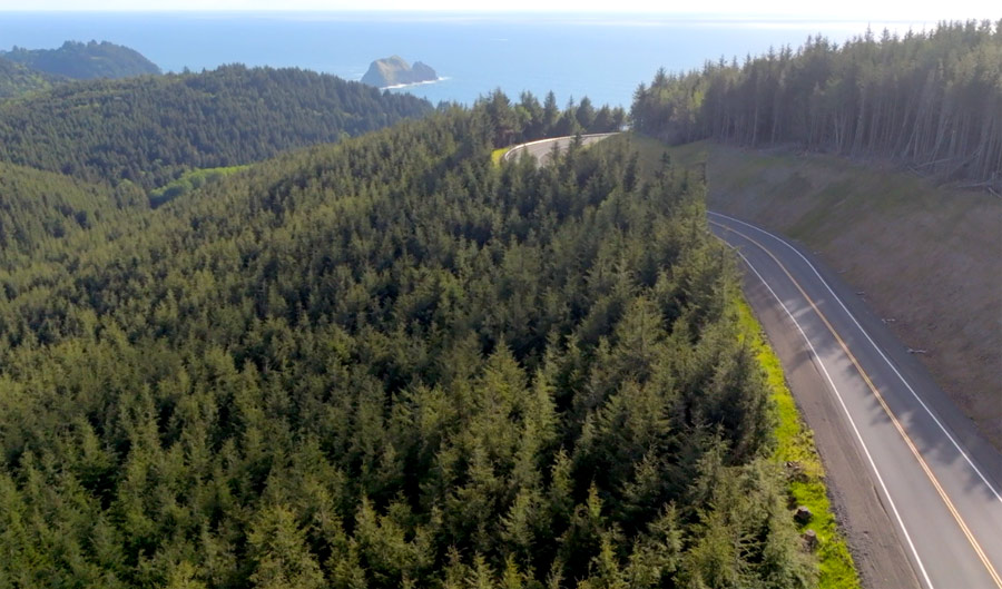
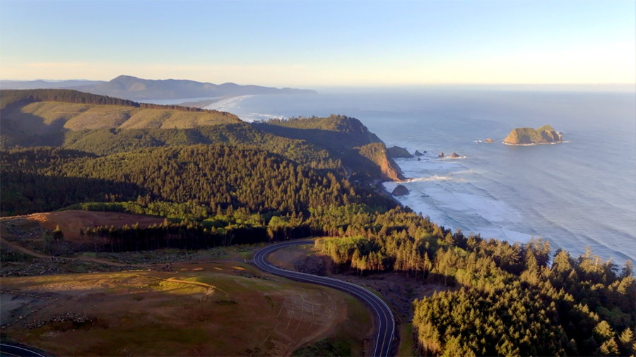
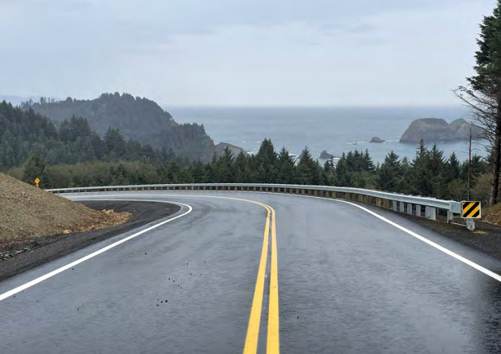
(Oceanside, Oregon) – If there's one thing Oregon's Tillamook Coast likes to beam about these days, it's the reopening of Cape Meares Loop Road between Oceanside and Cape Meares. After about ten years of being closed off due to a major landslide, it was finally redone and reopened earlier this year to much applause. Once again, the Three Capes Loop was a loop and not a “Route” that simply ended just before Cape Meares and you had to turn around. (Photos courtesy Tillamook Coast Visitors Association)
Includes exclusive listings; some specials in winter
In Cannon Beach:
Includes rentals not listed anywhere else
In Manzanita, Wheeler, Rockaway Beach:
Some specials for winter
In Pacific City, Oceanside:
Some specials for winter
In Lincoln City:
Some specials for winter
In Depoe Bay, Gleneden Beach:
Some specials for winter
In Newport:
Look for some specials
In Waldport
Some specials for winter
In Yachats, Florence
Some specials for winter
Southern Oregon Coast Hotels / Lodgings
Reedsport to Brookings, places to stay; winter deals
There are three capes again and not just, like.... 2 and a half.
Now, there's a sleek and eye-popping road back in service, coming complete with new pullouts that are seriously stunning – though still under construction to some degree. Cape Meares Loop Rd. Reopens, N. Oregon Coast's Three Capes is 'Loop' Again After 10 Years
Visit Tillamook Coast and various county agencies just released more photos of the extremely photogenic place and produced a video on this intriguing project – basically a decade worth of careful design and realignment.
It turns out this place has been almost cursed from way back in Oregon coast history. In 1877 the first landslide hit Cape Meares Loop Road. Throughout the '90s and 2000s it seemed to shut down almost every winter as one part or another crumbled.
“In November 2012, a significant landslide caused extensive damage, leading to the closure of the road in 2013,” the agency said.
Liane Welch was director of Tillamook County Public Works at the time. She said that in her ten and a half years, there were seven flood events in Tillamook County that were bad enough to be recognized as such by the feds. Then the road and lands around shifted in a spooky manner.
“Monitoring points moved 12-13 feet horizontally in eight months, making it imperative to close the road for safety," she said. “Despite the active slide, maintaining access between Cape Meares and Oceanside was essential for community safety and emergency response."

So how did this all get solved?
The video gets into much of that. So does Welch.
"We explored various options, and relocating the road east and upslope was the most cost-effective solution. This design places the new alignment above the active land movement," Welch said.

At the end of the day (or rather ten years of construction), the results were magnificent.
When it opened earlier this year, Nan Devlin, Executive Director of the Tillamook Coast Visitors Association, told Oregon Coast Beach Connection when she first was driven down that road and saw some of the scenery she actually gasped at one point.
The two pullouts still being finished offer amazing ocean vistas.

“One overlooks the ocean with a breathtaking view of Three Arch Rocks, and the other provides a miles-long vista of bays, reaching all the way to Manzanita on clear days," she said.
Currently, Chris Laity is Tillamook County Public Works director, and he and the department acknowledge the road's significance. It's truly a destination all its own now, he said, and the county has is proud to have restored a major corridor for tourism.
Yet there were major challenges. Special construction techniques had to be utilized to protect fragile Coleman Creek. That and other engineering feats are part of the video "Rebuilding the Scenic Cape Meares Loop Road," which was commissioned by the county's tourism bureau and produced in collaboration with Sea Legs Media.
Hotels in Three Capes - Where to eat - Three Capes Maps and Virtual Tours
Cannon Beach Lodging
Nehalem Bay Lodgings
Manzanita Hotels, Lodging
Three Capes Lodging
Pacific City Hotels, Lodging
Lincoln City Lodging
Depoe Bay Lodging
Newport Lodging
Waldport Lodging
Yachats Lodging
Oregon Coast Vacation Rentals
Oregon Coast Lodging Specials
More About Oregon Coast hotels, lodging.....
More About Oregon Coast Restaurants, Dining.....
 Andre' GW Hagestedt is editor, owner and primary photographer / videographer of Oregon Coast Beach Connection, an online publication that sees over 1 million pageviews per month. He is also author of several books about the coast.
LATEST Related Oregon Coast Articles
Old Neskowin in Pictures is Subject of Oregon Coast EventDecember 13 in Lincoln City: Neskowin: A Book of Found Photos. Lincoln City events
55 Years of 'Happy Exploding Whale Day' Celebrated in Oregon Coast's Florence
Nov 12 is the holiday, but Florence's celebrates Nov 16. Florence events, south coast events, Newport events
Holly Jolly Follies Return to Central Oregon Coast's Florence Events Center
Dec 5 - 7 with loads of dancing, song and even cocoa.
Mussel Gathering Closed Again on S. Oregon Coast After Biotoxins Found
Paralytic shellfish toxin found Cape Blanco to Brookings. Marine sciences
Lincoln City Kicks Out the Jams for Oregon Coast Holiday Events
Surfin? Holiday Market December 14, Winter Art Festival, more Lincoln City events
Some Thanksgiving and Holiday Weekend Vacation Rentals Still Open on Oregon C...
A handful of vacation rentals and one restaurant's feast: Newport hotel reviews, Lincoln City hotel reviews, Pacific City hotel reviews, Neskowin hotel reviews, Washington coast, specials
The Opposite of an Exploding Whale: Oregon Coast History of 'Zombie Whales'
1952: whale would not stay buried. Was it finally entombed in cement. Marine sciences
Oregon's Southern Curry Coast for the Holidays - and 2026 Preview
Holidays in Port Orford, Brookings, Gold Beach plus 2026 events. South coast events. Gold Beach Christmas, Dec.; Gold Beach Floats, Apr; Azalea Festival May; Brookings Art Walk, Brookings Art at the Port, Bootleg Festival, June; Solstice Shred, June; Bigfoot Blues, July; Pirates Fest, Aug.
Back to Oregon Coast
Contact Advertise on Oregon Coast Beach Connection
All Content, unless otherwise attributed, copyright © Oregon Coast Beach Connection. Unauthorized use or publication is not permitted


