 |
Believe It Or Not: High Winds on Oregon Coast Give Way to Snow
Published 03/12/2012

(Oregon Coast) – Wind gusts in Newport reached as high as 81 mph. Pacific City and a couple spots on the Washington coast had peak gusts of 87 mph. Garibaldi hit 82. Birds hunkered down on the beaches and couldn't fly. A few brave souls hit the sands, forced to lean in hard against the wind while walking into it.
Hurricane-force winds were predicted offshore Monday for the Oregon coast, and indeed that was briefly true even for headlands and beaches during this wild and odd late season storm.
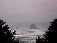 |
| Stormy Cannon Beach |
“Today's strong storm is more reminiscent of something we would see in December rather than March,” said Steve Pierce, president of the Oregon Chapter of the American Meteorological Society. “Winds have gusted to as high as nearly 90 mph along the northern Oregon coast and 45-60 mph at some locations in the Willamette Valley today.”
Lincoln City resident Karol Durham was among those who noted the plight of birds, especially one that could not get back into the air and huddled close to a hill.
“The ocean is really churned up.” Durham said. “The wind gusts were really something, too, and I feel sorry for the birds trying to fly.”
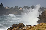
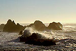
Others on the coast noted the surf was a huge wall of water all day.
As the National Weather Service predicted, Newport was among the hardest hit. Some of the usual hotspots for heavy winds again produced crazy results: Cape Meares clocked in at 80 mph, Cape Foulweather hit 81, and chunks of Clatsop County beaches – excluding Cannon Beach – were in the high 70's for peak gusts. Cannon Beach itself hit a mere 63 mph.
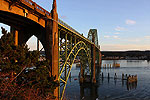
The Yaquina Bay Bridge at Newport – no picnic during storms – hit peak gusts at 72 mph.
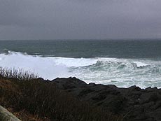 |
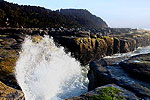
| Near Depoe Bay |
Meanwhile, heavy snowfall in the coast range caused accidents on Highway 26 towards Seaside and Cannon Beach.
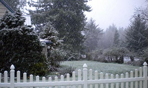
Weather on the Oregon coast isn't done with its wacky side. As of 6 p.m. it started lightly snowing around the region, such as in Seaside and Lincoln City.
Now, the storm will change its focus from gray to white, you could say.
“After the front passes by the region this afternoon, snow levels will fall dramatically this evening,” Pierce said. “Overnight tonight into Tuesday, snow could fall as low as the valley floor. Late tonight, an area of organized showers will rotate around the upper level low into western Oregon and Washington.
The coast range will get some more white, and the Portland area may well get some as well.
Snow has been a recurring oddity in the early spring weeks in recent years on the Oregon coast. At least three times in the last several years the north Oregon coast has seen some snow even in spring break.
What's going here? It's a bit of a cyclical thing, but it has been unusually frequent in the last six years thanks to some other factors.
 “Since 2007, snow has been falling at much lower elevations across western Oregon and Washington,” Pierce said. “Much of this has come in winters where we were experiencing a La Nina. We saw La Nina conditions in the winters of 2007/2008, 2008/2009 and again from late 2010 through 2012. The Pacific Decadal Oscillation is also at play here. It recently reverted to its negative phase in 2007 which normally means colder and wetter winters in the Pacific Northwest. Sticking snow in March happens about once every 10 years in areas such as Portland, and even less frequent on the coast."
Pierce said a complete explanation of the PDO is at this link.
More wet weather is in store for Portland and the coast this week, but it will warm up quickly after Wednesday morning.
Below: Sandlake Country Inn near Pacific City this afternoon.
More About Oregon Coast hotels, lodging.....
More About Oregon Coast Restaurants, Dining.....
 |
 |
 |
LATEST OREGON COAST NEWS STORIES
Oregon Coast Whales - Guide to Whale Watching; Whale News, Blog |
Back to Oregon Coast
Contact Advertise on BeachConnection.net
All Content, unless otherwise attributed, copyright BeachConnection.net Unauthorized use or publication is not permitted
Secrets of the Season |
Unusual Travel Articles TravelParanormal.com allows you to submit your own creepy tale or debunk one - or see up-to-the-minute news headlines about travel and the paranormal. News Headlines from All Over Oregon Need to scan Oregon headlines? Constantly updated news from all over Oregon: a comprehensive, up-to-the-minute display of news headlines from a variety of media |


