


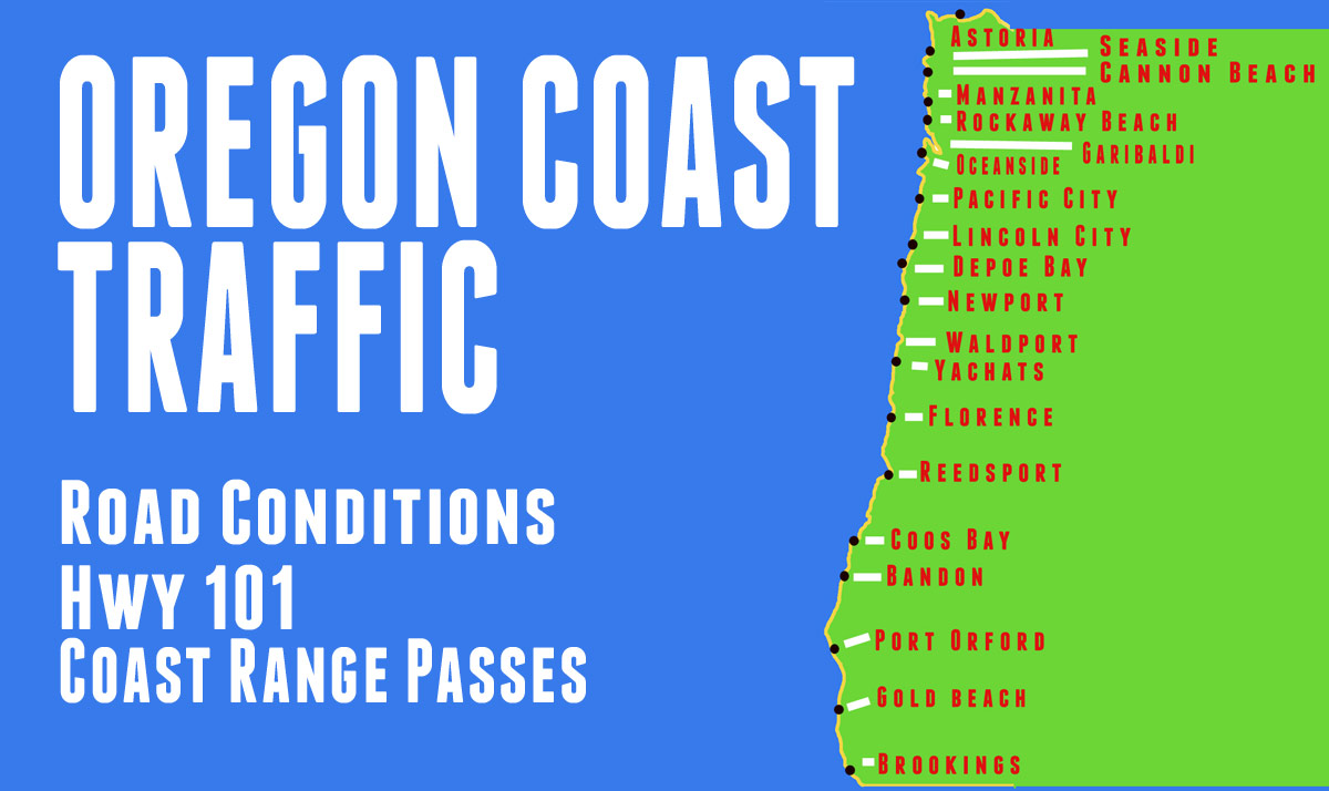
Oregon Coast Highway 101 Road Conditions, Traffic - Coast Range Passes
Highway 26 -- Highway 6 -- Highway 18 -- Highway 20 -- Highway 34 -- Highway 126 -- Highway 38 -- Highway 42
- Highway 101 North (Astoria, Seaside, Cannon Beach, Manzanita, Wheeler, Rockaway, Tillamook, Hebo, Lincoln City)
- Highway 101 Central (Depoe Bay, Newport, Yachats, Waldport, Florence)
- Highway 101 South (Reedsport, Gardiner, Coos Bay / North Bend, Bandon, Port Orford, Gold Beach, Brookings)
MORE OREGON TRAFFIC: Oregon Coast Highway 101 / Coast Range Traffic | Portland Street Traffic (Northwest, Southeast, Southwest, Northeast Traffic) | Portland, Oregon Traffic, Road Conditions - Traffic Cams: I-5 - I-205 - I-405 - Hwy 217 - I-84 - Highway 26 Beaverton | Willamette Valley / Salem Traffic | Eugene / Albany / Corvallis Traffic | Columbia Gorge Traffic | More Oregon Traffic Soon
US101, 4 Mi S of Tillamook, Unconfirmed, An unconfirmed report of a crash has been received. Use caution. US101, 4 Mi S of Tillamook, Unconfirmed, An unconfirmed report of a crash has been received. Use caution. US101, 3 Mi S of Warrenton, Delay ? TripCheck - US101 (@TripCheckUS101A) Jul 31, 2026 US101, 3 Mi S of Warrenton, Closed, A crash has closed the road. Use an alternate route. US101, 4 Mi N of Cannon Beach, Delay ? TripCheck - US101 (@TripCheckUS101A) Jul 31, 2026
31 Jul 2026 at 4:40pm
US101, 3 Mi S of Warrenton, Delay < 20min, A crash has occurred. Prepare to slow or move over for worker safety.
31 Jul 2026 at 2:07pm
US101, 3 Mi S of Warrenton, Closed, A crash has closed the road. Use an alternate route.
31 Jul 2026 at 1:32pm
US101, 4 Mi N of Cannon Beach, Delay < 20min, Road maint ops are occurring. Prepare to slow or move over for worker safety.
31 Jul 2026 at 8:17am
Highway 101 Astoria / Megler Bridge ODOT Live Traffic Web Cam - More Highway Astoria traffic info here
_pid3322.JPG)
Highway 101 Astoria / Megler Bridge ODOT LIve Traffic Cam
_pid3318.JPG)
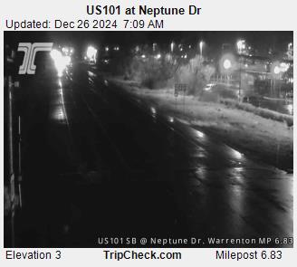
HIghway 101 Astoria - Live Traffic Cam at Neptune Dr
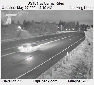
Highway 101 Warrenton / Gearhart - Camp Rilea Live Traffic Cam
Highway 101 at Seaside ODOT Live Traffic Web Cam - More Highway Seaside traffic info here

Cannon Beach / US 101 Live Road Traffic Cam
Traffic incidents or delays around Cannon Beach, Manzanita, Nehalem, Rockaway Beach, Wheeler
Garibaldi at Highway 101 - Live Traffic Cam (bay)
Three Capes Loop / Pacific City Live Traffic Cam - Webb Park Rd
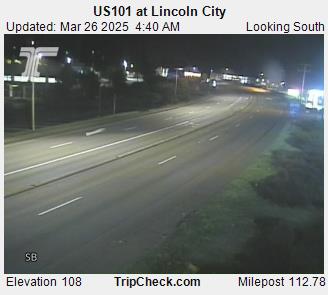
Highway 101 at Lincoln City ODOT Live Traffic Web Cam - More Lincoln City traffic info here
More web cams are here:
Oregon Coast Web Cams, Sky Cams
Astoria / Warrenton Weather
Seaside Weather
Cannon Beach weather
Manzanita weather
Nehalem Bay / Wheeler weather
Rockaway weather
Oceanside/Tillamook weather
Pacific City weather
Lincoln City weather
Maps, Attractions, More Travel Info
Astoria, Warrenton Map, Virtual Tour
Seaside Map, Virtual Tour
Cannon Beach, Arch Cape Map, Virtual Tour
Manzanita, Nehalem Map, Virtual Tour
Wheeler, Nehalem Bay Map, Virtual Tour
Rockaway Beach Map, Virtual Tour
Garibaldi, Tillamook Map, Virtual Tour
Oceanside, Netarts Map, Virtual Tour
Pacific City Map, Virtual Tour
Lincoln City Map, Virtual Tour

US101, Lincoln Beach, Delay < 20min, A crash has occurred. Prepare to slow or move over for worker safety. US101, Lincoln Beach, Delay ? TripCheck - US101 (@TripCheckUS101B) Aug 1, 2026 US101, 3 Mi S of Yachats, Unconfirmed, An unconfirmed report of a disabled veh, creating a hazard, has been received. Use caution. US101, 7 Mi N of Florence, Delay ? TripCheck - US101 (@TripCheckUS101B) Jul 29, 2026 US101, 3 Mi S of Waldport, Unconfirmed, An unconfirmed report of a crash has been received. Use caution.
31 Jul 2026 at 9:32pm
US101, 3 Mi S of Yachats, Unconfirmed, An unconfirmed report of a disabled veh, creating a hazard, has been received. Use caution.
31 Jul 2026 at 8:42pm
US101, 7 Mi N of Florence, Delay < 20min, Road maint ops are occurring. Prepare to slow or move over for worker safety.
29 Jul 2026 at 9:32am
US101, 3 Mi S of Waldport, Unconfirmed, An unconfirmed report of a crash has been received. Use caution.
27 Jul 2026 at 12:02pm
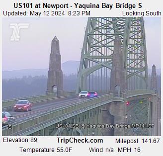
Highway 101 Newport Yaquina Bay Bridge ODOT Live Traffic Web Cam - More Highway 101 traffic info here
Highway 101 near Florence / Yachats ODOT Live Traffic Web Cams. Looking south and looking north - More Highway Newport to Florence traffic info here

Highway 101 / 126 at Florence Live Traffic Web Cam More Highway Newport to Florence traffic info here

- Back to top of page
More web cams are here:
Lincoln City Weather
Depoe Bay Weather
Newport Weather
Yachats Weather
Florence Weather
Maps, Attractions, More Travel Info
Depoe Bay, Gleneden Beach Map, Virtual Tour
Newport Map, Virtual Tour
Seal Rock, Waldport Map, Virtual Tour
Yachats Map, Virtual Tour
Between Yachats and Florence Map, Virtual Tour
Florence Map, Virtual Tour
Florence Hotels

US101, 2 Mi S of Coos Bay, Delay < 20min, A crash has occurred. Prepare to slow or move over for worker safety. US101, 2 Mi S of Coos Bay, Delay ? TripCheck - US101 (@TripCheckUS101C) Aug 1, 2026 US101, Coos Bay, Delay ? TripCheck - US101 (@TripCheckUS101C) Jul 30, 2026 US101, North Bend, Delay 20min-2hrs, A crash has occurred. Prepare to slow or move over for worker safety.
1 Aug 2026 at 2:34am
US101, Coos Bay, Delay < 20min, A disabled veh is creating a hazard. Prepare to slow or move over for worker safety.
30 Jul 2026 at 3:30pm
US101, North Bend, Delay 20min-2hrs, A crash has occurred. Prepare to slow or move over for worker safety.
29 Jul 2026 at 8:32pm
US101, 2 Mi N of Wedderburn, Delay < 20min, Road maint ops are occurring. Prepare to slow or move over for worker safety.MIKE GAGEIT SLOW KN US101, 2 Mi N of Wedderburn, Delay ? TripCheck - US101 (@TripCheckUS101D) Jul 31, 2026 US101, Wedderburn, Delay ? TripCheck - US101 (@TripCheckUS101D) Jul 29, 2026 US101, 3 Mi S of Brookings, Delay ? TripCheck - US101 (@TripCheckUS101D) Jul 29, 2026
31 Jul 2026 at 9:25am
US101, Wedderburn, Delay < 20min, A crash has occurred. Prepare to slow or move over for worker safety.
29 Jul 2026 at 12:42pm
US101, 3 Mi S of Brookings, Delay < 20min, A disabled veh is creating a hazard. Prepare to slow or move over for worker safety.
29 Jul 2026 at 12:22pm
Highway 101 Gardiner Live Traffic Web Cams - Near Oregon National Dunes Recreation Area. Looking north and south - More Highway 101 traffic info here
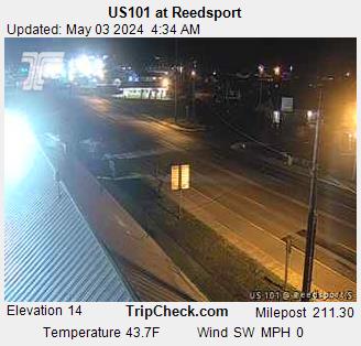
Highway 101 at Reedsport - Live Traffic Web Cams. Looking south and looking north - More Highway 101 South Coast
Highway 101 McCullough Bridge at Glasgow (North Bend - Coos Bay) Traffic Web Cam - More Highway 101 South Coast

Highway 101 South Coast - Beaver (north of Bandon)
%20SB_pid4323.jpg)
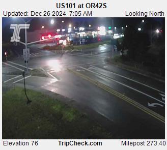
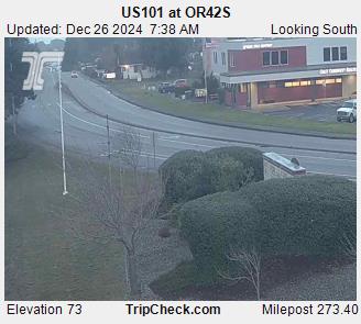
Bandon Traffic Live Cam - Highway 101 at OR 42 S
Port Orford Traffic Live Cam - Highway 101 north and south


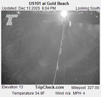
Gold Beach Traffic Live Cam - Highway 101 north and south
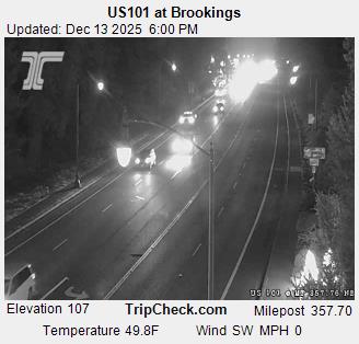
Brookings, Oregon Coast Traffic Live Cam - Highway 101 north and south
SOUTH OREGON COAST
South Oregon Coast Travel, Map
Reedsport Hotels
Coos Bay Hotels
Bandon Hotels
Port Orford Hotels
Gold Beach Hotels
Brookings Hotels
Reedsport - Winchester Bay Weather
Coos Bay - North Bend - Charleston Weather
Bandon Weather
Port Orford Weather
Gold Beach Weather
Brookings Weather
Highway 26 updates from ODOT - Hwy 26 from Portland, Coast Range, to Seaside/Cannon Beach
North Oregon Coast Range Weather Alerts (may affect traffic)
US26, 1 Mi W of North Plains, Unconfirmed, An unconfirmed report of a crash has been received. Use caution. US26, 1 Mi W of North Plains, Unconfirmed, An unconfirmed report of a crash has been received. Use caution. US26, 2 Mi W of North Plains, Delay ? TripCheck - US26 (@TripCheckUS26A) Aug 1, 2026 US26, Zoo, Delay ? TripCheck - US26 (@TripCheckUS26A) Jul 31, 2026 US26, Vista Ridge Tunnel, Unconfirmed, An unconfirmed report of a disabled veh, creating a hazard, has been received. Use caution.
1 Aug 2026 at 3:15am
US26, 2 Mi W of North Plains, Delay < 20min, A crash has occurred. Prepare to slow or move over for worker safety.
31 Jul 2026 at 8:20pm
US26, Zoo, Delay < 20min, A stall has the EB left ln closed just east of the Zoo. Prepare to slow or move over for worker safety.
31 Jul 2026 at 5:05pm
US26, Vista Ridge Tunnel, Unconfirmed, An unconfirmed report of a disabled veh, creating a hazard, has been received. Use caution.
31 Jul 2026 at 5:02pm
Highway 30 updates from ODOT - Hwy 30 from Portland, Coast Range, to Astoria
US30BY, from 1 Mi E of @ Lower Columbia River Hwy US30 to 1 Mi E of @ Lower Columbia River Hwy US30, Delay < 20min, Road maint ops are occurring. Prepare to slow or move over for worker safety. US30BY, from 1 Mi E of @ Lower Columbia River Hwy US30 to 1 Mi E of @ Lower Columbia River Hwy US30, Delay ? TripCheck - US30 (@TripCheckUS30A) Jul 31, 2026 US30, 1 Mi E of Warren, Unconfirmed, An unconfirmed report of a disabled veh, creating a hazard, has been received. Use caution. US30BY, 1 Mi E of @ E Portland Hwy I-205, Unconfirmed, An unconfirmed report of a disabled veh, creating a hazard, has been received. Use caution.
31 Jul 2026 at 10:02am
US30, 1 Mi E of Warren, Unconfirmed, An unconfirmed report of a disabled veh, creating a hazard, has been received. Use caution.
31 Jul 2026 at 3:57am
US30BY, 1 Mi E of @ E Portland Hwy I-205, Unconfirmed, An unconfirmed report of a disabled veh, creating a hazard, has been received. Use caution.
30 Jul 2026 at 9:37pm
Back to top of page
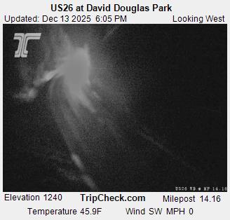
Highway 26 David Douglas Park
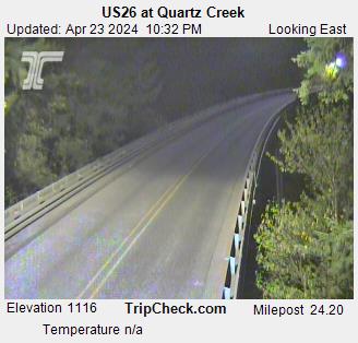
Highway 26 Quartz Creek
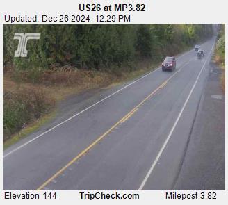
Highway 26 at MP 3
Back to top of page
Highway 6 updates from ODOT - from Portland to Tillamook
Check Tripcheck.com directly for any restrictions, traffic issues
Oregon Coast Lodging, Hotels
Oregon Coast Restaurants
Oregon Coast Weather
Highway 6 Coast Range ODOT Live Web Cam - More Highway 6 traffic info here
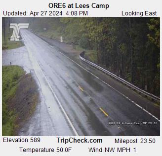
At Lees Camp - Coast Range
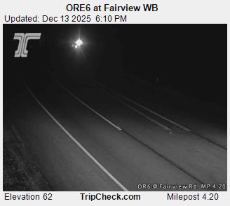
At Hwy 6 - At Fairview near MP 4 (close to Tillamook)
Highway 18 updates from ODOT via Twitter - Hwy 18 from McMinnville/Grande Ronde, Coast Range, to Lincoln City
Central Oregon Coast Range Weather Alerts (may affect traffic)
ORE18, Grand Ronde, Unconfirmed, An unconfirmed report of hazardous debris has been received. Use caution. ORE18, 9 Mi E of Otis, Unconfirmed, An unconfirmed report of a disabled veh, creating a hazard, has been received. Use caution. ORE18, @ Salem - Dayton Hwy OR221, Delay ? TripCheck - OR18 (@TripCheckOR18A) Jul 29, 2026 ORE18, 2 Mi E of Valley Junction, Delay ? TripCheck - OR18 (@TripCheckOR18A) Jul 27, 2026
ORE18, Grand Ronde, Unconfirmed, An unconfirmed report of hazardous debris has been received. Use caution.
30 Jul 2026 at 7:07pm
ORE18, 9 Mi E of Otis, Unconfirmed, An unconfirmed report of a disabled veh, creating a hazard, has been received. Use caution.
30 Jul 2026 at 7:00pm
ORE18, @ Salem - Dayton Hwy OR221, Delay < 20min, A crash has occurred. Prepare to slow or move over for worker safety.
29 Jul 2026 at 9:02am
ORE18, 2 Mi E of Valley Junction, Delay < 20min, A crash has occurred. Prepare to slow or move over for worker safety.
26 Jul 2026 at 7:09pm
Highway 18 Coast Range ODOT Live Web Cam - More Highway 18 traffic info here
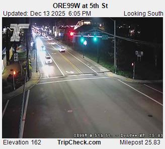
Highway 18 Traffic Cam at Dundee
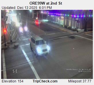
Highway 18 Traffic at McMinnville
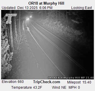
Highway 18 Murphy Summit Traffic Cam
Highway 20 updates from ODOT - Hwy 20 from Newport, Coast Range, to Newport

US20, 7 Mi W of Eddyville, Delay < 20min, A crash has occurred. Prepare to slow or move over for worker safety. US20, 7 Mi W of Eddyville, Delay ? TripCheck - US20 (@TripCheckUS20A) Jul 31, 2026 US20, 2 Mi E of Toledo, Unconfirmed, An unconfirmed report of hazardous debris has been received. Use caution. , @ Hwy W OR99W, Delay ? TripCheck - US20 (@TripCheckUS20A) Jul 29, 2026
31 Jul 2026 at 4:57pm
US20, 2 Mi E of Toledo, Unconfirmed, An unconfirmed report of hazardous debris has been received. Use caution.
30 Jul 2026 at 6:15pm
, @ Hwy W OR99W, Delay < 20min, A crash has occurred. Prepare to slow or move over for worker safety.
29 Jul 2026 at 5:32pm
Central Oregon Coast Range Weather Alerts (may affect traffic):
Highway 34 updates from ODOT - Hwy 34 Corvallis to Waldport, Coast Range. (no web traffic cam for Highway 34, text traffic alerts only)
Click on the link for exact time of update More Highway 34 traffic info here
Highway 126 updates from ODOT - Hwy 126 from Eugene to Florence / Reedsport
Central Oregon Coast Range Weather Alerts (may affect traffic)
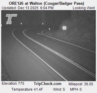
Highway 126 Coast Range ODOT Live Web Cam - More Highway 126 traffic info here

Highway ORE 38 updates from ODOT via Twitter - Hwy 38 from Cottage Grove / Sutherlin, Coast Range, to Reedsport (includes entire highway)
ORE38, 2 Mi W of Drain, Delay < 20min, A crash has occurred. Prepare to slow or move over for worker safety. ORE38, 2 Mi W of Drain, Delay ? TripCheck - OR38 (@TripCheckOR38) Jul 31, 2026 ORE38, 1 Mi E of @ Oregon Coast Hwy US101, Unconfirmed, An unconfirmed report of a crash has been received. Use caution. ORE38, 8 Mi E of @ Oregon Coast Hwy US101, Delay ? TripCheck - OR38 (@TripCheckOR38) Jul 28, 2026 ORE38, 10 Mi W of Elkton, Delay ? TripCheck - OR38 (@TripCheckOR38) Jul 25, 2026
31 Jul 2026 at 8:42am
ORE38, 1 Mi E of @ Oregon Coast Hwy US101, Unconfirmed, An unconfirmed report of a crash has been received. Use caution.
29 Jul 2026 at 5:42am
ORE38, 8 Mi E of @ Oregon Coast Hwy US101, Delay < 20min, Animals are on the roadway. Prepare to slow.
27 Jul 2026 at 8:15pm
ORE38, 10 Mi W of Elkton, Delay < 20min, A crash has occurred. Prepare to slow or move over for worker safety.
25 Jul 2026 at 6:27am
South Oregon Coast Range Weather Alerts (may affect traffic)
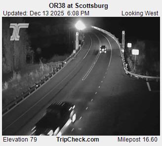
Highway 38 Coast Range ODOT Live Web Cam - More Highway 38 traffic info here
OREGON COAST TRAFFIC ARTICLES
Updates on Two Major Oregon Coast Projects: Whale Watching Center Closure and Hug Point
30 Jul 2026 at 9:39pm
Hug Point has some progress; Whale Center going down for awhile. Cannon Beach, marine sciences, Depoe Bay, traffic
Two-Car Collision Saturday on N. Oregon Coast Results in Serious Injuries, Life Flight
27 Jul 2026 at 8:35pm
One vehicle crossed the centerline and struck another near Seaside. Rescue, Cannon Beach, Astoria. Traffic
Oregon Coast Closures, Returns: Whale Center, Sutton Lake, Trolley, Outdoor Movies
23 Jul 2026 at 7:48pm
Whale Watching Center closing for repairs, movies in Astoria park return, Pacific City trolley, Florence lake ramp closure. Astoria events, Depoe Bay events, Florence events, Pacific City events, traffic
South Oregon Coast Fire Danger Levels Now 'High' - Curry, Coos, Douglas Counties
20 Jul 2026 at 10:03pm
State, private, county, unincorporated communities and BLM forestlands but not beach fires. Brookings, Gold Beach, Port Orford, Coos Bay, Charleston, North Bend, Reedsport, Winchester Bay, weather, rescue, traffic
ODOT Southwest Oregon Construction Report for the week of August 2-8, 2026
31 Jul 2026 at 2:36pm
Hav...
ODOT Southwest Oregon Construction Report for the week of July 26-August 1, 202624 Jul 2026 at 2:41pm
Hav...
Gold Beach: Share your feedback by Monday23 Jul 2026 at 5:15pm
Hav...
ODOT Southwest Oregon Construction Report for the week of July 19-25, 202617 Jul 2026 at 1:47pm
Hav...
Highway 42 updates from ODOT - ORE 42 from Roseburg to Bandon / Coos Bay (then Port Orford, Gold Beach, Brookings)
ORE42S, 5 Mi W of Riverton, Delay < 20min, There is a pedestrian in the roadway creating a hazard and causing traffic to slow. Use caution. ORE42S, 5 Mi W of Riverton, Delay ? TripCheck - OR42 (@TripCheckOR42B) Jul 21, 2026 ORE42S, 4 Mi W of Riverton, Delay ? TripCheck - OR42 (@TripCheckOR42B) Jul 20, 2026 ORE42S, @ Coos Bay - Roseburg Hwy OR42, Delay ? TripCheck - OR42 (@TripCheckOR42B) Jul 11, 2026 ORE42S, 1 Mi E of Bandon, Delay ? TripCheck - OR42 (@TripCheckOR42B) Jul 11, 2026
21 Jul 2026 at 5:07pm
ORE42S, 4 Mi W of Riverton, Delay < 20min, Hazardous tree or vegetation. Prepare to slow.
20 Jul 2026 at 6:53am
ORE42S, @ Coos Bay - Roseburg Hwy OR42, Delay < 20min, A crash has occurred. Prepare to slow or move over for worker safety.
10 Jul 2026 at 7:18pm
ORE42S, 1 Mi E of Bandon, Delay < 20min, A crash has occurred. Prepare to slow or move over for worker safety.
10 Jul 2026 at 7:03pm
Central Oregon Coast Range Weather Alerts (may affect traffic)
Highway 42 Coast Range ODOT Live Web Cam - More Highway 42 traffic info here

%20EB_pid4319.jpg?rand=1747118571227)


Search over 9,500 Pages for Oregon coast subjects, articles or lodging...
Back to Oregon Coast
Contact Advertise on BeachConnection.net
All Content, unless otherwise attributed, copyright BeachConnection.net Unauthorized use or publication is not permitted
Follow us on


South Coast Hotels
Oregon
Coast Hotels
Astoria/Warrenton Hotels
Seaside Hotels
Cannon
Beach Hotels
Nehalem Bay Lodgings
Manzanita Hotels, Lodging
Rockaway Beach Hotels
Three Capes Lodging
Pacific City Hotels, Lodging
Lincoln
City Lodging
Depoe
Bay Hotels
Newport Hotels
Waldport Lodging
Yachats
Hotels
Florence Hotels
Reedsport Hotels
Coos Bay Hotels
Bandon Hotels
Port Orford Hotels
Gold Beach Hotels
Brookings Hotels
Oregon
Coast Vacation Rentals
Oregon
Coast Lodging Specials
Oregon Coast Luxury Hotels
Oregon Coast Pet Friendly Hotels/Rentals
Oregon
Coast Bed and Breakfasts / B&Bs
Cannon Beach Vacation Rentals
Pacific City Vacation Rentals
Newport, Depoe Bay Vacation Rentals
Oregon Coast Restaurant, Dining
Guide
Seaside
Cannon
Beach Dining
Manzanita,
Rockaway, Wheeler Dining
Pacific
City, Oceanside, Netarts, Tierra Del Mar Restaurants
Tillamook
Bay Restaurants, Dining
Lincoln
City Dining, Restaurants
Depoe
Bay Restaurants, Dining
Newport Restaurants, Dining
Waldport,
Yachats Restaurants, Dining
Florence Restaurants, Dining
Restaurant
Reviews
Coast
Events Calendar
Astoria
Seaside,
Cannon Beach Calendar
Manzanita,
Rockaway Events
Tillamook,
Pacific City Calendar
Lincoln
City Events Calendar
Newport,
Depoe Bay Events Calendar
Yachats Events Calendar
Oregon Coast Weather
Astoria, Warrenton Weather
Seaside Weather
Cannon Beach
Manzanita
Nehalem Bay / Wheeler
Rockaway
Oceanside/Tillamook
Pacific City
Lincoln City
Depoe Bay Weather
Newport
Yachats
Florence
Reedsport - Winchester Bay Weather
Coos Bay - North Bend - Charleston
Bandon Weather
Port Orford Weather
Gold Beach Weather
Brookings Weather
Search for Oregon Coast Subjects, Articles
Explore Every Beach Spot

Astoria
Where the Columbia meets the Pacific, Land of Lewis & Clark and loads of atmosphere & history

Seaside
The Promenade, Tillamook Head, family fun & broad, sandy beaches

Cannon Beach
A mysterious lighthouse, upscale yet earthy, a huge monolith, fine eateries & an art mecca

Nehalem Bay - Manzanita, Rockaway, Wheeler
Manzanita's beaches, Nehalem and Wheeler's quirky beauty; laid back Rockaway

Tillamook Bay
Garibaldi, Barview, Bay City, Tillamook & an oceanfront ghost town

Three Cape Loop - Oceanside, Netarts, Pacific City
The hidden secret of the coast: Cape Meares, a lighthouse, Oceanside, Netarts and Pacific City

Lincoln City & the Corridor of Mystery
Miles & miles of unbroken beaches, Cascade Head, Neskowin and manmade attractions

Depoe Bay
A spouting horn downtown, freaky hidden cliffs and whales, whales, whales

Newport
Two lighthouses, timeless Nye Beach, bustling bayfront, regal bridge

Waldport, Seal Rock
Sands and dunes, craggy Seal Rock, semi-secret beaches

Yachats
Constantly dramatic wave action, a mix of the rugged & upscale

Upper Lane County
25 miles of deserted beaches & oodles of wonders

Florence
A lighthouse, ancient bayfront and miles and miles of fluffy dunes
South Oregon Coast Travel
News Headlines from All Over Oregon Need to scan Oregon headlines? Constantly updated news from all over Oregon: a comprehensive, up-to-the-minute display of news headlines from a variety of media
Oregon Coast Oceanfront Lodging, Hotels, Rentals