BEACH
NEWS YOU CAN USE
Spring Break Travel Secrets: Finding Deserted Oregon Beaches (Oregon Coast) - Finding a real hidden spot on the beach, with nary another soul around, is one of life's real pleasures. There are few more ecstatic experiences than stumbling upon a stretch of sand, tucked away behind some brush or squeezed between a couple minor headlands, and finding yourself completely alone. Unlike many travel destinations, this is something you’re a little more apt to find on Oregon’s coast. In many places, it’s one big hidden spot during most times of the year. But as spring break approaches and the weather improves on this often atmospherically temperamental area, even these beaches fill up a bit - almost as heavily and quickly as the motel rooms. Still, deserted beaches abound. You just have to look a little harder during busier times of the year. Here are a few spots that are characteristic of the pristine Oregon coast; spots the average tourist will find nothing short of remarkable. Bob Creek Wayside At the north end, you'll find plenty of mussels - but you'll have to cross the creek to do so. During the winter that's difficult, if not impossible and certainly unwise. During the summer months, it's much easier. Beach Less Traveled in Cannon Beach These sands, along one of the Oregon coast's more popular hotspots, are usually smothered with people. But there are some parts that are less populated, like the very northern end, near the southern face of the cliffs of Ecola State Park. It takes some walking, but that's why you'll find less folks there.
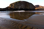
On the other side of that basalt structure lays an even more hidden beach: Crescent Beach. There, you'll find a large half-moon of a beach, cut off from any access but a one mile-plus hike. Pristine sands surround you, with almost never a human being there. As if designed by God to be a centerpiece, a sizable, monolithic sandstone sits practically in the middle. It's only accessible via a hike from the road that takes you to Ecola State Park, which begins at the private neighborhood. You can't park here: you'll have to park a ways away and hike the road to the beginning of the hiking trail. Behind Depoe Bay Look for Vista St. along the northern part of Depoe Bay, and follow that to a secret headland. Long stretches of basalt cliffs are the attraction here - some parts are smooth with odd patterns, while the rest is mostly craggy, pointy structures.
Walk just a little bit and it won't take long to notice you can often feel the tide shake and rattle these rocks ever so slightly. Meander to the south and the rocks take on a smoother and more colorful texture, with a long arm-sort-of-rock structure stretching out into the sea. Often, fishermen can be seen on these rocky shelves so close to the ocean. From here, you can glimpse a different view of Depoe Bay and see what it looks like from the front. Hidden Side of Seaside At the southern end of this North Coast town, the beaches get less populated - except by rocks. Larger cobblestones begin to cover the sand, and the beach gets a little rougher.
If you continue heading south, you'll run into the "Cove" - up against the bottom of Tillamook Head. (It was somewhere on this north face that part of Lewis and Clark's troupe climbed to get to what is now Cannon Beach.) Or, take Avenue U for a nice little beachside drive past interesting, old cottages and motels, and watch the beach change from to even larger, bulkier cobblestones. It ends up at the "Cove," which is a surfer's paradise. Neskowin
Hit the beach and you'll usually find loads of people milling about. But cross the creek, walk towards mysterious Proposal Rock, and the population density gets less. You can actually walk around on top of the rock and check out the views from the top (although be extremely cautious of the tide so as not to get stuck.) Walk further beyond the rock and you'll definitely be more alone. Along the way, note the stumps at the tideline, 5000-or-so-year-old remnants of something rather ominous. Somewhere in the last few thousand years, an enormous earthquake caused a chunk of forest to abruptly drop some six feet into the surf. The result was the salt water preserved them instead of allowing them to decay in normal ways. Winema Beach
Other interesting shapes and crevices present themselves as you walk northward. Some spots in the cliffs seem to invite climbing and exploring. And there's more than one hole in the rocks to huddle from the wind and cuddle a bit. The cliffs soar high and become a striking gold, with some awe-inspiring homes up top. After about a mile or so, the beach ends abruptly at the southern end of Nestucca Bay, allowing you an unusual glimpse of the area. |
||||
RELATED STORIES
Living "La Vida Local:" Oregon Coast Not Just Touristy Anymore Part time residents and travellers interested in digging in deeper are on the rise
Little Known Tips for Winter Trips to Oregon Coast You can say 'whatever' to the weather on the coast
Oregon Travel: Fun with Nocturnal Beaches Something new awaits the coastal traveler at night
Fun & Funky Restaurant Opens on North Oregon Coast Guido's Ristorante in Wheeler seems destined for great things
SPECIAL
SECTIONS |
|||||||||||||
| calendar of events | | |||||||||||||
| beach news | weather | |||||||||||||
| editor's adventure blog | |||||||||||||
| Oregon Coast Complete Guides | |||||||||||||
| coastal pubcrawl | Important Links | |||||||||||||
| coastal science | kooky coast | |||||||||||||
OR
TAKE THE VIRTUAL TOUR |
|||||||||||||
|
BREATHTAKING
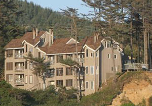
CLIFFTOP IN NEWPORT STARFISH
POINT
is located on the Central Oregon Coast - in Newport - and offers
only the finest in luxury condominium lodging. At Starfish Point,
every unit is focused on the beauty of the sea and the beach. |
 Family
Fun
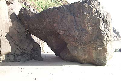 South
of Yachats, and just barely south of Strawberry Hill and Neptune
State Park, you'll find this almost mystical spot. More tide pools
populate this obscure but fascinating place than humans. They really
emerge at lower tides, clinging to odd, mushroom-shaped rocky blobs
at the southern end. At this end, there's also a small sea cave
and a huge boulder that together create a sort of arch by leaning
up against the cliffs here.
 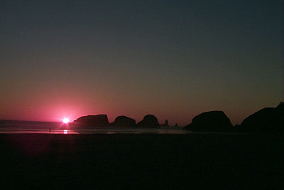 These
basalt headlands are perhaps half a mile from the nearest beach
access, which lies at the end of a private neighborhood at the end
of 5th St. You can, however, reach it by a much longer walk from
the last access downtown, from the park.
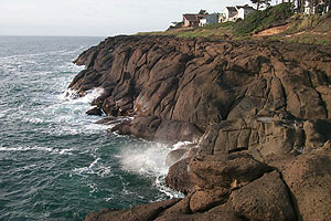 The
northern end has a strange, railroad-like shape, with incredible
views of some wild coves. Other areas seem to form natural seats,
perfect for sitting and viewing the crazed tide. There's a spot
that's sunken and slightly flat, like the remnants of a basement
- and a stairway-like structure formed naturally - rather ironic
and miraculous.
 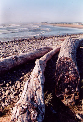 At
one time - as you'll notice from various historical photographs
- most of Seaside's beach was comprised of large stones and fine
sand. Presently, it's covered only with sand and dunes to the north.
The face of the beach was changed by the construction of the jetties
at Astoria to the north, which altered the tidal action in the area
and thus the distribution of sand. Now, the southern end is a bit
like walking into the town's past.
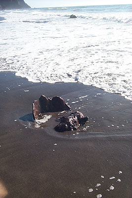 Just
south of Pacific City, Neskowin is the quiet little resort that's
constantly threatening to explode into something much bigger.
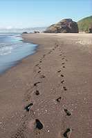 It's
hard to get more hidden than this. Just a few miles north of Neskowin,
another unassuming sign declares Winema Road. Follow that to the
bottom and a tract of sandy beach that nearly no one knows about.
There's another blob of a rock structure that looks a bit like Neskowin's
Proposal Rock to the north, which features a flat stretch at the
top that's perfect for lounging.
  ASTORIA
 SEASIDE
 CANNON
BEACH
 NEHALEM
BAY
 TILLAMOOK
BAY
 THREE
CAPES LOOP
 LINCOLN
CITY & THE CORRIDOR OF MYSTERY
 DEPOE
BAY
 NEWPORT
 WALDPORT
/ SEAL ROCK
 YACHATS
 UPPER
LANE COUNTY
 FLORENCE