What Are the Highest Elevation Viewpoints of Oregon Coast? From North to South
Published 08/08/23 at 6:11 a.m.
By Oregon Coast Beach Connection staff
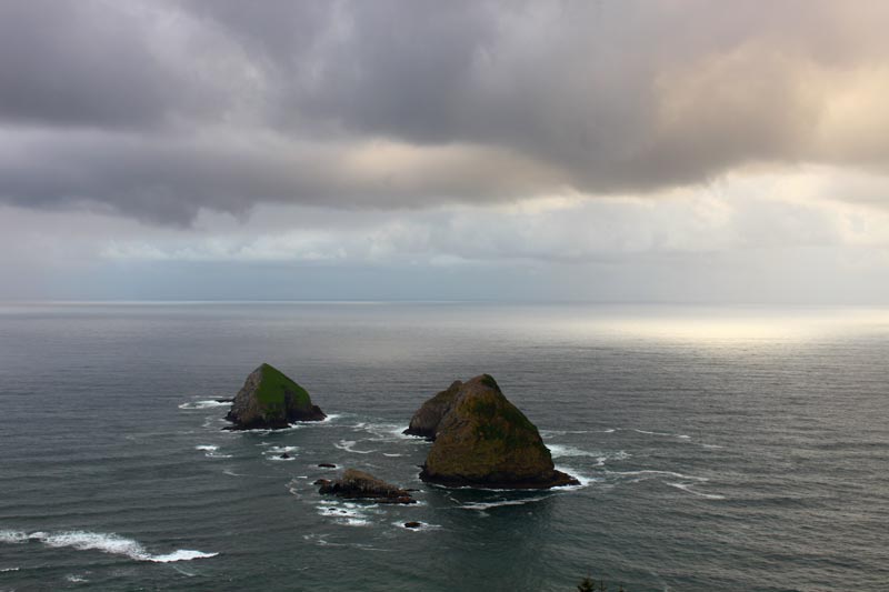
(Oregon Coast) – Up for a good hike to a lofty spot? Or want to find the highest viewpoint on the Oregon coast where you can park your rig? (Above: Oceanside's Maxwell Mountain)
According lidar from various public agencies, including the US Geological Survey, these are the most towering of destinations above the beaches and waves.
Includes exclusive listings; some specials in winter
In Cannon Beach:
Includes rentals not listed anywhere else
In Manzanita, Wheeler, Rockaway Beach:
Some specials for winter
In Pacific City, Oceanside:
Some specials for winter
In Lincoln City:
Some specials for winter
In Depoe Bay, Gleneden Beach:
Some specials for winter
In Newport:
Look for some specials
In Waldport
Some specials for winter
In Yachats, Florence
Some specials for winter
Southern Oregon Coast Hotels / Lodgings
Reedsport to Brookings, places to stay; winter deals
What are the highest spots on the coast? Number one is Humbug Mountain with a viewpoint at 1700 feet high – but it's a long, long hike.
Next is Neahkahnie Mountain at 1680 feet high. However, the famed viewpoints are at 600 feet high.
Third in the bunch is Cascade Head with the trails hitting 1,300 feet.
At fourth place is Tillamook Head with trails getting as high as 1,024 feet. However, the actual viewpoints are not that high.
Fifth is Cape Perpetua at 833 feet, while sixth place is Cape Sebastian at a bit over 600 feet.
Highest parking spots with a view are Neahkahnie and Cape Foulweather along with Maxwell Mountain.
Getting further into the numbers, here's some extra elevation data by north to south.
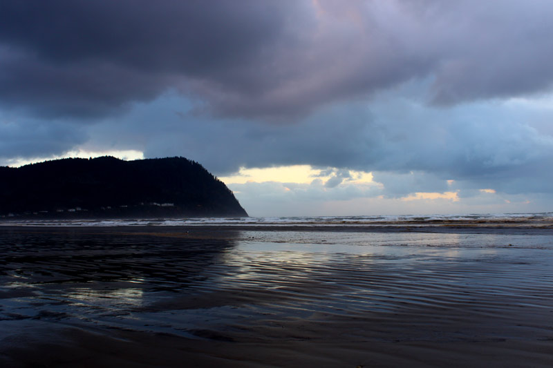
Tillamook Head – Seaside / Cannon Beach. The trail itself leads you up to some 1,024 feet, but the headland actually peaks at 1204 feet high in some areas, according to lidar. The whole trail from Seaside to Cannon Beach is almost seven miles long. Mysterious World War II Bunker Atop Oregon Coast's Tillamook Head
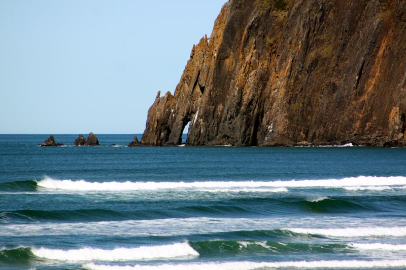
Neahkahnie Mountain, Manzanita. To the top of the peak gets you 1680 feet above sea level, where you can indeed see just about all of the north Oregon coast (as far south as Cape Meares). The Neahkahnie overlooks themselves are at 623 feet, give or take a few, depending on which spot you're at. Complete Guide to Neahkahnie Mountain: Hiking Neahkahnie Mountain
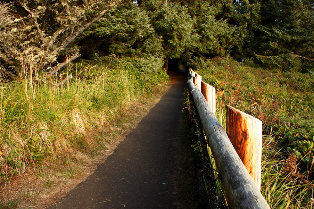
Cape Meares, near Oceanside. The last of the Three Capes actually soars as high as 220 feet in some areas just east of the main headland, according to lidar. However, more relevant is the parking lot that is 328 feet high and then there's a considerable dip to the Cape Meares Lighthouse at around 100 feet. Cape Meares Scary Geology
Oceanside. Nifty and fairly secret Maxwell Mountain tops out at 501 feet high, according to lidar. Three Arch Rocks, from Above, National Refuge
Cape Lookout, near Oceanside. Actual peaks around this headland are at 951 feet, but that's not a part of any trail. The trails through here are around 400 feet high, with a few elevation drops and gains here and there. Some of those are pretty close to the edge – so watch out. Misty Moments Above the Oregon Coast: Cape Lookout Trailhead
Cascade Head, Lincoln City. Actual peaks up here are at 1,447 feet, well enough to get hit by lower level snow events that usually just nab the Oregon Coast Range. The trails, however, max out at 1,300 feet.
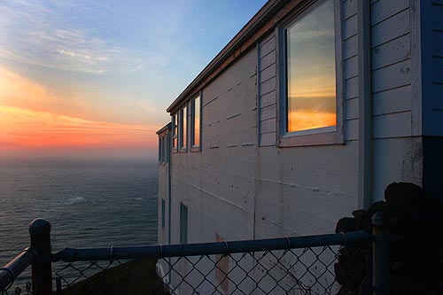
Cape Foulweather, Depoe Bay. It is one stunning spot, and it clocks in at 501 feet at the gift shop house. However, the viewpoint where most people gather is at 341 feet high. Cape Foulweather and Cliffs
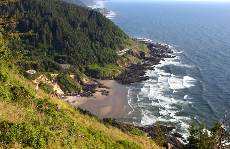
Cape Perpetua, near Yachats. Indeed, the fourth highest viewpoint on the Oregon coast takes you to 833 feet at the parking lot and lookout area. See geology of Perpetua Inside Heceta Head / Cliffs Near Florence: All Come from Oregon Coast Volcano
Heceta Head Lighthouse, near Florence. It's only about 75 feet high at its ground level. Some of the trails behind it go above the lighthouse as well, and some peaks – reachable or not – just northeast of here get to 475 feet high or so, according to lidar info.
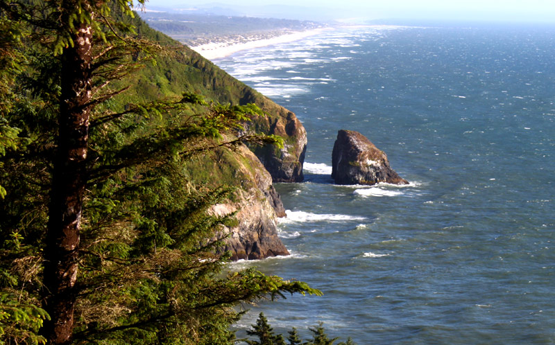
Nearby, Cox Rock and the secret viewpoints there are at 328 feet high. The next really high place is far down the southern Oregon coast (less if you're counting Shore Acres near Coos Bay). Cox Rock, Near Florence, an Oregon Coast Puzzle in History, Geology, Sightseeing
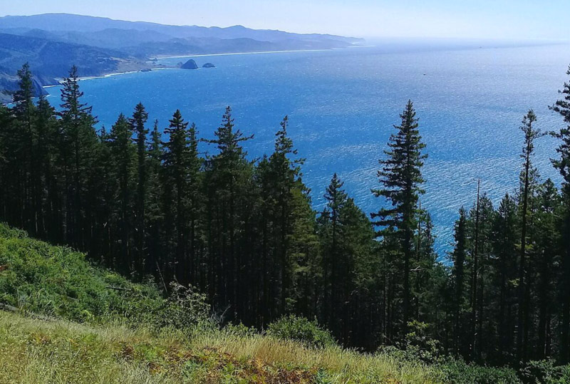
Humbug Mountain, near Port Orford. The highest spot overlooking the coast is a whopping 1700 feet high, but lidar maps don't show the trails through the trees. It does show, however, that not far away there are peaks at 2,200 feet high or more. Humbug Mountain and State Park on South Oregon Coast: Varied, Intricate Attractions
Cape Sebastian Scenic Corridor. The highway itself here takes you about 220 to 240 feet high, but all that is behind treelines. The parking lot to the viewpoints is at 787 feet, but the viewpoints are a ways lower, with one at 629 feet high.
From here on out southward it's not particularly lofty west of Highway 101.
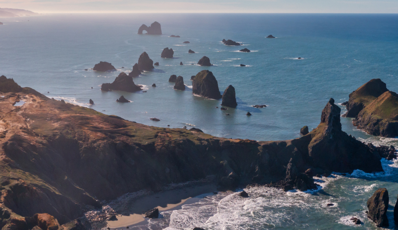
Near Crook Point by drone, courtesy Manuela Durson - see Manuela Durson Fine Arts for more
Crook Point Beach Trailhead. You're at 173 feet high, according to lidar. After that, viewpoints along the highway don't get much higher than 320 feet and most are substantially lower.
Oregon Coast Hotels in this area - South Coast Hotels - Where to eat - Maps - Virtual Tours
Cannon Beach Lodging
Nehalem Bay Lodgings
Manzanita Hotels, Lodging
Three Capes Lodging
Pacific City Hotels, Lodging
Lincoln City Lodging
Depoe Bay Lodging
Newport Lodging
Waldport Lodging
Yachats Lodging
Oregon Coast Vacation Rentals
Oregon Coast Lodging Specials
More About Oregon Coast hotels, lodging.....
More About Oregon Coast Restaurants, Dining.....
 Andre' GW Hagestedt is editor, owner and primary photographer / videographer of Oregon Coast Beach Connection, an online publication that sees over 1 million pageviews per month. He is also author of several books about the coast.
LATEST Related Oregon Coast Articles
General guide to dark sky viewing from south to north coast. Astronomy
Search for Missing Teen Called Off After Involving Coast Guard from Washingto...
Two companions that tried to help also needed rescue at Long Beach. Beach safety, sciences
Orcas Return to Central Oregon Coast on Mother's Day - with a Baby Killer Whale
First report had them chasing dolphins near Astoria. Marine sciences
Oregon Astronomer: Why Easter Moves Around, April's Meteor Showers
Lyrid meteors, smallest moon of the year, and what's up with Easter. Sciences. south coast events, Florence events, Astoria events, Seaside events, Cannon Beach events, Manzanita events, Rockaway Beach events, Tillamook events, Garibaldi events, Oceanside events, Pacific City events, Lincoln City events, Depoe Bay events, Newport events, Waldport events, Newport events, Yachats events
Getting Oregon Coast Stays on the 'Lowdown' - Where Lincoln City Cut Rates
Excellent Lincoln City specials abound. Lincoln City hotel reviews
Newport's Oregon Coast Jazz Party Announces Lineup for 2025
October 3-5 in the Alice Silverman Theatre at Newport Performing Arts Center. Newport events
N. Oregon Coast Bridge Work During Travel Season: Some Traffic Delays on Asto...
Occasional one-lane traffic from June through September at Astoria / Ilwaco. Washington coast
A Less Expensive May in Newport: Handful of Oregon Coast Inns Still Offering ...
Inn at Nye Beach, Nye Beach Cottages, Ocean House BnB: Newport hotel specials. Newport hotel reviews
Back to Oregon Coast
Contact Advertise on Oregon Coast Beach Connection
All Content, unless otherwise attributed, copyright Oregon Coast Beach Connection. Unauthorized use or publication is not permitted


