Washington, Oregon Coast Flooding, Sneaker Waves - Portland, Eugene, Seattle Flooding Possible
Published 11/16/24 at 8:05 p.m.
By Oregon Coast Beach Connection Staff

(Portland, Oregon) - It's going to be an extremely active weather situation for Oregon and Washington in the next week, especially along the coastlines. Flooding up and down the coast, flooding in the valley regions, sneaker wave threats coupled with king tides, and then the possibility of waves as high as 28 feet later in the week are just the beginning. (Above: flooding at Sunset Bay near Coos Bay / Oregon State Parks)
Includes exclusive listings; some specials in winter
In Cannon Beach:
Includes rentals not listed anywhere else
In Manzanita, Wheeler, Rockaway Beach:
Some specials for winter
In Pacific City, Oceanside:
Some specials for winter
In Lincoln City:
Some specials for winter
In Depoe Bay, Gleneden Beach:
Some specials for winter
In Newport:
Look for some specials
In Waldport
Some specials for winter
In Yachats, Florence
Some specials for winter
Southern Oregon Coast Hotels / Lodgings
Reedsport to Brookings, places to stay; winter deals
The National Weather Serivce (NWS) has issued numerous watches, advisories and warnings for the Washington and Oregon coast this weekend, and some predictions about later this week are rather eye-popping. Look for some flooding along the I-5 Corridor, from Eugene up through Seattle and Bremerton.
North Oregon Coast – South Washington Coast: Beach Hazards and Flooding Advisory. The NWS has issued both at the same time for Tillamook, Clatsop counties and the south Washington coast. A sneaker wave danger statement is in effect Sunday morning through evening. Coastal Flood Advisory in effect 11 a.m. to 3 p.m. Sunday. This includes the areas of Pacific City, Oceanside, Rockaway Beach, Manzanita, Cannon Beach, Seaside, Warrenton, Long Beach, Ocean Shores and Westport.
“Minor flooding, up to one foot above ground level, during high tides is expected in the low lying areas near bays, sloughs, Highway 101, and the lower reaches of the coastal rivers,” the NWS said.
Central Oregon Coast: The beach hazards statement for sneaker waves is in effect all day Sunday and includes Florence, Yachats, Newport, Waldport and Lincoln City.
What's the Difference Between King Tides and Oregon / Washington Coast Storm Wave Events
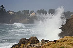
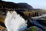
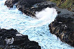
“Waves can run up significantly farther on a beach than normal, including over rocks and jetties. Sneaker waves can suddenly knock people off of their feet and quickly pull them into the frigid ocean,” the NWS said.
The spectacle – and the dangers – will be around longer than king tides.
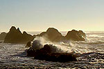
“Wave heights continue to grow and are expected to reach 15-17 ft at 13 seconds by Sunday night. Seas remain about this high through at least Wednesday,” the NWS said.
This looks to rise even higher on Thursday, with wave height possibly into the low 20s. That could be even higher on the south coast (see below).
Washington Coast Flood Warnings / Seattle Advisories. For the north and central coast (Westport through La Push), a coastal flood warning is in effect 9 a.m. to 4 p.m. Sunday.
“Significant coastal flooding expected. Inundation of around 2.5 feet above ground level is possible along shorelines and low-lying coastal areas,” the NWS said.
A similar flood advisory is in effect for the inner coastal areas of Washington from the peninsula waters into the Seattle / Tacoma areas, including Hood Canal and Bremerton.
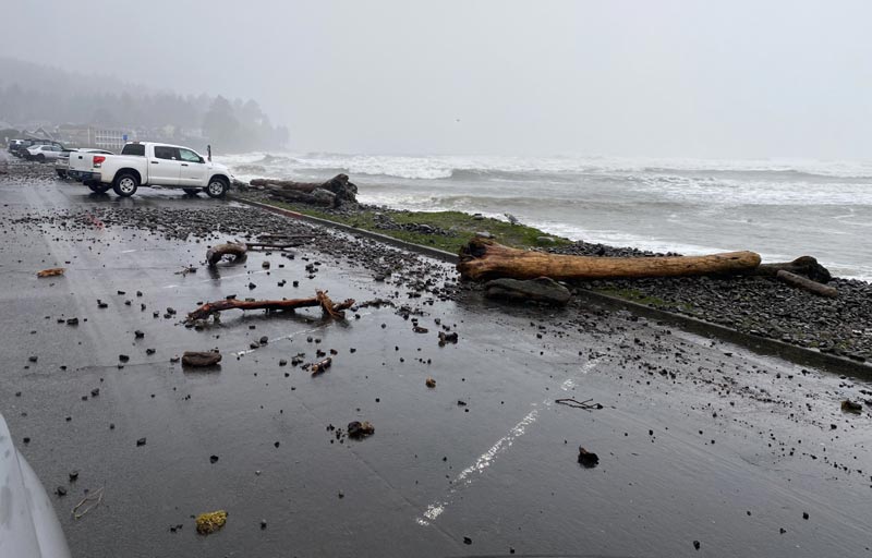
Seaside / courtesy Seaside Aquarium
South Oregon Coast Wave Height, Flooding. While there is no warning for flooding in the areas of Reedsport, Coos Bay and Bandon down through Brookings, more flooding is possible this week for those areas. The timing was not specified but the NWS in Medford said keep looking to its site for updates.
Wave height itself is rather impressive but not as dangerous as up north. However, it's going to get more hazardous and you may well see advisories or warnings for the area coming soon.
See Washington Coast Weather - Oregon Coast Weather (including tides)
“Another front moves in this afternoon through Sunday with gusty south winds and steep to very steep seas, highest north of Cape Blanco,” the NWS. “This front will be followed by another large swell late Sunday into Monday, peaking at 15-19 feet at 13-14 seconds.”
Seas briefly lower on Monday and then more large breakers come in Tuesday and Wednesday.

Portland - Oregon Coast Beach Connection photo
“Confidence is low to moderate in the details but models support advisory level surf is likely (with surf exceeding 20 feet) and there is chance of high surf warning level conditions (with surf reaching 28 feet or higher).”
Willamette Valley – Portland – Salem – Eugene Flooding. Rivers will start to rise Wednesday, the NWS predicted, and that day or Thursday could see some flooding.
“Current projections of the most likely amounts for storm total precipitation range from 5 to 8 inches for the Coast, Coast Range, and Cascades, with 2.5 to 4 inches for inland valley locations, including Portland, Salem, and Eugene,” the NWS said. “Upper end projections, with about a 10 percent chance of occurring, range from 6 to 11 inches for the Coast, Coast Range, and Cascades, with 5 to 7 inches for inland valleys. Snowmelt in the Cascades from 2000 to 4000 feet elevation could add runoff, although the main cause for flooding would be the heavy rain.”
Oregon Coast Hotels for this event - South Coast Hotels - Oregon Coast Vacation Rentals - Where to eat - Maps - Virtual Tours
Oregon Coast Vacation Rentals
Oregon Coast Lodging Specials
More About Oregon Coast hotels, lodging.....
More About Oregon Coast Restaurants, Dining.....
 Andre' GW Hagestedt is editor, owner and primary photographer / videographer of Oregon Coast Beach Connection, an online publication that sees over 1 million pageviews per month. He is also author of several books about the coast.
LATEST Related Oregon Coast Articles
Variety of Oregon State Parks Closed Due to Storm, from Coast to Columbia GorgeSilverton, Estacada, Coastline and others: several parks damaged or closed. Weather
Rockaway Beach Hotel News: New Inn Near Rockaway Beach is Really 100 Years Old
Boutique inn and BnB on north Oregon coastin a forest, marvelous details; bathroom vanities created by local craftsmen, headboards made of live edge wood. Pets. Rockaway Beach Hotel Reviews
Cannon Beach's Hug Point Erosion: N. Oregon Coast Fave Shut Down For Now
Closed indefinitely as repairs are extremely complex. Weather
Tsunami Alerts May Get Delayed, Not as Accurate for Oregon / Washington Coast
Funding cut off for some seismic stations, leaves coast more vulnerable. Weather
Saddle Mountain Rescue Needed USCG Helicopter, Several N. Oregon Coast Agencies
A complex 6.5 hours to rescue a stranded hiker. Safety, Seaside, Cannon Beach, Astoria, Manzanita, Saddle Mountain
Oregon Coast History - Articles, Archives, Updates - History Reference Guide
Search for Oregon Coast History subjects. Archive of hundreds of articles
N. Oregon Coast's Ecola State Park Closed Due to Landslides That Cracked Road
This part of Cannon Beach is prone to hillside movement: Indefinate closure. Weather, safety
Comet 31/Atlas Caught By Portland, Oregon Man On Its Way Out
Snapped by a Portlander as it zips out of the solar system. Astronomy, sciences
Back to Oregon Coast
Contact Advertise on Oregon Coast Beach Connection
All Content, unless otherwise attributed, copyright © Oregon Coast Beach Connection. Unauthorized use or publication is not permitted


