 |
BEACH
NEWS YOU CAN USE 10/20/06
Oregon Coast Beach Spots The Locals Want Hidden From You (Oregon Coast) – Hitting Oregon’s beaches is a multi-layered experience. It’s not just about the clam chowder, settling in with a book at your favorite lodging, or heading to the same spot each time. It’s time for the Oregon traveler to actually explore this coast. It’s time to find the hidden spots, the unusual aspects to beaches you may know well - and it's time to discover other beach secrets. It's time for the visitor to discover another side to coastal tourism.
Nameless
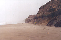
Spot South of Newport But a set of truly hidden crescent-shaped dents in the cliffs lie near a hidden beach access about eight miles south of Newport. Look for the Solace by the Sea Bed and Breakfast near MP 146, and less than a quarter mile south of that you'll see an unmarked beach access with a gravel patch by the side of the road. Once on this unnamed beach, you'll find a pleasant stream and a lot of striking sandstone cliffs. But head maybe a quarter of a mile to the south and there's a couple of these rounded-out areas in the cliffs, one of which has a tiny waterfall. There is a tiny stretch of climbable spots above the cliffs next to the beach access. Strange
Rocks At Depoe Bay Here, you'll find an area which delivers astounding, dizzying views of wild stuff you won't be able to witness any other way. To the north, weird coves and hidden caves become apparent. Straight out to sea, you're high above the crushing, crashing waves and a captive audience member to some amazing oceanic power. This spot is actually known as Depoe View Park, although there are no signs designating it as such. Throughout this entire section, large and small crevices, perches and an endless amount of craggy boulders make for incredible climbing and exploring fun. All of it sits about 50 ft. above where the roaring, rather frightening surf pounds onto the cliffs below. You can sometimes even feel the waves hitting the rocks as their power resonates through the stone. Then, at the area's southern end you can see Depoe Bay, and if you peep around the corner, you can catch close up glimpses of unusual rock structures.
A small trail meanders between these cliffs and the private residences above, and there's even a picnic table for those hungry for grub as well as astounding views. This area can be found by heading down Vista St. to its end, carefully parking without imposing on one of the private homes here, then follow the sign that says ``To the rocks.''
Seaside’s
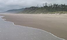
North Promenade Beach Access To the north, there are sizable dunes at the vegetation line, plenty of Seaside’s typically sandy beaches at the tide line and an estuary trail. This beach has its interesting secrets. The river mouth sits about a quarter mile from this access, and it’s usually fairly unpopulated if not completely deserted. Along the way, it’s possible to find thousands of sand dollars – many of them unbroken. It’s a treasure hunters’ paradise, if whole sand dollars are your thing. The walking trail is accessible from the parking lot at 12th Avenue. It winds on for about a mile as you enter more and more unspoiled territory, eventually winding up at a slightly rocky area near the bay mouth.
Try the beach accesses at Meares for a little getaway: wander towards the enormous cliffs to check out the nesting wildlife above and maybe you'll get lucky and find the tide low enough to find the hidden cove.
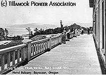
Or keep walking north to the spit - or take the road a mile into the spit - and hike Bayocean's big, fluffy dunes. This deliciously silent place, where an entire resort once stood, takes a round trip hike of about 3.9 miles if you walk through the sandy draw near the middle and come back around. Or you can hike the entire thing in an eight-mile loop. Bayocean is a weird remnant of history. There was once a large resort town here, bustling with two hotels, a natatorium, a dance hall of sorts and five miles of roads. Some 4000 lots were created for homes, with perhaps 1600 actually being sold.
All this happened around the 1910’s, with 1913 probably finding the place at its height. But heavy erosion in the area, failed business deals and finally the Great Depression ended the life of what was to be the “Atlantic City of the West.” By 1952 - when the spit was breached by a really bad winter – its streets were broken and crumbled and the place was a ghost town. A few years later, the government burned and bulldozed the majority of the buildings left. By 1971, the last of the remaining buildings had fallen into the sea. These days, sandy bluffs are all that’s left and you see no trace of the former resort. Although some locals say you can spot remnants of some parts of the community at extremely low tides – or even leftovers of foundations in shallow parts of the bay and nearby Meares Lake. Rock
Creek Campground and Roosevelt Beach
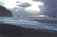
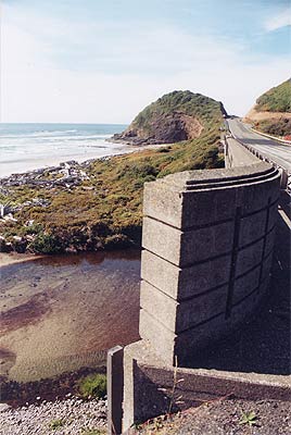
You’ll find this charming creek spilling into the ocean, and the other side of that headland from Ocean Beach looks strangely identical with a very similar indentation in it. The strand wanders on for a while and disappears out of sight beyond the sandstone bluffs, meanwhile dotted with intriguing rock structures and covered half in stones and half in sand. It’s a fascinating and enchanting spot, made more so by the fact it’s largely hidden and very unpopulated. |
RELATED STORIES
Oregon Coast Ghosts and Other Paranormal Legends Tales of ghosts, UFO's, spiritual spots and more abound on these beaches
Second Summer Rears Its Pretty Head on Oregon Coast The legend has arrived, bringing warm weather and some natural oddities
Coast Abuzz Over Photos of Green Flash, Glowing Sand Coastal residents caught photos of glowing sands and the green flash
Hiking It and Roughing It on Oregon’s Coast A look at trails and rugged campgrounds
Sampling Wines and Wine Bars on the Oregon Coast Wine shops and wine bars are a growing part of coastal tourism
BREATHTAKING
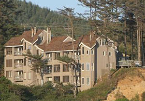
CLIFFTOP IN NEWPORT STARFISH
POINT is located on the Central
Oregon Coast - in Newport - and offers only the finest in luxury
condominium lodging. At Starfish Point, every unit is focused on
the beauty of the sea and the beach. |
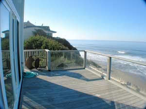
Lincoln City Vacation Homes There’s something for everyone among this selection of wondrous homes: smaller homes with a view to a large house that sleeps 15. All the homes are either oceanfront or just a few steps away from the sand – all with a low bank access and fantastic views. Most are in the Nelscott area; one is close to the casino. You’ll find a variety of goodies, depending on the home: fireplaces, multiple bedrooms, dishwashers, Jacuzzis, washer/dryers, hot tubs, cable TV, VCR, barbecues; there’s a loft in one, and another sprawling home has two apartments. Pets are allowed in some homes – ask ahead. Each comes with complete kitchens so you’ll have a home away from home. Most have the seventh night free. Prices range from winter $85 to summer $230 per night. www.getaway2thecoast.com. 541-994-8778. |
DIVE INTO LUXURY, HISTORY AT THE TIDES THE
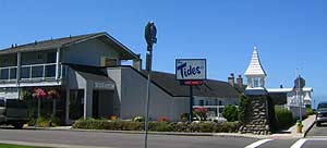
TIDES BY THE SEA, Seaside. For over 80 years, The Tides has
been a favorite of Seaside visitors. History meets modern luxury
here. 51 oceanfront condos, individually owned and decorated. Find
suites for couples, small apartments with fireplaces and kitchenettes,
one or two bedroom family units with fireplaces, kitchens and dining
rooms. There are wonderful oceanview cottages that sleep anywhere
from two to eight people, with two bedrooms, some with lofts, fireplaces
and kitchens. |
Weiss' Paradise Suites & Vacation Rentals - Seaside Unique Luxury Accommodations
in Seaside. 1BR Suites, 1BR & 2BR Duplex Units and 3BR Houses,
units for 2-8 people. Rent our entire property for 20-26. All units
close to beach, river and Broadway St. |
|
D Sands Condominium Motel, Lincoln City. Getting a free, fresh baked cookie upon check-in is just the beginning. Every room is beachfront, and it's all right up against Lincoln City's most famous stretch of beach, next to the D River. Each room, comes as a suite or mini-suite, and has a kitchen and balcony or patio. Some have gas fireplaces, while all have a DVD Players with movies available for renting (and movie rentals come with free popcorn). There's a heated indoor pool, a spa, and this fabulous beach is lit at night. Rooms sleep anywhere from two, four to six - including a deluxe fireplace suite. Gift certificates are available, and they offer special occasion packages as well. To make a reservation and see a virtual tour of the rooms, visit our website at www.dsandsmotel.com. 171 S.W. Highway 101. 800-527-3925. |
SPECIAL
SECTIONS |
|||||||||||||
| calendar of events | lewis & clark guide | |||||||||||||
| beach news | weather | |||||||||||||
| editor's adventure blog | |||||||||||||
| columnists: guy ditorrice (general) | peg miller (shopping) | |||||||||||||
| coastal pubcrawl | Important Links | |||||||||||||
| coastal science | kooky coast | |||||||||||||
| oregon coast mileage chart & map | day trips, suggested itineraries | |||||||||||||
| Search This Site's Over 800 pages | |||||||||||||
OR
TAKE THE VIRTUAL TOUR |
|||||||||||||
|
|
Tradewinds Motel, Rockaway Beach. All rooms at the Tradewinds Motel are immaculate and have TV’s, VCR’s and in-room phones with data ports. The oceanfronts all have a queen bed, a double hide-a-bed, kitchen, cozy firelog fireplace and a private deck. Some oceanfront units come with all those amenities but the kitchens. Both types sleep up to four people. Others are appointed with a queen bed, small fridge, and coffee maker – sizable for a two-person romantic getaway, yet still perfect for those on a budget. There is an elaborate oceanfront Jacuzzi suite that has two bedrooms, coming with a kitchen, double hide-a-bed, fireplace and private deck, sleeping as many as six. For those wanting bigger accommodations for family reunions or large gatherings such as weddings, some rooms can connect to create two-room and three-room suites. Some rooms are pet friendly.523 N. Pacific St., Rockaway Beach. (503) 355-2112 - 1-800-824-0938. www.tradewinds-motel.com |
|
D Sands Condominium Motel, Lincoln City. Fresh baked cookie upon check-in is just the beginning. All rooms beachfront. Each comes as a suite or mini-suite, and has a kitchen and balcony or patio. Some w/ gas fireplaces, while all have a DVD Players; movie rentals come with free popcorn. Heated indoor pool, a spa, and this fabulous beach is lit at night. Rooms sleep two, four to six - including a deluxe fireplace suite. Gift certificates are available, and they offer special occasion packages as well. ww.dsandsmotel.com. 171 S.W. Highway 101. 800-527-3925. |


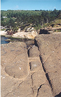 Look
for Vista St. along the northern part of Depoe Bay, just south of
the massive complex of condoos, and this will lead you down to a
charming, weather-beaten neighborhood and an amazing span of puffy,
bubble-like basalt cliffs.
 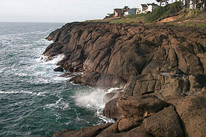 Also
at the southern end, a large formation juts out into the sea, sometimes
allowing you to climb up and walk out even farther out over the
ocean. However, much of the time its access point is so soaked by
seawater it's not a good idea to go ambling up these rocks. A spectacular
sight here is the ocean spraying this section with either small
waves or a constant stream of thick, salt-water mist.
 Bayocean
Spit and Its Ghost Town
 But
the real discovery is the beach. If you’re not camping here,
you can find this gem by looking for a couple of unmarked dusty
patches on the side of the road immediately south of a small bridge
– and just the other side from the headland at Ocean Beach.
You’ll find a long stretch of bluffs which allow you access
to Roosevelt Beach at various points.


 ASTORIA
 SEASIDE
 CANNON
BEACH
 NEHALEM
BAY
 TILLAMOOK
BAY
 THREE
CAPES LOOP
 LINCOLN
CITY & THE CORRIDOR OF MYSTERY
 DEPOE
BAY
 NEWPORT
 WALDPORT
/ SEAL ROCK
 YACHATS
 UPPER
LANE COUNTY
 FLORENCE
